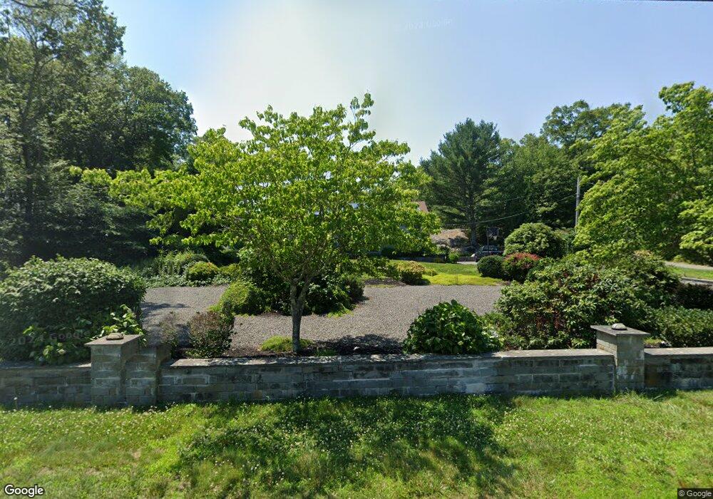
814 Sharps Lot Rd Swansea, MA 02777
Northeast Swansea NeighborhoodEstimated Value: $583,000 - $691,000
3
Beds
2
Baths
2,250
Sq Ft
$279/Sq Ft
Est. Value
About This Home
This home is located at 814 Sharps Lot Rd, Swansea, MA 02777 and is currently estimated at $627,000, approximately $278 per square foot. 814 Sharps Lot Rd is a home located in Bristol County with nearby schools including Joseph Case High School, SCEC Life Academy, and Swansea Wood School.
Ownership History
Date
Name
Owned For
Owner Type
Purchase Details
Closed on
Dec 6, 2024
Sold by
Ayer Christine C and Ayer Jonathan B
Bought by
Ayer Jonathan B
Current Estimated Value
Home Financials for this Owner
Home Financials are based on the most recent Mortgage that was taken out on this home.
Original Mortgage
$360,000
Outstanding Balance
$356,330
Interest Rate
6.13%
Mortgage Type
Adjustable Rate Mortgage/ARM
Estimated Equity
$270,670
Purchase Details
Closed on
Jun 26, 2015
Sold by
Ayer Christine C
Bought by
Ayer Jonathan B and Ayer Christine C
Purchase Details
Closed on
Aug 8, 2011
Sold by
Almeida Joseph U and Almeida Mary C
Bought by
Ayer Christine C
Home Financials for this Owner
Home Financials are based on the most recent Mortgage that was taken out on this home.
Original Mortgage
$212,000
Interest Rate
4%
Mortgage Type
Purchase Money Mortgage
Create a Home Valuation Report for This Property
The Home Valuation Report is an in-depth analysis detailing your home's value as well as a comparison with similar homes in the area
Home Values in the Area
Average Home Value in this Area
Purchase History
| Date | Buyer | Sale Price | Title Company |
|---|---|---|---|
| Ayer Jonathan B | -- | None Available | |
| Ayer Jonathan B | -- | None Available | |
| Ayer Jonathan B | -- | -- | |
| Ayer Christine C | $265,000 | -- | |
| Ayer Christine C | $265,000 | -- | |
| Ayer Jonathan B | -- | -- | |
| Ayer Christine C | $265,000 | -- |
Source: Public Records
Mortgage History
| Date | Status | Borrower | Loan Amount |
|---|---|---|---|
| Open | Ayer Jonathan B | $360,000 | |
| Closed | Ayer Jonathan B | $360,000 | |
| Previous Owner | Ayer Christine C | $212,000 |
Source: Public Records
Tax History Compared to Growth
Tax History
| Year | Tax Paid | Tax Assessment Tax Assessment Total Assessment is a certain percentage of the fair market value that is determined by local assessors to be the total taxable value of land and additions on the property. | Land | Improvement |
|---|---|---|---|---|
| 2025 | $5,996 | $503,000 | $178,000 | $325,000 |
| 2024 | $6,103 | $509,000 | $178,000 | $331,000 |
| 2023 | $5,599 | $426,400 | $131,200 | $295,200 |
| 2022 | $5,445 | $378,400 | $119,500 | $258,900 |
| 2021 | $5,275 | $337,500 | $119,500 | $218,000 |
| 2020 | $5,261 | $337,700 | $119,500 | $218,200 |
| 2019 | $5,011 | $323,100 | $106,900 | $216,200 |
| 2018 | $4,787 | $313,300 | $105,200 | $208,100 |
| 2017 | $4,000 | $301,200 | $105,200 | $196,000 |
| 2016 | $3,999 | $295,800 | $90,900 | $204,900 |
| 2015 | $3,734 | $284,400 | $90,900 | $193,500 |
| 2014 | $3,387 | $263,800 | $90,900 | $172,900 |
Source: Public Records
Map
Nearby Homes
- 55 Sailmaker Ct
- 822 Sharps Lot Rd
- 830 Sharps Lot Rd
- 0CWest Sharps Lot Rd
- 41 Sailmaker Ct
- 560 Marvel St
- 819 Sharps Lot Rd
- 3 Sailmaker Ct
- 66 Sailmaker Ct
- 542 Marvel St
- 23 Sailmaker Ct
- 520 Marvel St
- 7 Sailmaker Ct
- 863 Sharps Lot Rd
- 858 Sharps Lot Rd
- Lot 6 Sailmaker Ct
- 821 Sharps Lot Rd
- 42 Sailmaker Ct
- 46 Sailmaker Ct
- 6 Sailmaker Ct