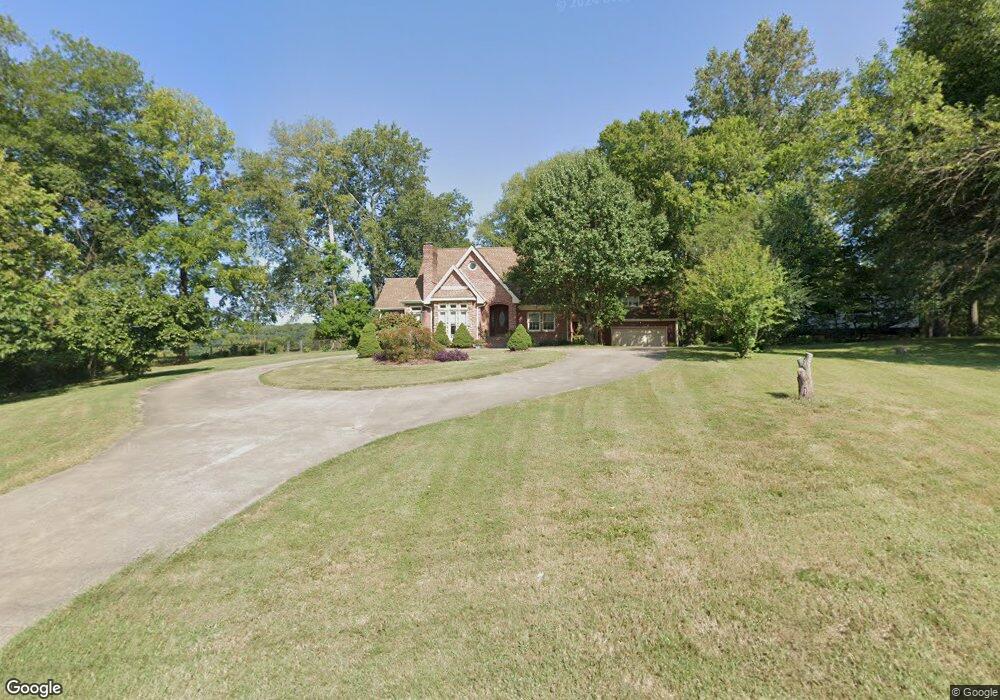
815 Dunbar Cave Rd Clarksville, TN 37043
Estimated Value: $438,000 - $599,000
--
Bed
3
Baths
2,881
Sq Ft
$185/Sq Ft
Est. Value
About This Home
This home is located at 815 Dunbar Cave Rd, Clarksville, TN 37043 and is currently estimated at $532,880, approximately $184 per square foot. 815 Dunbar Cave Rd is a home located in Montgomery County with nearby schools including Rossview Elementary School, Rossview Middle School, and Rossview High School.
Ownership History
Date
Name
Owned For
Owner Type
Purchase Details
Closed on
Apr 6, 2008
Sold by
Thomason Barry K
Bought by
State Of Tennessee
Current Estimated Value
Purchase Details
Closed on
Apr 27, 2004
Sold by
Ross Robert A
Bought by
Thomason Barry K
Purchase Details
Closed on
Oct 31, 1996
Sold by
Birchfield Irene W
Bought by
Ross Robert
Home Financials for this Owner
Home Financials are based on the most recent Mortgage that was taken out on this home.
Original Mortgage
$141,000
Interest Rate
8.02%
Create a Home Valuation Report for This Property
The Home Valuation Report is an in-depth analysis detailing your home's value as well as a comparison with similar homes in the area
Home Values in the Area
Average Home Value in this Area
Purchase History
| Date | Buyer | Sale Price | Title Company |
|---|---|---|---|
| State Of Tennessee | $5,500 | -- | |
| Thomason Barry K | $273,000 | -- | |
| Thomason Barry K | $273,000 | -- | |
| Ross Robert | $177,000 | -- |
Source: Public Records
Mortgage History
| Date | Status | Borrower | Loan Amount |
|---|---|---|---|
| Previous Owner | Ross Robert | $141,000 |
Source: Public Records
Tax History Compared to Growth
Tax History
| Year | Tax Paid | Tax Assessment Tax Assessment Total Assessment is a certain percentage of the fair market value that is determined by local assessors to be the total taxable value of land and additions on the property. | Land | Improvement |
|---|---|---|---|---|
| 2024 | $3,887 | $130,450 | $0 | $0 |
| 2023 | $3,887 | $82,975 | $0 | $0 |
| 2022 | $3,502 | $82,975 | $0 | $0 |
| 2021 | $3,502 | $82,975 | $0 | $0 |
| 2020 | $3,335 | $82,975 | $0 | $0 |
| 2019 | $3,335 | $82,975 | $0 | $0 |
| 2018 | $3,324 | $63,350 | $0 | $0 |
| 2017 | $956 | $77,125 | $0 | $0 |
| 2016 | $2,368 | $77,125 | $0 | $0 |
| 2015 | $3,251 | $77,125 | $0 | $0 |
| 2014 | $3,207 | $77,125 | $0 | $0 |
| 2013 | $3,247 | $74,125 | $0 | $0 |
Source: Public Records
Map
Nearby Homes
- 1986 Stone Valley Ct
- 800 Brooke Valley Trace
- 825 Salisbury Way
- 1885 Basham Ln
- 1992 Hannover Ct
- 405 Kimberly Dr
- 1421 English Oak Dr
- 1413 English Oak Dr
- 1401 English Oak Dr
- 1425 English Oak Dr
- 1387 English Oak Dr
- 811 River Run
- 809 Laurel Dr
- 1373 English Oak Dr
- 1395 English Oak Dr
- 1412 English Oak Dr
- 1330 English Oak Dr
- 1338 English Oak Dr
- Bentley Plan at The Oaks
- Bellemeade Plan at The Oaks
- 813 Dunbar Cave Rd
- 817 Dunbar Cave Rd
- 808 Dunbar Cave Rd
- 812 Dunbar Cave Rd
- 109 Swan Lake Village
- 816 Dunbar Cave Rd
- 108 Swan Lake Village
- 1817 Auburn Dr
- 1987 Stone Valley Ct
- 1815 Auburn Dr
- 1983 Stone Valley Ct
- 1991 Stone Valley Ct
- 29 Huntington Dr
- 27 Huntington Dr
- 808 Brooke Valley Trace
- 804 Brooke Valley Trace
- 1995 Stone Valley Ct
- 1809 Warfield Dr
- 812 Brooke Valley Trace
- 1812 Auburn Dr