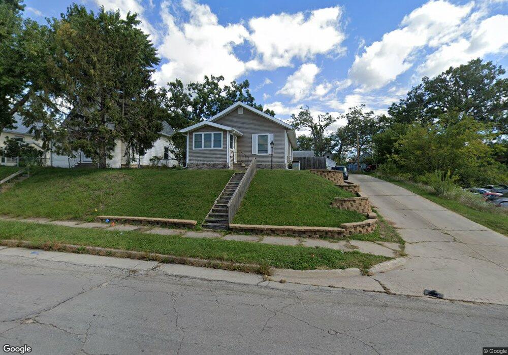
816 Center Point Rd NE Cedar Rapids, IA 52402
Mound View NeighborhoodEstimated Value: $101,000 - $125,838
3
Beds
2
Baths
960
Sq Ft
$116/Sq Ft
Est. Value
About This Home
This home is located at 816 Center Point Rd NE, Cedar Rapids, IA 52402 and is currently estimated at $111,710, approximately $116 per square foot. 816 Center Point Rd NE is a home located in Linn County with nearby schools including Garfield Elementary School, Franklin Middle School, and George Washington High School.
Ownership History
Date
Name
Owned For
Owner Type
Purchase Details
Closed on
Sep 10, 2018
Sold by
Welrab Dennis John and Wolrab Dennis J
Bought by
Wolrab Dennis John and Wolrab Antia D
Current Estimated Value
Home Financials for this Owner
Home Financials are based on the most recent Mortgage that was taken out on this home.
Original Mortgage
$67,100
Outstanding Balance
$50,067
Interest Rate
4.5%
Mortgage Type
Adjustable Rate Mortgage/ARM
Estimated Equity
$61,643
Purchase Details
Closed on
Sep 18, 2014
Sold by
Sells Anita M
Bought by
Wolrab Dennis John
Home Financials for this Owner
Home Financials are based on the most recent Mortgage that was taken out on this home.
Original Mortgage
$62,000
Interest Rate
4.15%
Create a Home Valuation Report for This Property
The Home Valuation Report is an in-depth analysis detailing your home's value as well as a comparison with similar homes in the area
Home Values in the Area
Average Home Value in this Area
Purchase History
| Date | Buyer | Sale Price | Title Company |
|---|---|---|---|
| Wolrab Dennis John | -- | None Available | |
| Wolrab Dennis John | $66,000 | None Available | |
| Wolrab Dennis John | $66,000 | None Available |
Source: Public Records
Mortgage History
| Date | Status | Borrower | Loan Amount |
|---|---|---|---|
| Open | Wolrab Dennis John | $67,100 | |
| Previous Owner | Wolrab Dennis John | $62,000 |
Source: Public Records
Tax History Compared to Growth
Tax History
| Year | Tax Paid | Tax Assessment Tax Assessment Total Assessment is a certain percentage of the fair market value that is determined by local assessors to be the total taxable value of land and additions on the property. | Land | Improvement |
|---|---|---|---|---|
| 2025 | $1,920 | $114,900 | $19,500 | $95,400 |
| 2024 | $1,866 | $108,500 | $17,500 | $91,000 |
| 2023 | $1,866 | $108,500 | $17,500 | $91,000 |
| 2022 | $1,648 | $88,500 | $16,600 | $71,900 |
| 2021 | $1,786 | $79,600 | $13,600 | $66,000 |
| 2020 | $1,786 | $80,900 | $13,600 | $67,300 |
| 2019 | $1,696 | $78,700 | $13,600 | $65,100 |
| 2018 | $1,650 | $78,700 | $13,600 | $65,100 |
| 2017 | $1,650 | $69,700 | $13,600 | $56,100 |
| 2016 | $1,536 | $72,300 | $13,600 | $58,700 |
| 2015 | $1,535 | $75,447 | $13,645 | $61,802 |
| 2014 | $1,391 | $79,660 | $13,645 | $66,015 |
| 2013 | $1,402 | $79,660 | $13,645 | $66,015 |
Source: Public Records
Map
Nearby Homes
- 826 Daniels St NE
- 832 Daniels St NE
- 910 Maplewood Dr NE
- 1046 12th St NE
- 420 16th St NE
- 1551 C Ave NE
- 1608 B Ave NE
- 2011 Sierra Cir NE
- 2015 Sierra Cir NE
- 2019 Sierra Cir NE
- 2000 Sierra Cir NE
- 2006 Sierra Cir NE
- 2023 Sierra Cir NE
- 1060 17th St NE
- 2012 Sierra Cir NE
- 2103 Sierra Cir NE
- 2018 Sierra Cir NE
- 2109 Sierra Cir NE
- 517 18th St NE
- 2115 Sierra Cir NE
- 824 Center Point Rd NE
- 826 Center Point Rd NE
- 823 Daniels St NE
- 821 Daniels St NE
- 825 Daniels St NE
- 1312 G Ave NE
- 819 Daniels St NE
- 831 Daniels St NE
- 1320 G Ave NE
- 815 Center Point Rd NE
- 828 Center Point Rd NE
- 811 Center Point Rd NE
- 837 Daniels St NE
- 1324 G Ave NE
- 809 Center Point Rd NE
- 848 Center Point Rd NE
- 843 Daniels St NE
- 803 Center Point Rd NE
- 839 Center Point Rd NE
- 1330 G Ave NE