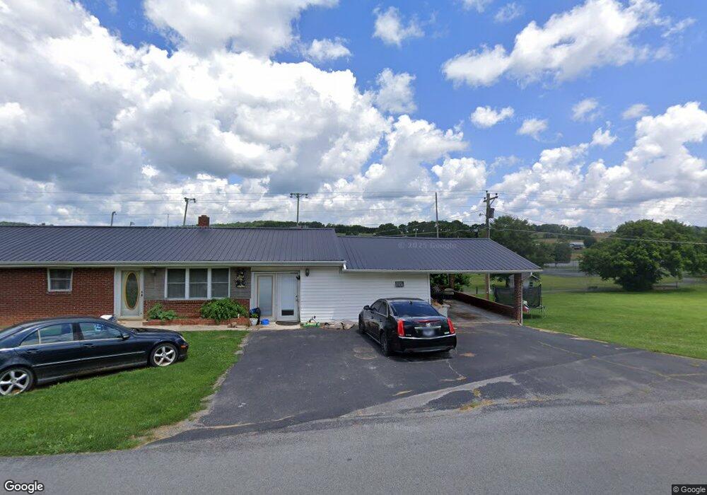
816 Old Highway 33 New Tazewell, TN 37825
Estimated Value: $190,722 - $240,000
--
Bed
1
Bath
1,536
Sq Ft
$138/Sq Ft
Est. Value
About This Home
This home is located at 816 Old Highway 33, New Tazewell, TN 37825 and is currently estimated at $212,681, approximately $138 per square foot. 816 Old Highway 33 is a home located in Claiborne County with nearby schools including Heriage Christian Academy.
Ownership History
Date
Name
Owned For
Owner Type
Purchase Details
Closed on
Apr 22, 1998
Sold by
Wilson Bernice G
Bought by
Barnett Teresa
Current Estimated Value
Purchase Details
Closed on
Dec 30, 1997
Bought by
Barnett Teresa Wilson
Purchase Details
Closed on
Jul 11, 1996
Sold by
Wilson Magdalene G
Bought by
Wilson Bernice G and Wilson George
Purchase Details
Closed on
Jul 20, 1995
Bought by
Wilson Bernice G and Wilson George R
Purchase Details
Closed on
Jan 1, 1984
Bought by
Wilson Magdalene G
Purchase Details
Closed on
Jan 2, 1965
Create a Home Valuation Report for This Property
The Home Valuation Report is an in-depth analysis detailing your home's value as well as a comparison with similar homes in the area
Home Values in the Area
Average Home Value in this Area
Purchase History
| Date | Buyer | Sale Price | Title Company |
|---|---|---|---|
| Barnett Teresa | $69,200 | -- | |
| Barnett Teresa Wilson | $69,200 | -- | |
| Wilson Bernice G | $60,000 | -- | |
| Wilson Bernice G | $60,000 | -- | |
| Wilson Magdalene G | -- | -- | |
| -- | -- | -- |
Source: Public Records
Tax History Compared to Growth
Tax History
| Year | Tax Paid | Tax Assessment Tax Assessment Total Assessment is a certain percentage of the fair market value that is determined by local assessors to be the total taxable value of land and additions on the property. | Land | Improvement |
|---|---|---|---|---|
| 2024 | $797 | $34,050 | $2,475 | $31,575 |
| 2023 | $797 | $34,050 | $2,475 | $31,575 |
| 2022 | $681 | $34,050 | $2,475 | $31,575 |
| 2021 | $567 | $22,000 | $2,200 | $19,800 |
| 2020 | $567 | $22,000 | $2,200 | $19,800 |
| 2019 | $567 | $22,000 | $2,200 | $19,800 |
| 2018 | $567 | $22,000 | $2,200 | $19,800 |
| 2017 | $567 | $22,000 | $2,200 | $19,800 |
| 2016 | $593 | $22,975 | $2,200 | $20,775 |
| 2015 | $570 | $22,975 | $2,200 | $20,775 |
| 2014 | $570 | $22,990 | $0 | $0 |
Source: Public Records
Map
Nearby Homes
- 1029 Rowe St
- 510 S Broad St (Commercial 3 9 Acre)
- 1264 Rowe St
- 1210 Rowe St
- 207 Nunn St
- 170 Mallory Dr
- 117 Mallory Dr
- Lot 1 Harmon Rd
- Lot 492 Citron
- 323 Harmon Rd
- 196 Poplar Dr
- 402 S Broad St ( 53 Acre)
- 0 Harmon Rd
- 0 Harmon Cir
- 120 Ruby Ln
- 352 Rutherford Dr
- 218 Adair Dr
- 137 Adair Dr
- 0 Cole Hollow Rd
- 142 Lone Holly Ln
- 818 Old Highway 33
- 808 Old Highway 33
- 806 Old Highway 33
- 799 Old Highway 33
- 799 Old Highway 33 Unit 33
- 103 Snodgrass Rd
- 101 Snodgrass Rd
- 905 Old Highway 33
- 105 Snodgrass Rd
- 0 S Hwy 33 and Snodgrass Unit 635763
- 201 Snodgrass Rd
- 203 Snodgrass Rd
- 906 Old Highway 33
- 745 Old Highway 33
- 205 Snodgrass Rd
- 927 Ramsey Ln
- 301 Snodgrass Rd
- 143 Lynch Ln
- 915 Old Highway 33
- 725 Old Highway 33