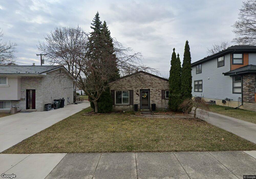
816 Stanley Ct Royal Oak, MI 48067
Estimated Value: $273,464 - $320,000
3
Beds
1
Bath
1,049
Sq Ft
$282/Sq Ft
Est. Value
About This Home
This home is located at 816 Stanley Ct, Royal Oak, MI 48067 and is currently estimated at $295,366, approximately $281 per square foot. 816 Stanley Ct is a home located in Oakland County with nearby schools including Keller Elementary, Royal Oak Middle School, and Royal Oak High School.
Ownership History
Date
Name
Owned For
Owner Type
Purchase Details
Closed on
Jul 23, 2010
Sold by
Onewest Bank Fsb
Bought by
Federal National Mortgage Association
Current Estimated Value
Purchase Details
Closed on
Jul 20, 2010
Sold by
Vanderhoff Jason
Bought by
Onewest Bank Fsb
Purchase Details
Closed on
Jun 28, 2004
Sold by
Rohrig Mark C
Bought by
Vanderhoff Jason
Purchase Details
Closed on
Jan 19, 1996
Sold by
Higgins Kenneth P
Bought by
Rohrig Mark C
Home Financials for this Owner
Home Financials are based on the most recent Mortgage that was taken out on this home.
Original Mortgage
$66,900
Interest Rate
7.19%
Create a Home Valuation Report for This Property
The Home Valuation Report is an in-depth analysis detailing your home's value as well as a comparison with similar homes in the area
Home Values in the Area
Average Home Value in this Area
Purchase History
| Date | Buyer | Sale Price | Title Company |
|---|---|---|---|
| Federal National Mortgage Association | -- | None Available | |
| Onewest Bank Fsb | $123,368 | None Available | |
| Vanderhoff Jason | $137,500 | Metropolitan Title Company | |
| Rohrig Mark C | $67,000 | -- |
Source: Public Records
Mortgage History
| Date | Status | Borrower | Loan Amount |
|---|---|---|---|
| Previous Owner | Rohrig Mark C | $66,900 |
Source: Public Records
Tax History Compared to Growth
Tax History
| Year | Tax Paid | Tax Assessment Tax Assessment Total Assessment is a certain percentage of the fair market value that is determined by local assessors to be the total taxable value of land and additions on the property. | Land | Improvement |
|---|---|---|---|---|
| 2024 | $2,321 | $114,120 | $0 | $0 |
| 2022 | $2,742 | $101,360 | $0 | $0 |
| 2020 | $2,815 | $93,040 | $0 | $0 |
| 2018 | $2,742 | $81,620 | $0 | $0 |
| 2017 | $2,655 | $81,620 | $0 | $0 |
| 2015 | -- | $67,900 | $0 | $0 |
| 2014 | -- | $64,730 | $0 | $0 |
| 2011 | -- | $58,980 | $0 | $0 |
Source: Public Records
Map
Nearby Homes
- 706 Chambers St
- 709 E 11 Mile Rd
- 406 N Altadena Ave
- 206 Kayser Ave
- 101 Curry Ave Unit 536
- 430 N Altadena Ave
- 1019 E 4th St
- 121 N Blair Ave
- 517 E 3rd St
- 923 E 5th St
- 611 N Gainsborough Ave
- 718 N Alexander Ave
- 805 Forest Ave
- 806 N Altadena Ave
- 418 E 5th St Unit 2
- 716 Hawthorn Ave
- 607 Knowles St
- 408 Forest Ave
- 350 N Main St Unit 814
- 350 N Main St Unit 517
- 818 Stanley Ct
- 814 Stanley Ct
- 810 Stanley Ct Unit Bldg-Unit
- 810 Stanley Ct
- 125 N Alexander Ave
- 121 N Alexander Ave
- 129 N Alexander Ave
- 117 N Alexander Ave
- 130 Potter Ave
- 118 Potter Ave
- 133 N Alexander Ave
- 809 Stanley Ct
- 817 Stanley Ct
- 134 Potter Ave
- 203 N Alexander Ave
- 111 N Alexander Ave
- 207 N Alexander Ave
- 821 Stanley Ct
- 206 Potter Ave
- 210 Potter Ave