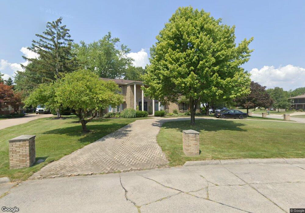
8163 Burning Bush Rd Grosse Ile, MI 48138
Estimated Value: $443,806 - $636,000
4
Beds
4
Baths
3,117
Sq Ft
$164/Sq Ft
Est. Value
About This Home
This home is located at 8163 Burning Bush Rd, Grosse Ile, MI 48138 and is currently estimated at $512,702, approximately $164 per square foot. 8163 Burning Bush Rd is a home located in Wayne County.
Ownership History
Date
Name
Owned For
Owner Type
Purchase Details
Closed on
Mar 4, 2017
Sold by
Percha Amy E
Bought by
Charney Matthew
Current Estimated Value
Home Financials for this Owner
Home Financials are based on the most recent Mortgage that was taken out on this home.
Original Mortgage
$254,900
Outstanding Balance
$130,206
Interest Rate
4.19%
Mortgage Type
New Conventional
Estimated Equity
$382,496
Purchase Details
Closed on
Apr 26, 2011
Sold by
Eccleston Rex J and Eccleston Cheryl L
Bought by
Percha Amy E
Create a Home Valuation Report for This Property
The Home Valuation Report is an in-depth analysis detailing your home's value as well as a comparison with similar homes in the area
Home Values in the Area
Average Home Value in this Area
Purchase History
| Date | Buyer | Sale Price | Title Company |
|---|---|---|---|
| Charney Matthew | -- | Title Source Inc | |
| Percha Amy E | $242,000 | Michigan Title Insurance Age |
Source: Public Records
Mortgage History
| Date | Status | Borrower | Loan Amount |
|---|---|---|---|
| Open | Charney Matthew | $254,900 |
Source: Public Records
Tax History Compared to Growth
Tax History
| Year | Tax Paid | Tax Assessment Tax Assessment Total Assessment is a certain percentage of the fair market value that is determined by local assessors to be the total taxable value of land and additions on the property. | Land | Improvement |
|---|---|---|---|---|
| 2025 | $2,398 | $212,500 | $0 | $0 |
| 2024 | $2,398 | $210,300 | $0 | $0 |
| 2023 | $2,743 | $192,600 | $0 | $0 |
| 2022 | $6,385 | $177,700 | $0 | $0 |
| 2021 | $6,107 | $175,200 | $0 | $0 |
| 2019 | $6,057 | $153,100 | $0 | $0 |
| 2018 | $2,605 | $153,100 | $0 | $0 |
| 2017 | $6,726 | $147,300 | $0 | $0 |
| 2016 | $5,952 | $146,500 | $0 | $0 |
| 2015 | $12,676 | $133,200 | $0 | $0 |
| 2013 | $12,280 | $128,000 | $0 | $0 |
| 2012 | $2,612 | $121,000 | $31,400 | $89,600 |
Source: Public Records
Map
Nearby Homes
- 22015 Ember Ct
- 8232 Island Blvd
- 21599 Parke Ln
- 8258 Concord Rd
- 7806 Island Blvd
- 8614 Island Blvd
- 21644 Knudsen Dr
- 22220 E River Rd
- 21604 E River Rd
- 21819 Meridian Rd
- 21321 Knudsen Dr
- 22133 Meridian Rd
- 9281 Island Dr
- 21071 Thorofare Rd
- 9000 Ferry Rd
- 8855 Ferry Rd
- Lot 503 Gi Pkwy
- 00000 Magnolia Ln
- VACANT Oriole Ave
- 21438 Meridian Rd
- 21950 Ember Ct
- 21845 Canterbury Ave
- 8150 Burning Bush Rd
- 8161 Burning Bush Rd
- 21879 Canterbury Ave
- 8172 Burning Bush Rd
- 21913 Canterbury Ave
- 8128 Burning Bush Rd
- 8117 Burning Bush Rd
- 8192 Burning Bush Rd
- 21931 Canterbury Ave
- 21947 Canterbury Ave
- 8106 Burning Bush Rd
- 8159 Berkshire Dr
- 8095 Burning Bush Rd
- 21818 Canterbury Ave
- 8191 Berkshire Dr
- 21834 Canterbury Ave
- 22015 Ember Ct Unit Bldg-Unit
- 21959 Ember Ct