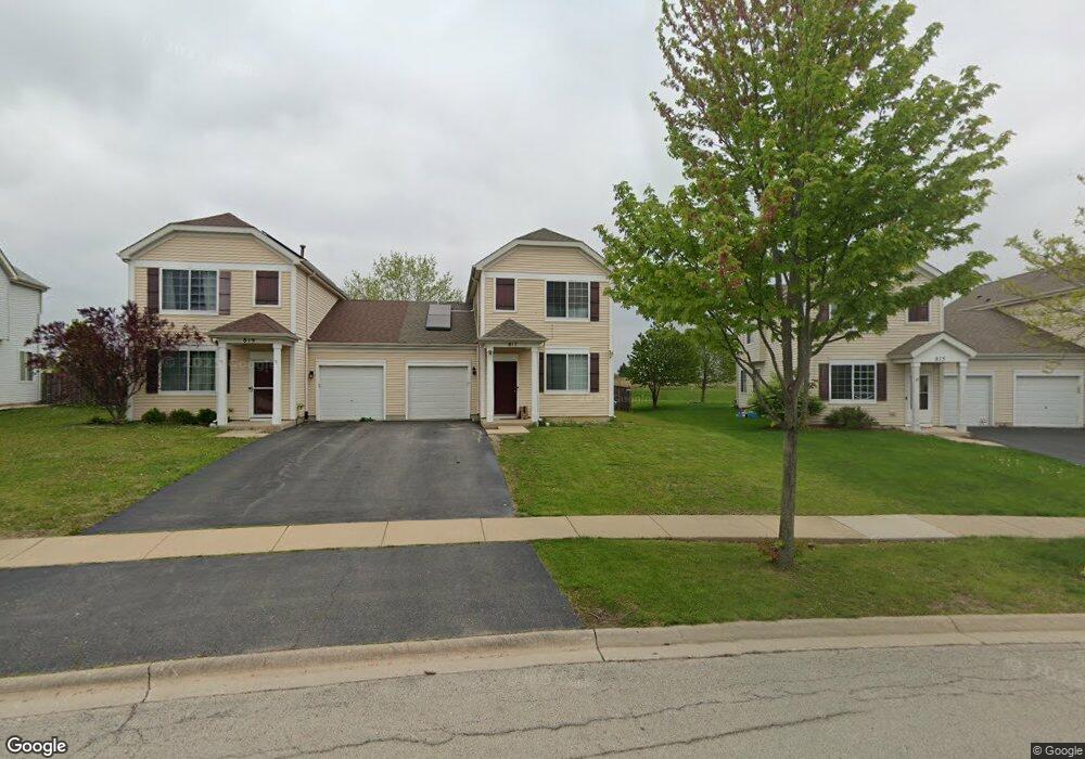
817 Daniel Dr Minooka, IL 60447
North Minooka NeighborhoodEstimated Value: $270,269 - $284,000
Studio
1
Bath
1,596
Sq Ft
$173/Sq Ft
Est. Value
About This Home
This home is located at 817 Daniel Dr, Minooka, IL 60447 and is currently estimated at $275,567, approximately $172 per square foot. 817 Daniel Dr is a home located in Kendall County with nearby schools including Jones Elementary School, Minooka Junior High School, and Minooka Intermediate School.
Ownership History
Date
Name
Owned For
Owner Type
Purchase Details
Closed on
Sep 1, 2008
Sold by
Centex Homes
Bought by
Oliver Annie
Current Estimated Value
Home Financials for this Owner
Home Financials are based on the most recent Mortgage that was taken out on this home.
Original Mortgage
$150,793
Outstanding Balance
$100,298
Interest Rate
6.52%
Mortgage Type
FHA
Estimated Equity
$175,269
Create a Home Valuation Report for This Property
The Home Valuation Report is an in-depth analysis detailing your home's value as well as a comparison with similar homes in the area
Home Values in the Area
Average Home Value in this Area
Purchase History
| Date | Buyer | Sale Price | Title Company |
|---|---|---|---|
| Oliver Annie | $153,500 | None Available |
Source: Public Records
Mortgage History
| Date | Status | Borrower | Loan Amount |
|---|---|---|---|
| Open | Oliver Annie | $150,793 |
Source: Public Records
Tax History
| Year | Tax Paid | Tax Assessment Tax Assessment Total Assessment is a certain percentage of the fair market value that is determined by local assessors to be the total taxable value of land and additions on the property. | Land | Improvement |
|---|---|---|---|---|
| 2024 | $5,933 | $77,356 | $11,506 | $65,850 |
| 2023 | $4,585 | $67,739 | $7,481 | $60,258 |
| 2022 | $4,585 | $59,931 | $6,927 | $53,004 |
| 2021 | $4,436 | $56,705 | $7,032 | $49,673 |
| 2020 | $4,493 | $55,336 | $6,862 | $48,474 |
| 2019 | $4,063 | $49,422 | $6,862 | $42,560 |
| 2018 | $3,712 | $46,903 | $6,512 | $40,391 |
| 2017 | $3,563 | $42,766 | $6,512 | $36,254 |
| 2016 | $3,286 | $39,629 | $6,432 | $33,197 |
| 2015 | $2,975 | $36,190 | $6,105 | $30,085 |
| 2014 | -- | $33,824 | $6,105 | $27,719 |
| 2013 | -- | $33,824 | $6,105 | $27,719 |
Source: Public Records
Map
Nearby Homes
- 837 Briarcliff Dr
- 1302 Kettleson Dr
- 2050 Isabella Ln
- 194 acres W Holt Rd
- Lot 1 Minooka Ridge & Jones Rd
- 2041 Isabella Ln
- 2200 Holt Rd
- LOT 1 Bob Blair Rd
- 701 Davidson Dr Unit B
- 201 W Church St
- 405 W Mondamin St
- 105 Blackhawk Dr
- 2037 Isabella Ln
- 1133 Coneflower Ct
- 6010-6060 E Minooka Rd
- 706 O Toole Dr
- 517 Rivers Edge Dr
- 0 County Line Rd
- 521 Rivers Edge Dr
- 103 Northfield Dr
- 815 Daniel Dr
- 823 Daniel Dr
- 813 Daniel Dr
- 821 Daniel Dr
- 811 Daniel Dr
- 825 Daniel Dr
- 809 Daniel Dr
- 809 Daniel Dr Unit 2A
- 816 Daniel Dr
- 827 Daniel Dr
- 807 Daniel Dr
- 806 Daniel Dr
- 829 Daniel Dr
- 822 Daniel Dr
- 822 Daniel Dr Unit 1
- 804 Daniel Dr Unit 2A
- 831 Daniel Dr
- 803 Daniel Dr
- 802 Daniel Dr
- 833 Daniel Dr