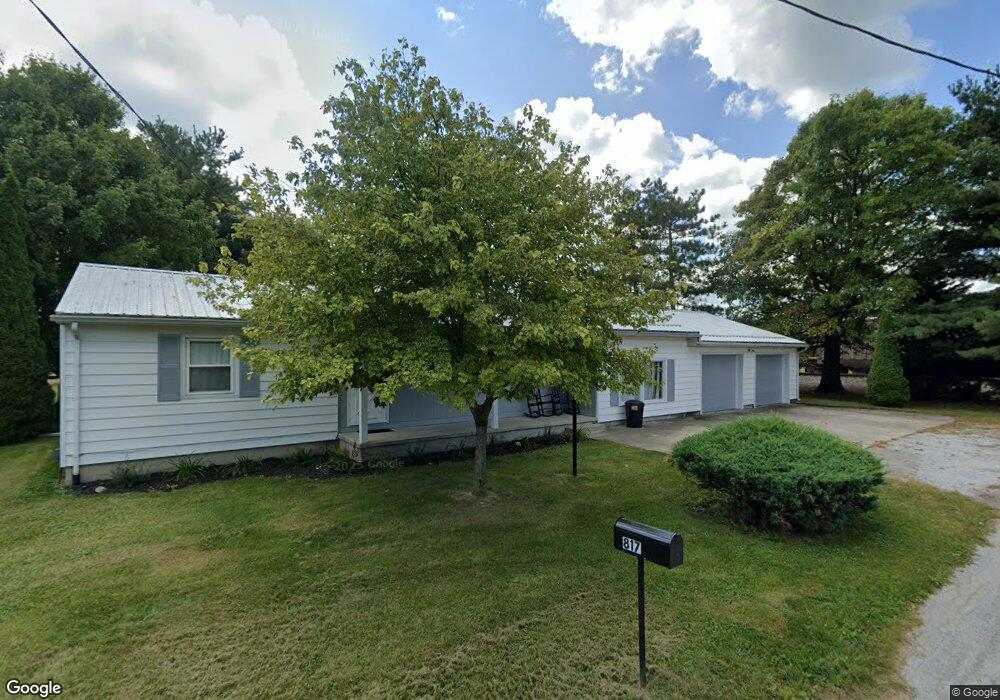
817 Kroger Dr Upper Sandusky, OH 43351
Estimated Value: $154,066 - $190,000
2
Beds
1
Bath
1,380
Sq Ft
$128/Sq Ft
Est. Value
About This Home
This home is located at 817 Kroger Dr, Upper Sandusky, OH 43351 and is currently estimated at $176,267, approximately $127 per square foot. 817 Kroger Dr is a home located in Wyandot County with nearby schools including Upper Sandusky High School and St. Peter Elementary School.
Ownership History
Date
Name
Owned For
Owner Type
Purchase Details
Closed on
Aug 22, 2022
Sold by
Frey Rodney J and Frey Kim M
Bought by
Frey Principal Protection Trust
Current Estimated Value
Purchase Details
Closed on
Dec 5, 2018
Sold by
Ekleberry Lewis R
Bought by
Frey Rodney J and Frey Kim M
Purchase Details
Closed on
Nov 20, 2018
Sold by
Ekleberry Darwin W and Ekleberry Nancy
Bought by
Ekleberry Lewis R
Create a Home Valuation Report for This Property
The Home Valuation Report is an in-depth analysis detailing your home's value as well as a comparison with similar homes in the area
Home Values in the Area
Average Home Value in this Area
Purchase History
| Date | Buyer | Sale Price | Title Company |
|---|---|---|---|
| Frey Principal Protection Trust | -- | -- | |
| Frey Principal Protection Trust | -- | None Listed On Document | |
| Frey Rodney J | $62,000 | None Available | |
| Ekleberry Lewis R | -- | None Available |
Source: Public Records
Tax History
| Year | Tax Paid | Tax Assessment Tax Assessment Total Assessment is a certain percentage of the fair market value that is determined by local assessors to be the total taxable value of land and additions on the property. | Land | Improvement |
|---|---|---|---|---|
| 2025 | $1,613 | $52,340 | $4,260 | $48,080 |
| 2024 | $1,436 | $44,080 | $3,610 | $40,470 |
| 2023 | $1,436 | $44,080 | $3,610 | $40,470 |
| 2022 | $1,436 | $34,180 | $2,930 | $31,250 |
| 2021 | $1,165 | $34,180 | $2,930 | $31,250 |
| 2020 | $1,165 | $34,180 | $2,930 | $31,250 |
| 2019 | $1,163 | $34,180 | $2,930 | $31,250 |
| 2018 | $1,045 | $31,270 | $3,440 | $27,830 |
| 2017 | $1,037 | $31,270 | $3,440 | $27,830 |
| 2016 | -- | $31,270 | $3,440 | $27,830 |
| 2015 | -- | $30,210 | $3,440 | $26,770 |
| 2014 | -- | $30,210 | $3,440 | $26,770 |
| 2013 | -- | $30,210 | $3,440 | $26,770 |
Source: Public Records
Map
Nearby Homes
- 605 Polaris Dr
- 386 W Finley St
- 212 N Hazel St
- 512 N 7th St
- 9768 County Highway 111
- 137 N 8th St
- 479 N 5th St
- 225 S Hazel St
- 333 N 5th St
- 116 E Walker St
- 334 N 4th St
- 314 N 4th St
- 0 Ohio 53
- 326 S 8th St
- 432 E Bigelow St
- 387 S Warpole St
- 479 Front St
- 430 S Sandusky Ave
- 379 W Spring St
- 0 State Route 53 & 67 Unit 11165687
- 0 Betty Lou St Lot #7
- 815 Kroger Dr
- 0 Betty Lou St (Lot 7)
- 816 Kroger Dr
- 811 Kroger Dr
- 814 Kroger Dr
- 502 Baker Ct
- 801 Kroger Dr
- 525 Betty Lou St
- 512 Baker Ct
- 535 Betty Lou St
- 00 Betty Lou St
- 0 Betty Lou St
- lot 7 Betty Lou St
- 735 Kroger Dr
- 0 Baker Ct Unit H116660
- 0 Baker Ct Unit H135148
- 0 Baker Ct Unit H136220
- 503 Baker Ct
- 522 Baker Ct
Your Personal Tour Guide
Ask me questions while you tour the home.