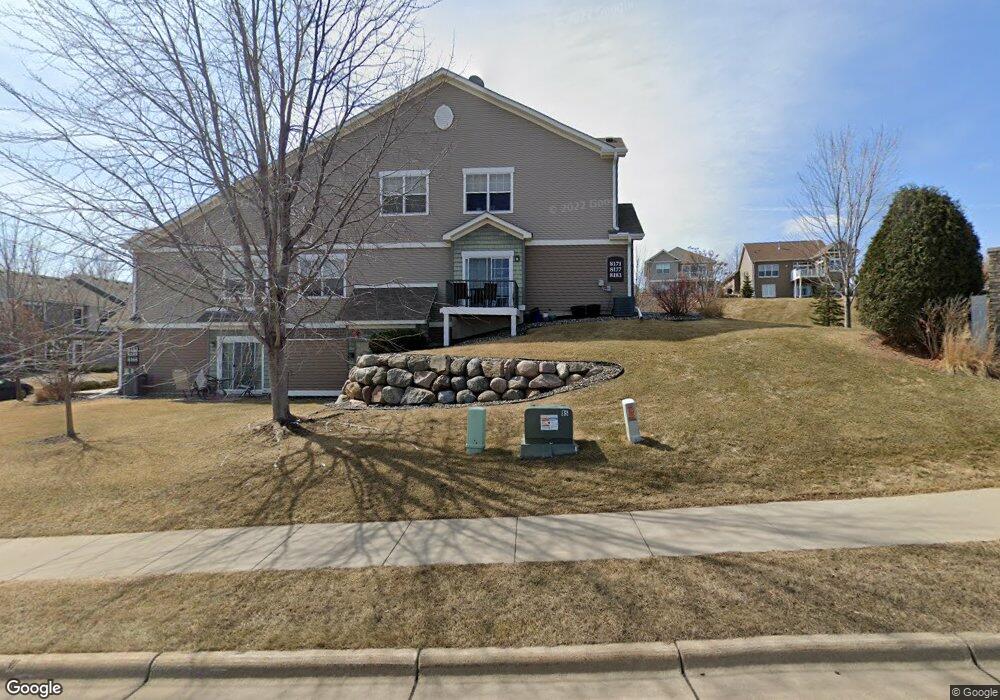
8171 W 133rd St Savage, MN 55378
Estimated Value: $285,000 - $323,000
2
Beds
3
Baths
1,595
Sq Ft
$187/Sq Ft
Est. Value
About This Home
This home is located at 8171 W 133rd St, Savage, MN 55378 and is currently estimated at $297,612, approximately $186 per square foot. 8171 W 133rd St is a home located in Scott County with nearby schools including Eagle Ridge Middle School, Burnsville High School, and Aspen Academy.
Ownership History
Date
Name
Owned For
Owner Type
Purchase Details
Closed on
Jul 7, 2016
Sold by
Flavin Mitchel H and Flavin Mary
Bought by
Lombard David M and Lombard Melissa
Current Estimated Value
Home Financials for this Owner
Home Financials are based on the most recent Mortgage that was taken out on this home.
Original Mortgage
$140,000
Outstanding Balance
$63,693
Interest Rate
3.66%
Mortgage Type
New Conventional
Estimated Equity
$233,919
Purchase Details
Closed on
Apr 2, 2007
Sold by
Trout Run Preserve Llc
Bought by
Flavin Mitchel H and Flavin Mary
Create a Home Valuation Report for This Property
The Home Valuation Report is an in-depth analysis detailing your home's value as well as a comparison with similar homes in the area
Home Values in the Area
Average Home Value in this Area
Purchase History
| Date | Buyer | Sale Price | Title Company |
|---|---|---|---|
| Lombard David M | $205,000 | Edina Realty Title Inc | |
| Flavin Mitchel H | $233,089 | -- |
Source: Public Records
Mortgage History
| Date | Status | Borrower | Loan Amount |
|---|---|---|---|
| Open | Lombard David M | $140,000 |
Source: Public Records
Tax History Compared to Growth
Tax History
| Year | Tax Paid | Tax Assessment Tax Assessment Total Assessment is a certain percentage of the fair market value that is determined by local assessors to be the total taxable value of land and additions on the property. | Land | Improvement |
|---|---|---|---|---|
| 2025 | $2,970 | $284,500 | $88,200 | $196,300 |
| 2024 | $2,792 | $285,400 | $88,200 | $197,200 |
| 2023 | $2,838 | $266,000 | $81,700 | $184,300 |
| 2022 | $2,640 | $270,800 | $86,500 | $184,300 |
| 2021 | $2,652 | $241,900 | $68,500 | $173,400 |
| 2020 | $3,048 | $229,200 | $54,900 | $174,300 |
| 2019 | $2,804 | $251,000 | $54,900 | $196,100 |
| 2018 | $2,528 | $0 | $0 | $0 |
| 2016 | $2,388 | $0 | $0 | $0 |
| 2014 | -- | $0 | $0 | $0 |
Source: Public Records
Map
Nearby Homes
- 8160 Virginia Ln
- 13539 Foxberry Rd
- 8600 W 132nd St
- 13251 Pennsylvania Ave
- 13186 Meadow Ln
- 8821 Preserve Place
- 9007 Meadow Place
- 13651 Dan Patch Dr
- 9042 Preserve Trail
- 13032 Falcons Way
- 9200 W 136th St
- 8109 139th St
- 13933 Ventura Place
- 13986 W Virginia Ave
- 9120 138th St W
- 13954 Shoreside Cir
- 6627 133rd St
- xxxx Sumter Ave
- 13913 Nevada Ave
- 7013 Connelly Ct
- 8177 W 133rd St
- 8159 8159 133rd-Street-
- 8159 W 133rd St
- 8131 W 133rd St
- 8183 W 133rd St
- 8165 W 133rd St
- 8129 W 133rd St
- 8135 W 133rd St
- 8141 W 133rd St
- 8141 8141 133rd-Street-
- 8147 W 133rd St
- 13318 Virginia Ave S
- 13322 Virginia Ave S
- 13335 13335 W Virginia-Avenue-
- 13326 Virginia Ave S
- 13330 Virginia Ave S
- 8227 W 133rd Place
- 8225 W 133rd Place
- 8229 W 133rd Place
- 8221 W 133rd Place