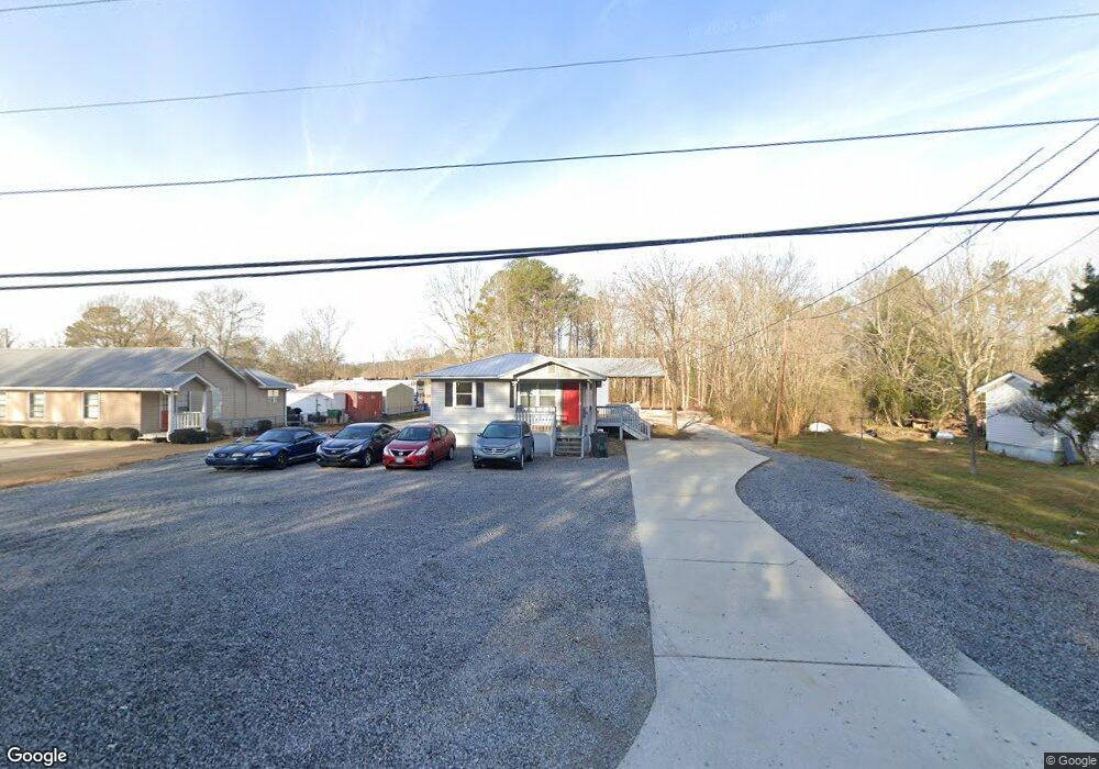
8182 Highway 17 Alabaster, AL 35114
Estimated Value: $174,000 - $251,000
--
Bed
--
Bath
665
Sq Ft
$339/Sq Ft
Est. Value
About This Home
This home is located at 8182 Highway 17, Alabaster, AL 35114 and is currently estimated at $225,237, approximately $338 per square foot. 8182 Highway 17 is a home with nearby schools including Thompson Intermediate School, Thompson Middle School, and Thompson High School.
Ownership History
Date
Name
Owned For
Owner Type
Purchase Details
Closed on
Jan 23, 2025
Sold by
Ferguson Family Enterprises Llc
Bought by
Blaising Auto Sales Llc
Current Estimated Value
Home Financials for this Owner
Home Financials are based on the most recent Mortgage that was taken out on this home.
Original Mortgage
$192,000
Outstanding Balance
$188,845
Interest Rate
6.6%
Mortgage Type
Credit Line Revolving
Estimated Equity
$36,392
Purchase Details
Closed on
Aug 19, 2019
Sold by
Doss Carl Leonard and Pennington Mary Jane
Bought by
Ferguson Family Enterprises Llc
Purchase Details
Closed on
Oct 7, 2008
Sold by
Doss William A
Bought by
Doss Carl Leonard and Pennington Mary Jane
Create a Home Valuation Report for This Property
The Home Valuation Report is an in-depth analysis detailing your home's value as well as a comparison with similar homes in the area
Home Values in the Area
Average Home Value in this Area
Purchase History
| Date | Buyer | Sale Price | Title Company |
|---|---|---|---|
| Blaising Auto Sales Llc | $240,000 | None Listed On Document | |
| Ferguson Family Enterprises Llc | $70,000 | None Available | |
| Doss Carl Leonard | $5,000 | None Available |
Source: Public Records
Mortgage History
| Date | Status | Borrower | Loan Amount |
|---|---|---|---|
| Open | Blaising Auto Sales Llc | $192,000 |
Source: Public Records
Tax History Compared to Growth
Tax History
| Year | Tax Paid | Tax Assessment Tax Assessment Total Assessment is a certain percentage of the fair market value that is determined by local assessors to be the total taxable value of land and additions on the property. | Land | Improvement |
|---|---|---|---|---|
| 2024 | $1,170 | $26,600 | $0 | $0 |
| 2023 | $1,070 | $24,320 | $0 | $0 |
| 2022 | $541 | $12,300 | $0 | $0 |
| 2021 | $491 | $11,160 | $0 | $0 |
| 2020 | $481 | $0 | $0 | $0 |
| 2019 | $201 | $4,560 | $0 | $0 |
| 2017 | $194 | $4,420 | $0 | $0 |
| 2015 | $176 | $4,000 | $0 | $0 |
| 2014 | $173 | $3,940 | $0 | $0 |
Source: Public Records
Map
Nearby Homes
- 104 Maple St
- 128 Oak St
- 731 Crider Rd
- 640 Round Rd
- 1315 Yellowleaf Cir
- 252 Lacey Ave
- 257 Lacey Ave
- 409 Sweet Leaf Ln
- 226 Lake Forest Way
- 155 Victoria Station
- 189 Sweetbay Dr
- 236 Queens Gate
- 549 Ramsgate Dr
- 501 Ramsgate Dr
- 545 Ramsgate Dr
- 208 Queens Gate
- 217 Kensington Ln
- 309 Cedar Grove Ct
- 537 Ramsgate Dr
- 306 Mayfair Cir
- 8200 Highway 17
- 8166 Highway 17
- 180 Chinaberry Ln
- 184 Chinaberry Ln
- 176 Chinaberry Ln
- 101 Chinaberry Ln
- 0 Highway 17 Unit 1
- 172 Chinaberry Ln
- 8244 Highway 17
- 100 Chinaberry Ln
- 8248 Highway 17
- 179 Chinaberry Ln
- 170 Chinaberry Ln
- 113 Chinaberry Ln
- 113 Chinaberry Ln Unit 25
- 171 Chinaberry Ln
- 168 Chinaberry Ln
- 108 Chinaberry Ln
- 203 Chinaberry Ln
- 163 Chinaberry Ln