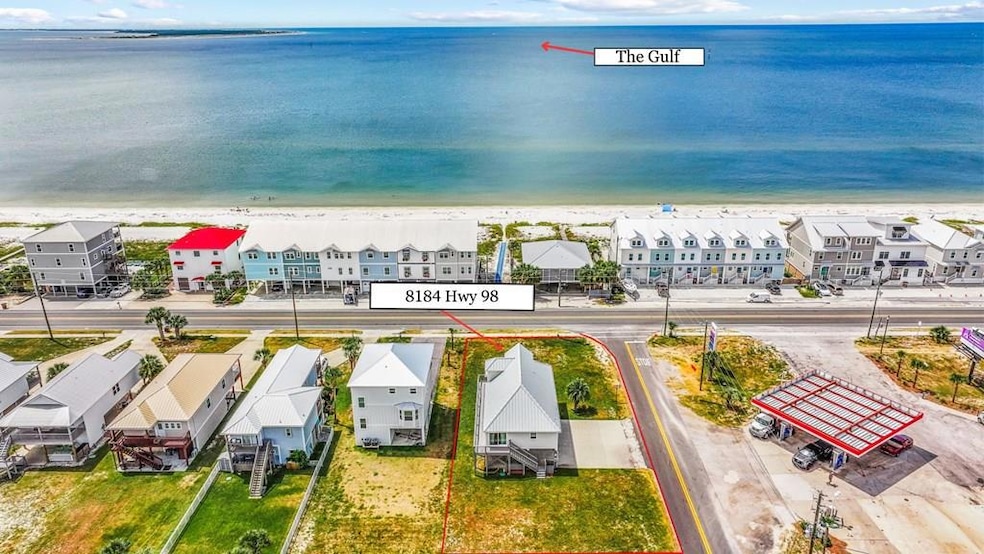
8184 W Highway 98 Port Saint Joe, FL 32456
Saint Joe Beach NeighborhoodEstimated payment $5,672/month
Highlights
- Parking available for a boat
- Gulf View
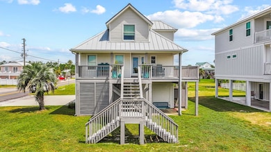
- Beach House
- In Ground Pool
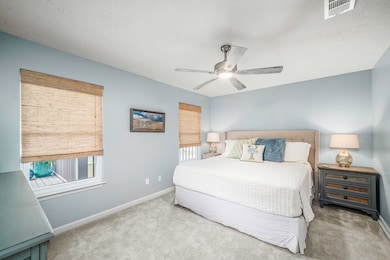
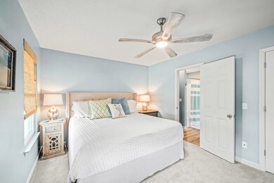
- Sitting Area In Primary Bedroom
- Corner Lot
About This Home
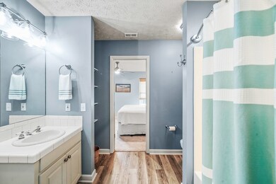
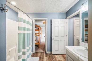
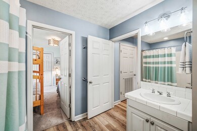
Welcome to this inviting 2-story beach house with a Gulf view in the Summer House subdivision, where public beach access is directly across the street and a community pool offers endless days of fun in the sun. Perfectly positioned in the X-FLOOD ZONE and on a large corner lot, this property provides the kind of convenience and flexibility rare in a beach home—ample space for boat parking, easy access in and out, and even storage beneath the home for all your gear. Step inside to a bright, coastal-inspired interior finished in a soft, neutral palette. The main level features a separate den perfect for family game night or just relaxing in front of the TV, an open living/dining combo with charming wainscoting, and a kitchen designed for both function and entertaining, with a breakfast bar, small island, and generous cabinet space. A bedroom on the main floor accommodates a king-size bed with Gulf views. The Jack & Jill bath connects to a dedicated bunk room that offers a fun and flexible space for kids or guests. Upstairs, the entire level is devoted to the master suite, complete with a sitting area offering gorgeous Gulf views, a walk-in closet, and a master bath featuring a double vanity with granite countertops. The covered front porch is ideal for enjoying the view and the ocean breeze with your morning coffee or spend your evenings watching sunsets over the water. The wraparound porch adds extra outdoor living space along the side of the home. Underneath the house, there's plenty of room for more than just your boat: store kayaks, paddleboards, fishing rods, and beach toys with ease. There's even a small storage room and a refrigerator —perfect for keeping your fresh catch of the day cold after a fishing trip. Whether you're searching for a full-time home, a vacation retreat, or an investment property, this property checks all the boxes: direct beach access, room for your boat, storage for all your coastal toys, and spacious porches to enjoy THE BEACH LIFE!
Listing Agent
Beach Properties Real Estate Group Brokerage Phone: 8502272500 License #3068203 Listed on: 09/09/2025
Home Details
Home Type
- Single Family
Est. Annual Taxes
- $7,139
Year Built
- Built in 2000
Lot Details
- 0.33 Acre Lot
- Lot Dimensions are 70 x 205
- Corner Lot
HOA Fees
- $75 Monthly HOA Fees
Home Design
- Beach House
- Pillar, Post or Pier Foundation
- Frame Construction
- Metal Roof
- Vinyl Siding
Interior Spaces
- 1,928 Sq Ft Home
- 2-Story Property
- Furnished
- Ceiling Fan
- Recessed Lighting
- Window Treatments
- Family Room
- Combination Dining and Living Room
- Carpet
- Gulf Views
- Fire and Smoke Detector
Kitchen
- Breakfast Bar
- Electric Oven
- Microwave
- Dishwasher
- Kitchen Island
Bedrooms and Bathrooms
- 3 Bedrooms
- Sitting Area In Primary Bedroom
- Walk-In Closet
- Dual Vanity Sinks in Primary Bathroom
Laundry
- Dryer
- Washer
Parking
- 6 Parking Spaces
- Tuck Under Parking
- Covered Parking
- Driveway
- Open Parking
- Parking available for a boat
Outdoor Features
- In Ground Pool
- Front Porch
Utilities
- Central Heating and Cooling System
- Vented Exhaust Fan
Listing and Financial Details
- Assessor Parcel Number 03806745R
Community Details
Overview
- Association fees include accounting, management, recreational facilities
- Summer Place Subdivision
- The community has rules related to covenants
Recreation
- Community Pool
Map
Home Values in the Area
Average Home Value in this Area
Tax History
| Year | Tax Paid | Tax Assessment Tax Assessment Total Assessment is a certain percentage of the fair market value that is determined by local assessors to be the total taxable value of land and additions on the property. | Land | Improvement |
|---|---|---|---|---|
| 2024 | $7,139 | $727,546 | $330,000 | $397,546 |
| 2023 | $7,264 | $733,557 | $330,000 | $403,557 |
| 2022 | $6,884 | $675,425 | $220,000 | $455,425 |
| 2021 | $3,456 | $257,494 | $174,800 | $82,694 |
| 2020 | $3,201 | $230,390 | $143,750 | $86,640 |
| 2019 | $3,242 | $230,390 | $143,750 | $86,640 |
| 2018 | $5,385 | $377,088 | $0 | $0 |
| 2017 | $4,766 | $371,437 | $0 | $0 |
| 2016 | $4,062 | $273,283 | $0 | $0 |
| 2015 | $3,800 | $249,310 | $0 | $0 |
| 2014 | $3,607 | $250,998 | $0 | $0 |
Property History
| Date | Event | Price | List to Sale | Price per Sq Ft |
|---|---|---|---|---|
| 09/09/2025 09/09/25 | For Sale | $949,000 | -- | $492 / Sq Ft |
Purchase History
| Date | Type | Sale Price | Title Company |
|---|---|---|---|
| Special Warranty Deed | $424,500 | None Available | |
| Warranty Deed | $230,000 | -- |
Mortgage History
| Date | Status | Loan Amount | Loan Type |
|---|---|---|---|
| Previous Owner | $184,000 | No Value Available |
Source: Forgotten Coast REALTOR® Association
MLS Number: 324025
APN: 03806-745R
Disclaimer: Certain information contained herein is derived from information provided by parties other than Homes.com. All information provided is deemed reliable, but is not guaranteed to be accurate and should be independently verified.
![]() Property information provided by the FCRA MLS – a service of the Forgotten Coast REALTOR® Association.
Property information provided by the FCRA MLS – a service of the Forgotten Coast REALTOR® Association.
IDX information is provided exclusively for consumers’ personal, non-commercial use, and that it may not be used for any purpose other than to identify prospective properties consumers may be interested in purchasing, and that data is deemed reliable but is not guaranteed accurate by the MLS.
- 107 Kaelyn Ln
- 138 Atlantic St Unit ID1044687P
- 492 Vermilion Cir
- 404 Colorado Dr
- 316 Hatley Dr
- 2502 U S 98 Unit B
- 2502 Highway 98 Unit B
- 2502 Us-98
- 150 Heron Ct
- 165 Saltspray Ct
- 155 Town Village
- 321 Salt Creek Ln
- 321 Salt Crk Ln
- 3050 W Highway 98
- 3050 W Highway 98 Unit B45
- 385 Sunshine Rd
- 953 Backwater Rd
- 121 Westcott Cir
- 1508 Long Ave
- 103 Mimosa Ave
