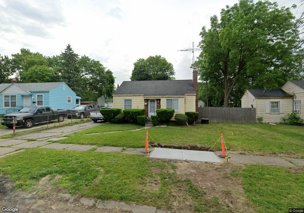
819 Hubbard Ave Flint, MI 48503
Glendale NeighborhoodEstimated Value: $44,000 - $61,736
2
Beds
1
Bath
800
Sq Ft
$68/Sq Ft
Est. Value
About This Home
This home is located at 819 Hubbard Ave, Flint, MI 48503 and is currently estimated at $54,434, approximately $68 per square foot. 819 Hubbard Ave is a home located in Genesee County with nearby schools including Durant-Tuuri-Mott Elementary School, St. Paul Lutheran School, and First Flint Seventh-day Adventist Christian School.
Ownership History
Date
Name
Owned For
Owner Type
Purchase Details
Closed on
May 8, 2001
Sold by
Bankers Trust Co Of California Na
Bought by
Schwertner Gary Duane
Current Estimated Value
Home Financials for this Owner
Home Financials are based on the most recent Mortgage that was taken out on this home.
Original Mortgage
$46,500
Interest Rate
7.18%
Purchase Details
Closed on
May 7, 2001
Sold by
Weaver Susan M and Schwertner Michael T
Bought by
Schwertner Gary Duane
Home Financials for this Owner
Home Financials are based on the most recent Mortgage that was taken out on this home.
Original Mortgage
$46,500
Interest Rate
7.18%
Create a Home Valuation Report for This Property
The Home Valuation Report is an in-depth analysis detailing your home's value as well as a comparison with similar homes in the area
Home Values in the Area
Average Home Value in this Area
Purchase History
| Date | Buyer | Sale Price | Title Company |
|---|---|---|---|
| Schwertner Gary Duane | -- | Greco Title | |
| Schwertner Gary Duane | -- | Philip F Greco Title Company |
Source: Public Records
Mortgage History
| Date | Status | Borrower | Loan Amount |
|---|---|---|---|
| Closed | Schwertner Gary Duane | $46,500 |
Source: Public Records
Tax History Compared to Growth
Tax History
| Year | Tax Paid | Tax Assessment Tax Assessment Total Assessment is a certain percentage of the fair market value that is determined by local assessors to be the total taxable value of land and additions on the property. | Land | Improvement |
|---|---|---|---|---|
| 2025 | $1,087 | $27,800 | $0 | $0 |
| 2024 | $981 | $24,200 | $0 | $0 |
| 2023 | $962 | $17,700 | $0 | $0 |
| 2022 | $0 | $15,000 | $0 | $0 |
| 2021 | $1,002 | $13,900 | $0 | $0 |
| 2020 | $900 | $13,600 | $0 | $0 |
| 2019 | $875 | $13,500 | $0 | $0 |
| 2018 | $882 | $12,800 | $0 | $0 |
| 2017 | $940 | $0 | $0 | $0 |
| 2016 | $934 | $0 | $0 | $0 |
| 2015 | -- | $0 | $0 | $0 |
| 2014 | -- | $0 | $0 | $0 |
| 2012 | -- | $17,100 | $0 | $0 |
Source: Public Records
Map
Nearby Homes
- 916 Mann Ave
- 960 Mann Ave
- 976 Barney Ave
- 3414 Van Buren Ave
- 996 Barney Ave
- 3821 W Court St
- 960 Salisbury Ave
- 911 Hughes Ave
- 3921 Joyner St
- 3705 Gratiot Ave
- 1017 Stocker Ave
- 863 Tacken St
- 1010 Hughes Ave
- 3517 Norwood Dr
- 874 Tacken St
- 870 Tacken St
- 866 Tacken St
- 959 Tacken St
- 2913 Gibson St
- 1122 Stocker Ave
- 813 Hubbard Ave
- 812 Barney Ave
- 806 Barney Ave Unit Bldg-Unit
- 806 Barney Ave
- 807 Hubbard Ave
- 818 Barney Ave
- 802 Barney Ave
- 818 Hubbard Ave
- 814 Hubbard Ave
- 822 Hubbard Ave
- 801 Hubbard Ave
- 810 Hubbard Ave
- 901 Hubbard Ave
- 734 Barney Ave
- 806 Hubbard Ave
- 902 Barney Ave
- 813 Barney Ave
- 807 Barney Ave
- 721 Barney Ave
- 3512 W Court St