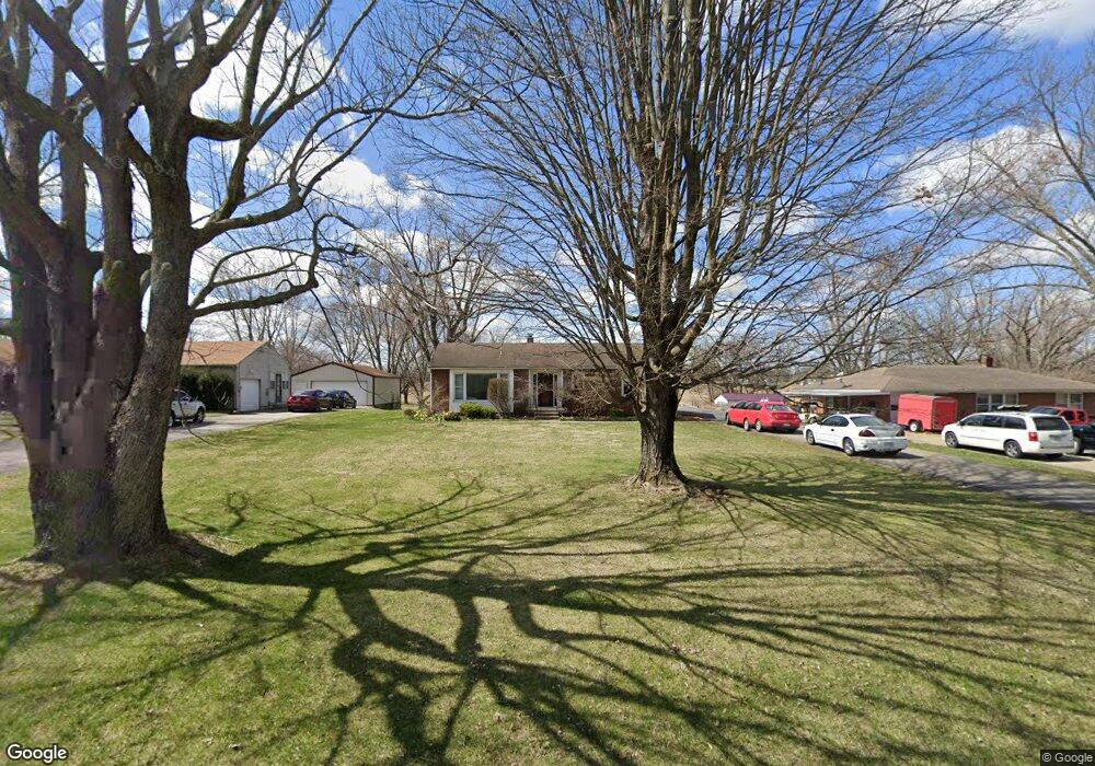
819 S Bird Rd Springfield, OH 45505
Estimated Value: $227,655 - $283,000
3
Beds
2
Baths
1,329
Sq Ft
$195/Sq Ft
Est. Value
About This Home
This home is located at 819 S Bird Rd, Springfield, OH 45505 and is currently estimated at $258,914, approximately $194 per square foot. 819 S Bird Rd is a home located in Clark County with nearby schools including Possum Elementary School, Shawnee Middle School/High School, and Catholic Central Elementary School - Lagonda Campus.
Ownership History
Date
Name
Owned For
Owner Type
Purchase Details
Closed on
Jun 13, 2003
Sold by
Moore Anna M and Moore Anna M
Bought by
Plott Dwayne L and Plott Chastity S
Current Estimated Value
Home Financials for this Owner
Home Financials are based on the most recent Mortgage that was taken out on this home.
Original Mortgage
$121,440
Outstanding Balance
$51,826
Interest Rate
5.78%
Mortgage Type
FHA
Estimated Equity
$207,088
Create a Home Valuation Report for This Property
The Home Valuation Report is an in-depth analysis detailing your home's value as well as a comparison with similar homes in the area
Home Values in the Area
Average Home Value in this Area
Purchase History
| Date | Buyer | Sale Price | Title Company |
|---|---|---|---|
| Plott Dwayne L | $122,400 | -- |
Source: Public Records
Mortgage History
| Date | Status | Borrower | Loan Amount |
|---|---|---|---|
| Open | Plott Dwayne L | $121,440 |
Source: Public Records
Tax History
| Year | Tax Paid | Tax Assessment Tax Assessment Total Assessment is a certain percentage of the fair market value that is determined by local assessors to be the total taxable value of land and additions on the property. | Land | Improvement |
|---|---|---|---|---|
| 2025 | $2,675 | $67,210 | $16,770 | $50,440 |
| 2024 | $2,606 | $53,350 | $12,140 | $41,210 |
| 2023 | $2,606 | $53,350 | $12,140 | $41,210 |
| 2022 | $2,585 | $53,350 | $12,140 | $41,210 |
| 2021 | $2,241 | $41,410 | $9,410 | $32,000 |
| 2020 | $2,259 | $41,410 | $9,410 | $32,000 |
| 2019 | $2,295 | $41,410 | $9,410 | $32,000 |
| 2018 | $2,264 | $40,300 | $8,550 | $31,750 |
| 2017 | $2,320 | $40,306 | $8,554 | $31,752 |
| 2016 | $2,093 | $40,306 | $8,554 | $31,752 |
| 2015 | $2,069 | $38,507 | $8,554 | $29,953 |
| 2014 | $2,075 | $38,507 | $8,554 | $29,953 |
| 2013 | $1,803 | $38,507 | $8,554 | $29,953 |
Source: Public Records
Map
Nearby Homes
- 801 S Bird Rd
- 225 Ambassador Dr
- 224 Roebling St
- 255 S Bird Rd
- 224 Mackinac Dr
- 218 Golden Gate Ave
- 195 Skyway Dr
- 3154 Sherwood Park Dr
- 39 S Bird Rd
- 169 Chesapeake Cir
- 221 Scorsese St
- 3012 E High St
- 4027 Chakeres Ave
- 728 Mavor St
- 4016 Chakeres Ave
- 206 Scorsese St
- 138 Lawnview Ave
- Bradford Plan at Melody Parks
- Empress Plan at Melody Parks
- Juniper Plan at Melody Parks
- 809 S Bird Rd
- 831 S Bird Rd
- 834 S Bird Rd
- 741 S Bird Rd
- 818 S Bird Rd
- 907 S Bird Rd
- 734 S Bird Rd
- 945 S Bird Rd
- 955 S Bird Rd
- 3659 S Charleston Pike
- 3667 S Charleston Pike
- 3683 S Charleston Pike
- 4300 E National Rd
- 1011 S Bird Rd
- 1017 S Bird Rd
- 3735 S Charleston Pike
- 3640 E High St
- 1055 S Bird Rd
- 3496 E High St
- 3482 E High St
Your Personal Tour Guide
Ask me questions while you tour the home.