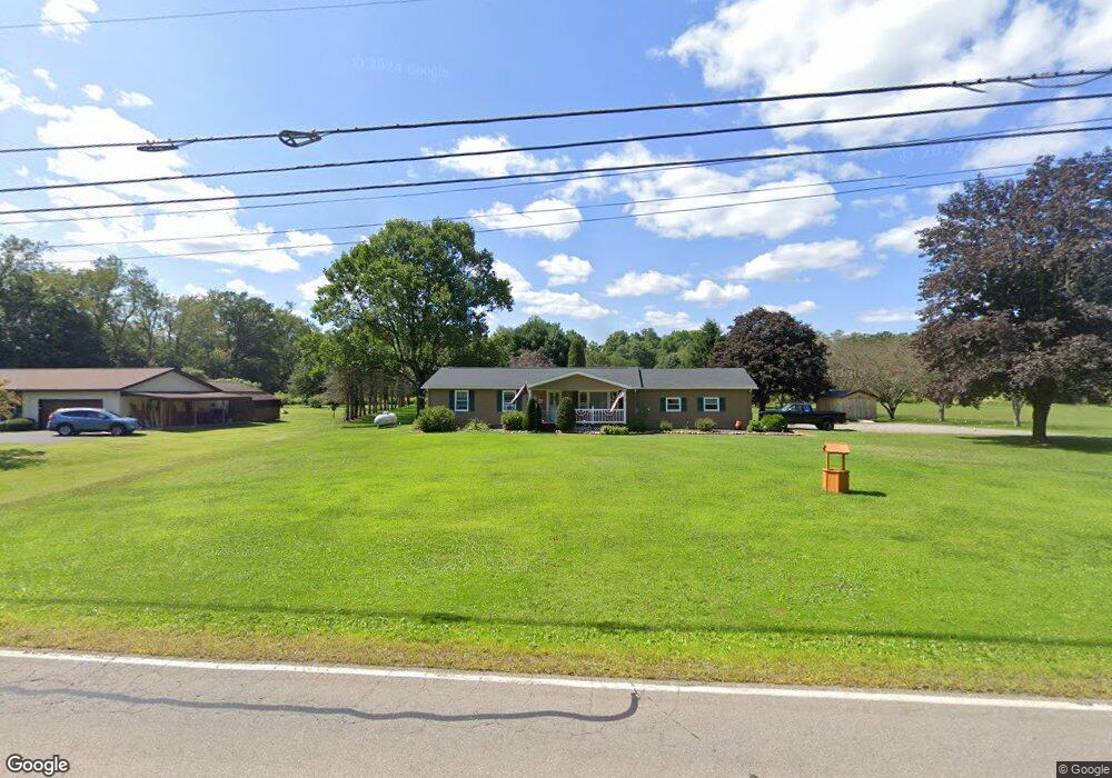
819 State Route 427 Franklin, PA 16323
Estimated Value: $122,000 - $231,000
3
Beds
2
Baths
1,196
Sq Ft
$156/Sq Ft
Est. Value
About This Home
This home is located at 819 State Route 427, Franklin, PA 16323 and is currently estimated at $186,653, approximately $156 per square foot. 819 State Route 427 is a home located in Venango County with nearby schools including Valley Grove Elementary School and Rocky Grove Junior/Senior High School.
Ownership History
Date
Name
Owned For
Owner Type
Purchase Details
Closed on
Mar 21, 2017
Sold by
Midfirst Bank
Bought by
Bowser Erika E
Current Estimated Value
Purchase Details
Closed on
Jan 11, 2017
Sold by
Donovan Clint A
Bought by
Midfirst Bank
Purchase Details
Closed on
Mar 31, 2006
Sold by
Gardinier Winniw M
Bought by
Donovan Clint A and Donovan Amy J
Home Financials for this Owner
Home Financials are based on the most recent Mortgage that was taken out on this home.
Original Mortgage
$80,752
Interest Rate
7.87%
Mortgage Type
Non Purchase Money Mortgage
Create a Home Valuation Report for This Property
The Home Valuation Report is an in-depth analysis detailing your home's value as well as a comparison with similar homes in the area
Home Values in the Area
Average Home Value in this Area
Purchase History
| Date | Buyer | Sale Price | Title Company |
|---|---|---|---|
| Bowser Erika E | $70,001 | None Available | |
| Midfirst Bank | $1,865 | None Available | |
| Donovan Clint A | $100,940 | None Available |
Source: Public Records
Mortgage History
| Date | Status | Borrower | Loan Amount |
|---|---|---|---|
| Previous Owner | Donovan Clint A | $80,752 |
Source: Public Records
Tax History Compared to Growth
Tax History
| Year | Tax Paid | Tax Assessment Tax Assessment Total Assessment is a certain percentage of the fair market value that is determined by local assessors to be the total taxable value of land and additions on the property. | Land | Improvement |
|---|---|---|---|---|
| 2025 | $2,455 | $96,860 | $17,300 | $79,560 |
| 2024 | $2,406 | $96,860 | $17,300 | $79,560 |
| 2023 | $2,336 | $96,860 | $17,300 | $79,560 |
| 2022 | $2,281 | $96,860 | $17,300 | $79,560 |
| 2021 | $2,281 | $96,860 | $17,300 | $79,560 |
| 2020 | $2,281 | $96,860 | $17,300 | $79,560 |
| 2019 | $2,281 | $96,860 | $17,300 | $79,560 |
| 2018 | $2,281 | $96,860 | $17,300 | $79,560 |
| 2017 | -- | $96,860 | $17,300 | $79,560 |
| 2016 | $2,154 | $96,860 | $17,300 | $79,560 |
| 2015 | -- | $96,860 | $17,300 | $79,560 |
| 2014 | -- | $96,860 | $17,300 | $79,560 |
Source: Public Records
Map
Nearby Homes
- 239 Sleepy Hollow Dr
- 0 Pennsylvania 427
- 194 Maple Lane Dr
- 410 Chestnut Grove Rd
- 0 Red Bridge Ln
- 1108 Patchel Run Rd
- 230 Causeway Dr
- 238 Causeway Dr
- 147 Gierlach Dr
- 116 3rd St
- 0 S Edgewood Dr Unit 1728822
- 315 Long Rd
- 3857 Academy St
- 327 Cherrytree Rd
- 140 Highland Park Dr
- 626 Cherrytree Rd
- 0 Deckards Run Rd and Judson Rd Unit 11536704
- Deckard's Run Rd and Judson Rd
- 147 Warren Rd
- 3124 State Route 417
- 819 State Route 427
- 809 State Route 427
- 831 State Route 427
- 315 Sleepy Hollow Dr
- 285 Sleepy Hollow Dr
- 870 State Route 427
- 267 Sleepy Hollow Dr
- 171 Abel Heath Ln
- 291 Sleepy Hollow Dr
- 197 Abel Heath Ln
- 237 Sleepy Hollow Dr
- 330 Sleepy Hollow Dr
- 914 State Route 427
- 374 Sleepy Hollow Dr
- 933 State Route 427
- 933 Pennsylvania 427
- 930 State Route 427
- 195 Sleepy Hollow Dr
- 938 State Route 427
- 362 Beatty Run Rd