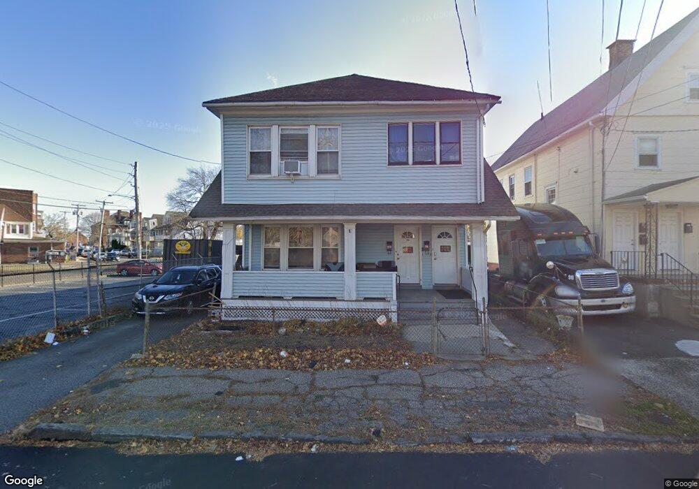
82 Beardsley St Unit 84 Bridgeport, CT 06607
East End NeighborhoodEstimated Value: $336,468 - $460,000
4
Beds
2
Baths
3,356
Sq Ft
$118/Sq Ft
Est. Value
About This Home
This home is located at 82 Beardsley St Unit 84, Bridgeport, CT 06607 and is currently estimated at $397,367, approximately $118 per square foot. 82 Beardsley St Unit 84 is a home located in Fairfield County with nearby schools including Dunbar School, Harding High School, and The Bridge Academy.
Ownership History
Date
Name
Owned For
Owner Type
Purchase Details
Closed on
Mar 8, 2010
Sold by
Wells Fargo Bk
Bought by
Greene Thomassena
Current Estimated Value
Purchase Details
Closed on
Jun 12, 2009
Sold by
Collins-Perkins Ruth
Bought by
Wells Fargo Bank Na
Purchase Details
Closed on
May 27, 2005
Sold by
Ford Jacqueline
Bought by
Perkins Ruth
Home Financials for this Owner
Home Financials are based on the most recent Mortgage that was taken out on this home.
Original Mortgage
$172,000
Interest Rate
7.87%
Create a Home Valuation Report for This Property
The Home Valuation Report is an in-depth analysis detailing your home's value as well as a comparison with similar homes in the area
Home Values in the Area
Average Home Value in this Area
Purchase History
| Date | Buyer | Sale Price | Title Company |
|---|---|---|---|
| Greene Thomassena | $45,000 | -- | |
| Greene Thomassena | $45,000 | -- | |
| Wells Fargo Bank Na | -- | -- | |
| Wells Fargo Bank Na | -- | -- | |
| Perkins Ruth | $215,000 | -- | |
| Perkins Ruth | $215,000 | -- |
Source: Public Records
Mortgage History
| Date | Status | Borrower | Loan Amount |
|---|---|---|---|
| Previous Owner | Perkins Ruth | $172,000 |
Source: Public Records
Tax History Compared to Growth
Tax History
| Year | Tax Paid | Tax Assessment Tax Assessment Total Assessment is a certain percentage of the fair market value that is determined by local assessors to be the total taxable value of land and additions on the property. | Land | Improvement |
|---|---|---|---|---|
| 2025 | $6,336 | $145,830 | $27,800 | $118,030 |
| 2024 | $6,336 | $145,830 | $27,800 | $118,030 |
| 2023 | $6,336 | $145,830 | $27,800 | $118,030 |
| 2022 | $6,336 | $145,830 | $27,800 | $118,030 |
| 2021 | $6,336 | $145,830 | $27,800 | $118,030 |
| 2020 | $5,648 | $104,620 | $15,550 | $89,070 |
| 2019 | $5,648 | $104,620 | $15,550 | $89,070 |
| 2018 | $5,688 | $104,620 | $15,550 | $89,070 |
| 2017 | $5,688 | $104,620 | $15,550 | $89,070 |
| 2016 | $5,688 | $104,620 | $15,550 | $89,070 |
| 2015 | $6,290 | $149,050 | $26,670 | $122,380 |
| 2014 | $6,290 | $149,050 | $26,670 | $122,380 |
Source: Public Records
Map
Nearby Homes
- 520 Seaview Ave
- 93 Clifford St
- 239 Beardsley St Unit 241
- 40 5th St
- 55 Deforest Ave
- 54 6th St
- 27 Bunnell St Unit 31
- 49 Bunnell St Unit 51
- 325 Jefferson St
- 194 Adams St
- 73 Newfield Ave Unit 75
- 320 Union Ave
- 408 Union Ave
- 376 Seaview Ave
- 363 Carroll Ave Unit 365
- 247 6th St
- 221 Bunnell St
- 445 Nichols St
- 249 Hough Ave Unit 251
- 1440 Stratford Ave
- 80 Beardsley St Unit 2
- 78 Beardsley St Unit 80
- 82-84 Beardsley St
- 79 Beardsley St Unit 81
- 87 Beardsley St Unit 95
- 73 Beardsley St
- 43 Beardsley St Unit 47
- 43 Beardsley St
- 43 Smith St
- 41 Smith St
- 49 Smith St
- 57 Smith St Unit 61
- 15 Beardsley St
- 54 Smith St
- 820 Seaview Ave Unit 5
- 820 Seaview Ave Unit 3
- 820 Seaview Ave Unit 4
- 820 Seaview Ave Unit 2
- 820 Seaview Ave Unit 1
- 810 Seaview Ave Unit 1