Estimated Value: $92,478 - $202,000
3
Beds
2
Baths
1,456
Sq Ft
$99/Sq Ft
Est. Value
About This Home
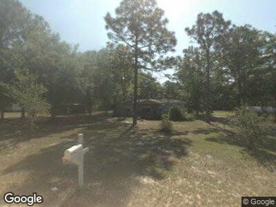
This home is located at 82 Bob White Cir, Jesup, GA 31545 and is currently estimated at $144,370, approximately $99 per square foot. 82 Bob White Cir is a home located in Wayne County with nearby schools including Bacon Elementary School, Martha Puckett Middle School, and Wayne County High School.
Ownership History
Date
Name
Owned For
Owner Type
Purchase Details
Closed on
Mar 8, 2016
Sold by
Bayview Loan Servicing Llc
Bought by
Polk Julius B
Current Estimated Value
Purchase Details
Closed on
Nov 17, 2006
Sold by
Weatherfod Herbert
Bought by
Canty Lori
Home Financials for this Owner
Home Financials are based on the most recent Mortgage that was taken out on this home.
Original Mortgage
$74,049
Interest Rate
6.33%
Mortgage Type
FHA
Purchase Details
Closed on
Jun 30, 2005
Sold by
Odum Terry H
Bought by
Weatherford Herbert H and Weatherford Pauline M
Purchase Details
Closed on
Dec 1, 1997
Purchase Details
Closed on
Sep 1, 1991
Purchase Details
Closed on
Jan 1, 1985
Create a Home Valuation Report for This Property
The Home Valuation Report is an in-depth analysis detailing your home's value as well as a comparison with similar homes in the area
Home Values in the Area
Average Home Value in this Area
Purchase History
| Date | Buyer | Sale Price | Title Company |
|---|---|---|---|
| Polk Julius B | $24,000 | -- | |
| Canty Lori | $75,200 | -- | |
| Weatherford Herbert H | $54,000 | -- | |
| -- | $27,500 | -- | |
| -- | $5,000 | -- | |
| -- | $70,000 | -- |
Source: Public Records
Mortgage History
| Date | Status | Borrower | Loan Amount |
|---|---|---|---|
| Previous Owner | Canty Lori | $74,049 |
Source: Public Records
Tax History Compared to Growth
Tax History
| Year | Tax Paid | Tax Assessment Tax Assessment Total Assessment is a certain percentage of the fair market value that is determined by local assessors to be the total taxable value of land and additions on the property. | Land | Improvement |
|---|---|---|---|---|
| 2024 | $406 | $15,322 | $4,000 | $11,322 |
| 2023 | $418 | $13,932 | $4,000 | $9,932 |
| 2022 | $377 | $11,986 | $4,000 | $7,986 |
| 2021 | $363 | $10,772 | $4,000 | $6,772 |
| 2020 | $376 | $10,772 | $4,000 | $6,772 |
| 2019 | $387 | $10,772 | $4,000 | $6,772 |
| 2018 | $387 | $10,772 | $4,000 | $6,772 |
| 2017 | $328 | $10,772 | $4,000 | $6,772 |
| 2016 | $328 | $10,958 | $4,000 | $6,958 |
| 2014 | $407 | $13,556 | $4,000 | $9,556 |
| 2013 | -- | $18,627 | $4,000 | $14,627 |
Source: Public Records
Map
Nearby Homes
- 1 Tank Rd
- 0 Tank Rd Unit 160525
- 0 Tank Rd
- 34 Boardwalk Ave
- 67 Boardwalk Ave
- 31 Boardwalk Ave
- 50 Loftis Dr
- 363 Sea Island Rd
- 297 Jekyll Island Rd
- 98 Saint Simons St
- 0 Red Oak Dr Unit 160341
- 14 Sparrow Ln
- 1700 Chapman Plantation Rd
- 82 Meadowood Dr
- 0 Bay Acres Rd Unit 22612643
- 0 Bay Acres Rd Unit 1651861
- 0 Bay Acres Rd Unit 159302
- 0 Bay Acres Rd Unit 10457722
- 95 Mayflower Rd
- Lot 1,2,3 Rayonier Rd