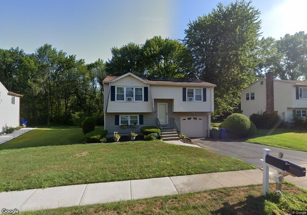
82 Cartpath Dr Meriden, CT 06450
Estimated Value: $332,288 - $365,000
2
Beds
1
Bath
1,244
Sq Ft
$279/Sq Ft
Est. Value
About This Home
This home is located at 82 Cartpath Dr, Meriden, CT 06450 and is currently estimated at $346,822, approximately $278 per square foot. 82 Cartpath Dr is a home located in New Haven County with nearby schools including Thomas Hooker School, Washington Middle School, and Francis T. Maloney High School.
Ownership History
Date
Name
Owned For
Owner Type
Purchase Details
Closed on
Aug 28, 2008
Sold by
Falcone Justine M
Bought by
Salufu-Dright Dorothy A
Current Estimated Value
Home Financials for this Owner
Home Financials are based on the most recent Mortgage that was taken out on this home.
Original Mortgage
$211,678
Interest Rate
6.25%
Purchase Details
Closed on
Sep 23, 1998
Sold by
Piccoli Brian J and Piccoli Lynn G
Bought by
Walus Justine M
Home Financials for this Owner
Home Financials are based on the most recent Mortgage that was taken out on this home.
Original Mortgage
$86,400
Interest Rate
6.87%
Create a Home Valuation Report for This Property
The Home Valuation Report is an in-depth analysis detailing your home's value as well as a comparison with similar homes in the area
Home Values in the Area
Average Home Value in this Area
Purchase History
| Date | Buyer | Sale Price | Title Company |
|---|---|---|---|
| Salufu-Dright Dorothy A | $215,000 | -- | |
| Walus Justine M | $88,000 | -- |
Source: Public Records
Mortgage History
| Date | Status | Borrower | Loan Amount |
|---|---|---|---|
| Open | Walus Justine M | $213,150 | |
| Closed | Walus Justine M | $211,678 | |
| Previous Owner | Walus Justine M | $84,150 | |
| Previous Owner | Walus Justine M | $86,400 | |
| Closed | Walus Justine M | $3,000 |
Source: Public Records
Tax History
| Year | Tax Paid | Tax Assessment Tax Assessment Total Assessment is a certain percentage of the fair market value that is determined by local assessors to be the total taxable value of land and additions on the property. | Land | Improvement |
|---|---|---|---|---|
| 2025 | $5,931 | $147,910 | $62,440 | $85,470 |
| 2024 | $5,371 | $147,910 | $62,440 | $85,470 |
| 2023 | $5,146 | $147,910 | $62,440 | $85,470 |
| 2022 | $4,880 | $147,910 | $62,440 | $85,470 |
| 2021 | $4,513 | $110,460 | $49,350 | $61,110 |
| 2020 | $4,513 | $110,460 | $49,350 | $61,110 |
| 2019 | $4,513 | $110,460 | $49,350 | $61,110 |
| 2018 | $4,533 | $110,460 | $49,350 | $61,110 |
| 2017 | $4,410 | $110,460 | $49,350 | $61,110 |
| 2016 | $4,305 | $117,530 | $51,940 | $65,590 |
| 2015 | $4,305 | $117,530 | $51,940 | $65,590 |
| 2014 | $4,201 | $117,530 | $51,940 | $65,590 |
Source: Public Records
Map
Nearby Homes
- 291 Cartpath Dr
- 93 Overlook Rd
- 131 Oxbow Dr
- 190 Elmwood Dr
- 29 Schwink Dr
- 78 Kennedy Dr
- 67 Royal Oak Cir
- 1280 E Main St
- 198 Mildred Rd
- 1274 E Main St Unit D27
- 774 Murdock Ave
- 55 Meetinghouse Village Unit 2
- 160 Bee St
- 170 Bee St
- 180 Bee St
- 61 Meetinghouse Village Unit 5
- 108 Wayne Ln
- 65 Brooklawn Dr
- 80 Dryden Dr
- 111,113 & 115 Sunset Ave
Your Personal Tour Guide
Ask me questions while you tour the home.