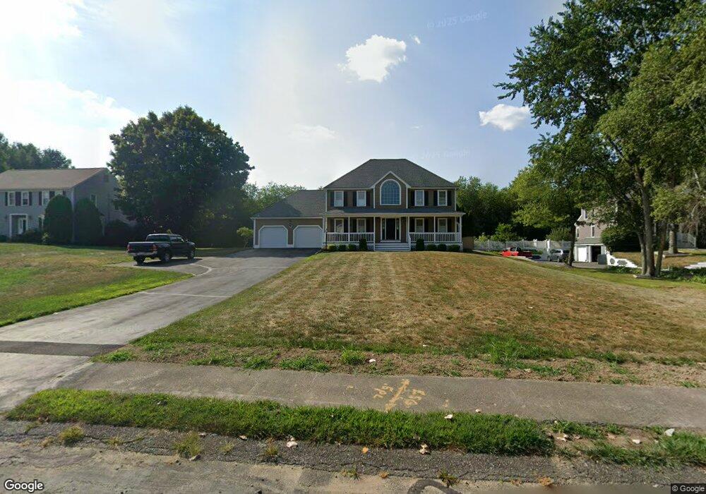
82 Devon St Taunton, MA 02780
Whittenton Junction NeighborhoodEstimated Value: $666,524 - $742,000
About This Home
This home is located at 82 Devon St, Taunton, MA 02780 and is currently estimated at $706,631, approximately $307 per square foot. 82 Devon St is a home located in Bristol County with nearby schools including Benjamin Friedman Middle School, Joseph C. Chamberlain Elementary School, and Taunton High School.
Ownership History
We collect this data history from publicly available records. To have your information removed, we recommend requesting removal directly through your county’s website.
Purchase Details
Home Financials for this Owner
Home Financials are based on the most recent Mortgage that was taken out on this home.Home Values in the Area
Average Home Value in this Area
Purchase History
We collect this data history from publicly available records. To have your information removed, we recommend requesting removal directly through your county’s website.
| Date | Buyer | Sale Price | Title Company |
|---|---|---|---|
| $195,000 | -- |
Mortgage History
We collect this data history from publicly available records. To have your information removed, we recommend requesting removal directly through your county’s website.
| Date | Status | Borrower | Loan Amount |
|---|---|---|---|
| Closed | $123,000 |
Tax History
We collect this data history from publicly available records. To have your information removed, we recommend requesting removal directly through your county’s website.
| Year | Tax Paid | Tax Assessment Tax Assessment Total Assessment is a certain percentage of the fair market value that is determined by local assessors to be the total taxable value of land and additions on the property. | Land | Improvement |
|---|---|---|---|---|
| 2025 | $6,644 | $607,300 | $139,700 | $467,600 |
| 2024 | $6,311 | $564,000 | $158,700 | $405,300 |
| 2023 | $6,268 | $520,200 | $158,700 | $361,500 |
| 2022 | $6,023 | $457,000 | $137,500 | $319,500 |
| 2021 | $5,821 | $409,900 | $120,200 | $289,700 |
| 2020 | $5,697 | $383,400 | $120,200 | $263,200 |
| 2019 | $0 | $375,100 | $126,000 | $249,100 |
| 2018 | $5,754 | $366,000 | $127,300 | $238,700 |
| 2017 | $5,509 | $350,700 | $120,600 | $230,100 |
| 2016 | $5,369 | $342,400 | $117,100 | $225,300 |
| 2015 | $5,127 | $341,600 | $117,600 | $224,000 |
| 2014 | $5,035 | $344,600 | $116,700 | $227,900 |
Map
- 405 Norton Ave
- 8 Thayer Dr
- 6 Northway
- 33 Thayer Dr
- 49 Eastbridge Rd
- 45 Southway
- 22 Thayer Dr
- 2 Riverway St
- 22 Southway
- 0 Clemenceau Unit 73543464
- 229 Tremont St
- 193 Tremont St Unit 105
- 30 Princess Pine Cir
- 111 Downing Dr
- 408 W Britannia St
- 361 Tremont St
- 15 Crapo St
- 35 Worcester St
- 289 W Britannia St
- 16 Clifton St Unit F
Ask me questions while you tour the home.