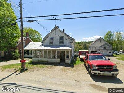
82 Main St New Sharon, ME 04955
Estimated Value: $130,358 - $226,000
--
Bed
--
Bath
--
Sq Ft
5,227
Sq Ft Lot
About This Home
This home is located at 82 Main St, New Sharon, ME 04955 and is currently estimated at $175,840. 82 Main St is a home with nearby schools including Mt. Blue High School.
Ownership History
Date
Name
Owned For
Owner Type
Purchase Details
Closed on
Apr 12, 2018
Sold by
Bridge Workers Disablty T
Bought by
Olson Michael E and Olson Sarah L
Current Estimated Value
Purchase Details
Closed on
Jan 24, 2018
Sold by
Franklin Sb
Bought by
Bridge Workers Disblty T
Home Financials for this Owner
Home Financials are based on the most recent Mortgage that was taken out on this home.
Original Mortgage
$11,000
Interest Rate
3.93%
Mortgage Type
New Conventional
Purchase Details
Closed on
Oct 31, 2017
Sold by
Currier Delmar L Est
Bought by
Franklin Sb
Create a Home Valuation Report for This Property
The Home Valuation Report is an in-depth analysis detailing your home's value as well as a comparison with similar homes in the area
Home Values in the Area
Average Home Value in this Area
Purchase History
| Date | Buyer | Sale Price | Title Company |
|---|---|---|---|
| Olson Michael E | -- | -- | |
| Bridge Workers Disblty T | -- | -- | |
| Franklin Sb | -- | -- |
Source: Public Records
Mortgage History
| Date | Status | Borrower | Loan Amount |
|---|---|---|---|
| Previous Owner | Bridge Workers Disblty T | $11,000 | |
| Previous Owner | Childrens Museum Land T | $21,000 | |
| Previous Owner | Currier Delmar L | $60,000 |
Source: Public Records
Tax History Compared to Growth
Tax History
| Year | Tax Paid | Tax Assessment Tax Assessment Total Assessment is a certain percentage of the fair market value that is determined by local assessors to be the total taxable value of land and additions on the property. | Land | Improvement |
|---|---|---|---|---|
| 2024 | $1,330 | $121,990 | $11,820 | $110,170 |
| 2023 | $1,370 | $78,310 | $8,000 | $70,310 |
| 2022 | $1,251 | $78,310 | $8,000 | $70,310 |
| 2021 | $1,346 | $78,310 | $8,000 | $70,310 |
| 2020 | $1,308 | $78,310 | $8,000 | $70,310 |
| 2019 | $1,292 | $78,310 | $8,000 | $70,310 |
| 2018 | $1,253 | $78,310 | $8,000 | $70,310 |
| 2017 | $1,261 | $78,310 | $8,000 | $70,310 |
| 2016 | $1,323 | $78,310 | $8,000 | $70,310 |
| 2014 | $1,190 | $78,310 | $8,000 | $70,310 |
Source: Public Records
Map
Nearby Homes
- 5 Nadeau Ln
- 48 Starks Rd
- 35 Industry Rd
- 20 Webster Rd
- Lot 74 Flagg Rd
- 59 Chandler Rd
- 82 Lane Rd
- 64 Mile Hill Rd
- Lot 9 & 12 Smith Rd
- Lot #33 Cape Cod Hill Rd
- 33 Kimball Pond
- 05 Farmington Falls Rd
- 335 Swan Rd
- 1092 Farmington Falls Rd
- 129 Philbrick St
- 490 Mile Hill Rd
- 203 Beans Corner Rd
- Lot 33-4 Industry Rd
- Lot 33-3 Industry Rd
- Lot 33-2 Industry Rd