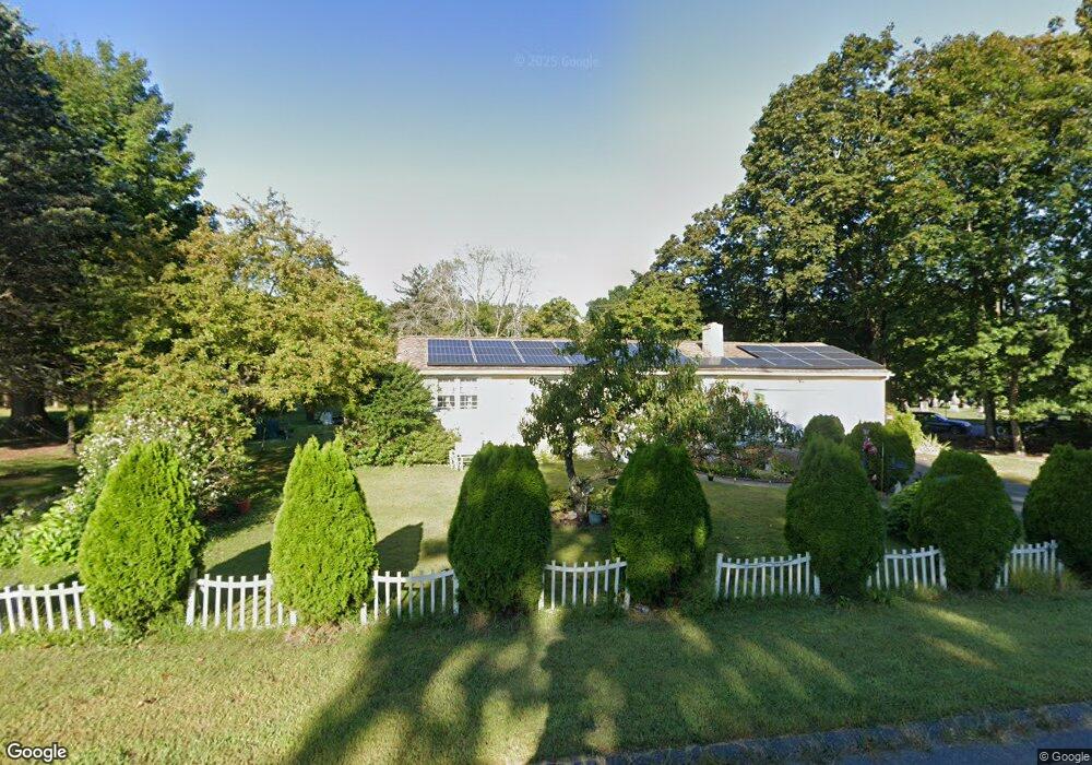
82 N Maple St Hadley, MA 01035
Estimated Value: $425,000 - $483,000
3
Beds
2
Baths
960
Sq Ft
$475/Sq Ft
Est. Value
About This Home
This home is located at 82 N Maple St, Hadley, MA 01035 and is currently estimated at $456,326, approximately $475 per square foot. 82 N Maple St is a home located in Hampshire County with nearby schools including Hadley Elementary School, Hopkins Academy, and Pioneer Valley Chinese Immersion Charter School.
Ownership History
Date
Name
Owned For
Owner Type
Purchase Details
Closed on
Jun 30, 2005
Sold by
Carreira Armando A and Carreira Kathleen A
Bought by
Quintero Brenda
Current Estimated Value
Home Financials for this Owner
Home Financials are based on the most recent Mortgage that was taken out on this home.
Original Mortgage
$53,000
Outstanding Balance
$27,083
Interest Rate
5.73%
Mortgage Type
Purchase Money Mortgage
Estimated Equity
$429,243
Create a Home Valuation Report for This Property
The Home Valuation Report is an in-depth analysis detailing your home's value as well as a comparison with similar homes in the area
Home Values in the Area
Average Home Value in this Area
Purchase History
| Date | Buyer | Sale Price | Title Company |
|---|---|---|---|
| Quintero Brenda | $265,000 | -- |
Source: Public Records
Mortgage History
| Date | Status | Borrower | Loan Amount |
|---|---|---|---|
| Open | Quintero Brenda | $53,000 |
Source: Public Records
Tax History
| Year | Tax Paid | Tax Assessment Tax Assessment Total Assessment is a certain percentage of the fair market value that is determined by local assessors to be the total taxable value of land and additions on the property. | Land | Improvement |
|---|---|---|---|---|
| 2025 | $3,837 | $329,900 | $122,400 | $207,500 |
| 2024 | $3,652 | $320,600 | $122,400 | $198,200 |
| 2023 | $3,513 | $304,400 | $122,400 | $182,000 |
| 2022 | $3,306 | $271,400 | $122,400 | $149,000 |
| 2021 | $3,058 | $254,800 | $122,400 | $132,400 |
| 2020 | $3,074 | $240,500 | $122,400 | $118,100 |
| 2019 | $2,973 | $240,500 | $122,400 | $118,100 |
| 2018 | $2,908 | $240,500 | $122,400 | $118,100 |
| 2017 | $2,803 | $242,300 | $122,400 | $119,900 |
| 2016 | $2,702 | $242,300 | $122,400 | $119,900 |
| 2015 | $2,631 | $242,300 | $122,400 | $119,900 |
| 2014 | $2,578 | $242,300 | $122,400 | $119,900 |
Source: Public Records
Map
Nearby Homes
- 30 Greenleaves Dr
- 63 Amity Place Unit 63
- 27 Greenleaves Dr Unit 726
- 24 Greenleaves Dr Unit 418
- 75 Amity Place Unit 75
- 26 Greenleaves Dr Unit 635
- Lot 3 Roosevelt St
- 0 Main St
- 48 Gray St
- 170 E Hadley Rd Unit 87
- 39 Valley Ln
- 60 Red Gate Ln
- 0 Red Gate Ln Unit 73348273
- 58 Main St Unit 4
- 58 Main St Unit 3
- 141 Tracy Cir
- 270 N East St
- 3 Frost Ln
- 185 Cherry Ln
- 12 Teawaddle Ln
- 80 N Maple St
- 83 N Maple St
- 171 Rocky Hill Rd
- 193 Rocky Hill Rd
- 85 N Maple St
- 78 N Maple St
- 169 Rocky Hill Rd
- 76 N Maple St
- 197 Rocky Hill Rd
- 167 Rocky Hill Rd
- 194 Rocky Hill Rd
- 140 Huntington Rd
- 0 & 323 Rocky Hill Rd
- 72 N Maple St
- 81 N Maple St
- 199 Rocky Hill Rd
- 196 Rocky Hill Rd
- 165 Rocky Hill Rd
- 91 N Maple St
- 70 N Maple St
Your Personal Tour Guide
Ask me questions while you tour the home.