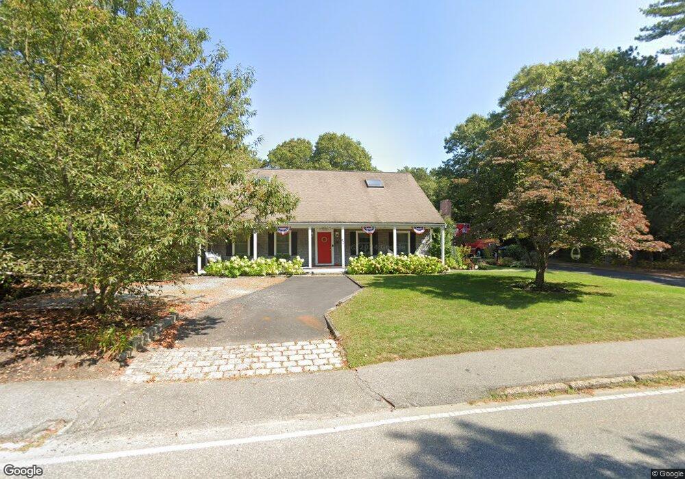
82 Old Oyster Rd Cotuit, MA 02635
Cotuit NeighborhoodEstimated Value: $1,161,000 - $1,573,000
About This Home
This home is located at 82 Old Oyster Rd, Cotuit, MA 02635 and is currently estimated at $1,297,189, approximately $461 per square foot. 82 Old Oyster Rd is a home located in Barnstable County with nearby schools including Barnstable United Elementary School, West Villages Elementary School, and Barnstable Intermediate School.
Ownership History
We collect this data history from publicly available records. To have your information removed, we recommend requesting removal directly through your county’s website.
Purchase Details
Purchase Details
Home Values in the Area
Average Home Value in this Area
Purchase History
We collect this data history from publicly available records. To have your information removed, we recommend requesting removal directly through your county’s website.
| Date | Buyer | Sale Price | Title Company |
|---|---|---|---|
| -- | None Available | ||
| $575,000 | -- |
Mortgage History
We collect this data history from publicly available records. To have your information removed, we recommend requesting removal directly through your county’s website.
| Date | Status | Borrower | Loan Amount |
|---|---|---|---|
| Previous Owner | $565,000 | ||
| Previous Owner | $25,000 | ||
| Previous Owner | $394,000 | ||
| Previous Owner | $92,000 | ||
| Closed | $358,000 | ||
| Closed | $40,000 | ||
| Previous Owner | $90,000 | ||
| Previous Owner | $55,000 |
Tax History
We collect this data history from publicly available records. To have your information removed, we recommend requesting removal directly through your county’s website.
| Year | Tax Paid | Tax Assessment Tax Assessment Total Assessment is a certain percentage of the fair market value that is determined by local assessors to be the total taxable value of land and additions on the property. | Land | Improvement |
|---|---|---|---|---|
| 2025 | $7,551 | $904,300 | $228,000 | $676,300 |
| 2024 | $6,877 | $872,700 | $228,000 | $644,700 |
| 2023 | $6,607 | $789,400 | $207,300 | $582,100 |
| 2022 | $6,581 | $636,500 | $142,600 | $493,900 |
| 2021 | $6,303 | $570,900 | $144,800 | $426,100 |
| 2020 | $6,402 | $546,700 | $144,800 | $401,900 |
| 2019 | $6,157 | $518,300 | $153,600 | $364,700 |
| 2018 | $5,904 | $497,000 | $179,000 | $318,000 |
| 2017 | $5,745 | $486,900 | $179,000 | $307,900 |
| 2016 | $5,582 | $485,000 | $177,100 | $307,900 |
| 2015 | $5,671 | $492,300 | $177,300 | $315,000 |
Map
- 552 Main St
- 134 School St
- 263 Oxford Dr
- 239 Oxford Dr
- 33 Oyster Place Rd
- 107 Abbey Gate Rd
- 7 Oxford Dr
- 11 Riverview Ave Unit A
- 11 Riverview Ave Unit 11A
- 994 Main St
- 10 Abbey Gate Rd
- 359 Santuit Rd
- 359 Santuit Rd
- 1089 Main St
- 399 Santuit Rd
- 120 Ocean View Ave
- 105 Bay Rd
- 75 Trout Brook Rd
- 205 Little River Rd
- 30 Pleasant Park Dr
- 150 Highland Ave
- 160 Highland Ave
- 75 Old Oyster Rd
- 9 West St
- 26 Old Oyster Rd
- 136 Highland Ave
- 705 Main St
- 29 Old Oyster Rd
- 157 Highland Ave
- 141 Highland Ave
- 173 Highland Ave
- 124 Highland Ave
- 40 Lewis Pond Rd
- 50 West St
- 26 Lewis Pond Rd
- 19 Old Oyster Rd
- 125 Highland Ave
- 36 Peirson Way
- 82 Coolidge St
- 110 Highland Ave
Ask me questions while you tour the home.