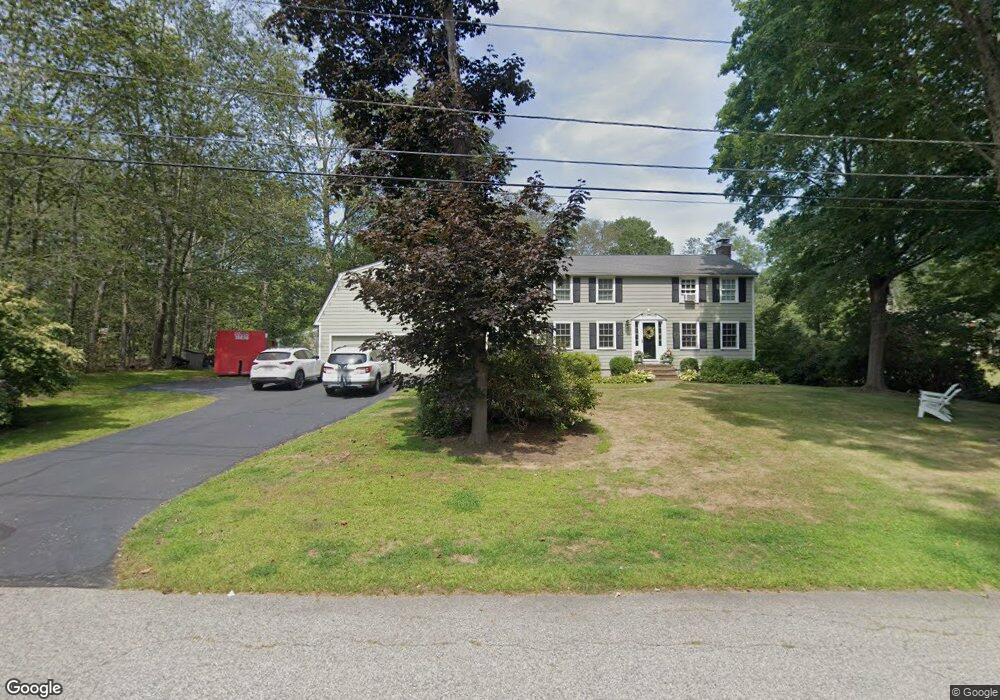
82 Ortins Rd Unit 1 South Hamilton, MA 01982
Estimated Value: $1,322,136 - $1,470,000
5
Beds
4
Baths
3,321
Sq Ft
$422/Sq Ft
Est. Value
About This Home
This home is located at 82 Ortins Rd Unit 1, South Hamilton, MA 01982 and is currently estimated at $1,402,284, approximately $422 per square foot. 82 Ortins Rd Unit 1 is a home located in Essex County with nearby schools including Winthrop School, Cutler Elementary School, and Bessie Buker Elementary School.
Ownership History
Date
Name
Owned For
Owner Type
Purchase Details
Closed on
Sep 16, 2025
Sold by
Walker Katharine S
Bought by
Walker Ft and Walker
Current Estimated Value
Purchase Details
Closed on
May 30, 2014
Sold by
Enright Sarah N
Bought by
Walker Katherine
Home Financials for this Owner
Home Financials are based on the most recent Mortgage that was taken out on this home.
Original Mortgage
$470,000
Interest Rate
4.26%
Mortgage Type
New Conventional
Purchase Details
Closed on
Mar 8, 2011
Sold by
Enright Michael H and Enright Sarah N
Bought by
Enright Sarah N
Purchase Details
Closed on
Jul 31, 1997
Sold by
Jones Scott P and Jones Rosamund D
Bought by
Enright Michael H and Enright Sarah N
Purchase Details
Closed on
Jun 19, 1992
Sold by
Hale Fred W and Hale Joan M
Bought by
Jones Scott P and Jones Rosamund D
Create a Home Valuation Report for This Property
The Home Valuation Report is an in-depth analysis detailing your home's value as well as a comparison with similar homes in the area
Home Values in the Area
Average Home Value in this Area
Purchase History
| Date | Buyer | Sale Price | Title Company |
|---|---|---|---|
| Walker Ft | -- | -- | |
| Walker Katherine | $699,000 | -- | |
| Enright Sarah N | -- | -- | |
| Enright Michael H | $380,000 | -- | |
| Jones Scott P | $291,000 | -- |
Source: Public Records
Mortgage History
| Date | Status | Borrower | Loan Amount |
|---|---|---|---|
| Previous Owner | Jones Scott P | $470,000 |
Source: Public Records
Tax History Compared to Growth
Tax History
| Year | Tax Paid | Tax Assessment Tax Assessment Total Assessment is a certain percentage of the fair market value that is determined by local assessors to be the total taxable value of land and additions on the property. | Land | Improvement |
|---|---|---|---|---|
| 2025 | $15,190 | $970,600 | $389,900 | $580,700 |
| 2024 | $14,463 | $957,200 | $389,900 | $567,300 |
| 2023 | $13,695 | $838,100 | $337,700 | $500,400 |
| 2022 | $13,430 | $751,100 | $301,600 | $449,500 |
| 2021 | $13,152 | $751,100 | $301,600 | $449,500 |
| 2020 | $12,978 | $764,300 | $302,100 | $462,200 |
| 2019 | $12,324 | $747,800 | $292,700 | $455,100 |
| 2018 | $11,787 | $726,700 | $276,200 | $450,500 |
| 2017 | $11,945 | $710,600 | $258,300 | $452,300 |
| 2016 | $11,963 | $693,500 | $253,600 | $439,900 |
| 2015 | $10,064 | $588,900 | $241,300 | $347,600 |
| 2014 | $9,523 | $547,300 | $240,500 | $306,800 |
Source: Public Records
Map
Nearby Homes
- 0 Meyer Ln
- Zero Bridge Street Lot Eight
- 30 Autumn Ln
- 946 Bay Rd Unit 2
- 173 Miles River Rd
- 150 Sagamore St
- 968 Bay Rd
- 34 Knowlton St
- 99 Essex St
- 88 Maple St
- 350 Essex St
- 42 Maple St
- 45 Walnut Rd
- 133 Essex St
- 231 Larch Row
- 232 Larch Row
- 18 Birch Rd
- NHN Hamilton Heights
- 22 Sagamore Rd
- 104 Gregory Island Rd