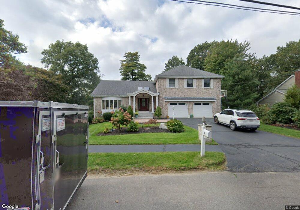
82 Pigeon Ln Waltham, MA 02452
North Waltham NeighborhoodEstimated Value: $1,261,473 - $1,580,000
5
Beds
3
Baths
3,615
Sq Ft
$403/Sq Ft
Est. Value
About This Home
This home is located at 82 Pigeon Ln, Waltham, MA 02452 and is currently estimated at $1,456,618, approximately $402 per square foot. 82 Pigeon Ln is a home located in Middlesex County with nearby schools including Northeast Elementary School, John F Kennedy Middle School, and Waltham Sr High School.
Ownership History
Date
Name
Owned For
Owner Type
Purchase Details
Closed on
Oct 7, 2024
Sold by
Bedrossian Avedis and Bedrossian Silva
Bought by
Avedis Bedrossian Ret and Bedrossian
Current Estimated Value
Purchase Details
Closed on
Sep 26, 1997
Sold by
Danis Katherine A
Bought by
Mehdizadeh Ayoub and Mehdizadeh Mahin T
Create a Home Valuation Report for This Property
The Home Valuation Report is an in-depth analysis detailing your home's value as well as a comparison with similar homes in the area
Home Values in the Area
Average Home Value in this Area
Purchase History
| Date | Buyer | Sale Price | Title Company |
|---|---|---|---|
| Avedis Bedrossian Ret | -- | None Available | |
| Avedis Bedrossian Ret | -- | None Available | |
| Mehdizadeh Ayoub | $425,000 | -- |
Source: Public Records
Mortgage History
| Date | Status | Borrower | Loan Amount |
|---|---|---|---|
| Previous Owner | Mehdizadeh Ayoub | $417,000 | |
| Previous Owner | Mehdizadeh Ayoub | $417,000 | |
| Previous Owner | Mehdizadeh Ayoub | $382,000 |
Source: Public Records
Tax History Compared to Growth
Tax History
| Year | Tax Paid | Tax Assessment Tax Assessment Total Assessment is a certain percentage of the fair market value that is determined by local assessors to be the total taxable value of land and additions on the property. | Land | Improvement |
|---|---|---|---|---|
| 2025 | $9,408 | $958,000 | $534,600 | $423,400 |
| 2024 | $8,938 | $927,200 | $509,600 | $417,600 |
| 2023 | $9,000 | $872,100 | $463,300 | $408,800 |
| 2022 | $9,136 | $820,100 | $426,200 | $393,900 |
| 2021 | $3,949 | $750,500 | $407,700 | $342,800 |
| 2020 | $8,816 | $737,700 | $379,900 | $357,800 |
| 2019 | $9,280 | $733,000 | $375,200 | $357,800 |
| 2018 | $6,492 | $674,100 | $347,400 | $326,700 |
| 2017 | $8,060 | $641,700 | $315,000 | $326,700 |
| 2016 | $7,628 | $623,200 | $296,500 | $326,700 |
| 2015 | $8,226 | $626,500 | $291,900 | $334,600 |
Source: Public Records
Map
Nearby Homes
- 70 Rosewood Dr
- 116 Raffaele Dr
- 511 Lexington St
- 28 College Farm Rd Unit 2
- 34 Cedar Hill Ln
- 266 Linden St
- 49 Lincoln St
- 55 Circle Dr
- 44 Sachem St
- 326 Bacon St
- 214 Church St
- 158 Church St
- 14 Piedmont Ave
- 750 Trapelo Rd
- 23 Wight St
- 16 Winter St Unit 26C
- 45 Chase Rd
- 65 Montclair Ave
- 129 Lake St
- 30 Jacqueline Rd Unit C