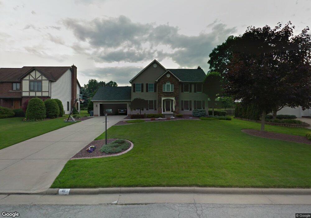
82 Red Grouse Ct Youngstown, OH 44511
Estimated Value: $393,000 - $463,000
4
Beds
3
Baths
2,456
Sq Ft
$173/Sq Ft
Est. Value
About This Home
This home is located at 82 Red Grouse Ct, Youngstown, OH 44511 and is currently estimated at $424,258, approximately $172 per square foot. 82 Red Grouse Ct is a home located in Mahoning County with nearby schools including Canfield Village Middle School, Canfield High School, and Youngstown Christian School.
Ownership History
Date
Name
Owned For
Owner Type
Purchase Details
Closed on
Mar 18, 1998
Sold by
Jones Robert D and Jones Sharon E
Bought by
Melligan James E and Melligan Sandra L
Current Estimated Value
Home Financials for this Owner
Home Financials are based on the most recent Mortgage that was taken out on this home.
Original Mortgage
$80,000
Outstanding Balance
$14,790
Interest Rate
7.14%
Estimated Equity
$409,468
Purchase Details
Closed on
Nov 6, 1991
Bought by
Jones Robert D and S E
Create a Home Valuation Report for This Property
The Home Valuation Report is an in-depth analysis detailing your home's value as well as a comparison with similar homes in the area
Home Values in the Area
Average Home Value in this Area
Purchase History
| Date | Buyer | Sale Price | Title Company |
|---|---|---|---|
| Melligan James E | $215,000 | -- | |
| Jones Robert D | $163,500 | -- |
Source: Public Records
Mortgage History
| Date | Status | Borrower | Loan Amount |
|---|---|---|---|
| Open | Melligan James E | $80,000 |
Source: Public Records
Tax History Compared to Growth
Tax History
| Year | Tax Paid | Tax Assessment Tax Assessment Total Assessment is a certain percentage of the fair market value that is determined by local assessors to be the total taxable value of land and additions on the property. | Land | Improvement |
|---|---|---|---|---|
| 2024 | $5,164 | $113,390 | $16,300 | $97,090 |
| 2023 | $5,086 | $113,390 | $16,300 | $97,090 |
| 2022 | $5,021 | $87,690 | $16,310 | $71,380 |
| 2021 | $5,025 | $87,690 | $16,310 | $71,380 |
| 2020 | $5,042 | $87,690 | $16,310 | $71,380 |
| 2019 | $4,771 | $73,680 | $13,700 | $59,980 |
| 2018 | $4,506 | $73,680 | $13,700 | $59,980 |
| 2017 | $4,466 | $73,680 | $13,700 | $59,980 |
| 2016 | $4,571 | $72,470 | $13,700 | $58,770 |
| 2015 | $4,481 | $72,470 | $13,700 | $58,770 |
| 2014 | $4,497 | $72,470 | $13,700 | $58,770 |
| 2013 | $4,443 | $72,470 | $13,700 | $58,770 |
Source: Public Records
Map
Nearby Homes
- 138 Robinhood Way
- 1342 Shields Rd
- 4506 Green Glen Dr
- 5097 Tippwood Ct
- 1272 Valley View Dr
- 4615 Beech Ct
- 4543 Tippecanoe Rd
- 0 Linden Place
- 3682 Sperone Dr
- 3236 Linden Place
- 4096 Bob o Link Dr
- 5670 Tracy Dr
- 3630 Joyce Ann Dr
- 3885 Shields Rd
- 990 Westport Dr
- 4042 Baymar Dr
- 3873 Whippoorwill Ln
- 2981 Louise Rita Ct
- 4101 Canfield Rd
- 1422 Turnberry Dr
- 84 Red Grouse Ct
- 80 Red Grouse Ct
- 126 Robin Hood Dr
- 86 Red Grouse Ct
- 74 Red Grouse Ct
- 132 Robin Hood Dr
- 61 Red Grouse Ct
- 57 Red Grouse Ct
- 114 Robin Hood Dr
- 65 Red Grouse Ct
- 88 Red Grouse Ct
- 73 Red Grouse Ct
- 138 Robin Hood Dr
- 98 Robin Hood Dr
- 62 Red Grouse Ct
- 90 Red Grouse Ct
- 51 Red Grouse Ct
- 75 Robin Hood Dr
- 69 Robin Hood Dr
- 81 Robin Hood Dr