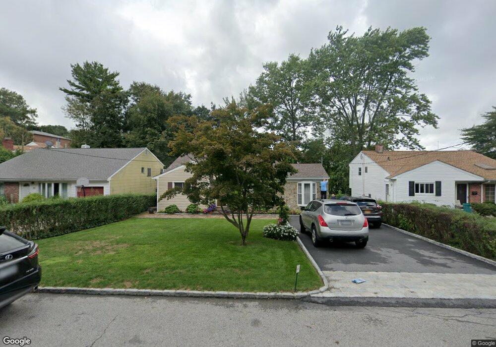
82 Whitman Rd Yonkers, NY 10710
Northeast Yonkers NeighborhoodEstimated Value: $740,405 - $855,000
3
Beds
1
Bath
1,623
Sq Ft
$487/Sq Ft
Est. Value
About This Home
This home is located at 82 Whitman Rd, Yonkers, NY 10710 and is currently estimated at $790,351, approximately $486 per square foot. 82 Whitman Rd is a home located in Westchester County with nearby schools including St. Eugene School.
Ownership History
Date
Name
Owned For
Owner Type
Purchase Details
Closed on
Nov 15, 2023
Sold by
Montanaro Paul and Montanaro Jessica
Bought by
Montanaro Paul
Current Estimated Value
Purchase Details
Closed on
Jan 4, 2019
Sold by
Montanaro Jessica and Montanaro Antonietta
Bought by
Montanaro Paul and Montanaro Jessica
Purchase Details
Closed on
Apr 14, 2009
Sold by
Montanaro Frank and Montanaro Antonietta
Bought by
Montanaro Frank and Montanaro Antonietta
Purchase Details
Closed on
Sep 30, 2003
Sold by
Grunfeld Ernst and Kurtz Robert D
Bought by
Montanaro Frank and Montanaro Antonietta
Home Financials for this Owner
Home Financials are based on the most recent Mortgage that was taken out on this home.
Original Mortgage
$240,000
Interest Rate
5.71%
Mortgage Type
Purchase Money Mortgage
Purchase Details
Closed on
Sep 20, 1997
Sold by
Grunfeld Ernst and Grunfeld Lore
Bought by
Grunfeld Ernst and Grunfeld Lore
Create a Home Valuation Report for This Property
The Home Valuation Report is an in-depth analysis detailing your home's value as well as a comparison with similar homes in the area
Home Values in the Area
Average Home Value in this Area
Purchase History
| Date | Buyer | Sale Price | Title Company |
|---|---|---|---|
| Montanaro Paul | $293,296 | Thoroughbred Title | |
| Montanaro Paul | -- | None Available | |
| Montanaro Frank | -- | Sac Title & Abstract Corp | |
| Montanaro Frank | $441,000 | Commonwealth Land Title Ins | |
| Grunfeld Ernst | -- | Stewart Title Insurance Co |
Source: Public Records
Mortgage History
| Date | Status | Borrower | Loan Amount |
|---|---|---|---|
| Previous Owner | Montanaro Frank | $240,000 |
Source: Public Records
Tax History
| Year | Tax Paid | Tax Assessment Tax Assessment Total Assessment is a certain percentage of the fair market value that is determined by local assessors to be the total taxable value of land and additions on the property. | Land | Improvement |
|---|---|---|---|---|
| 2024 | $1,871 | $10,500 | $3,000 | $7,500 |
| 2023 | $1,861 | $10,500 | $3,000 | $7,500 |
| 2022 | $1,849 | $10,500 | $3,000 | $7,500 |
| 2021 | $9,034 | $10,500 | $3,000 | $7,500 |
| 2020 | $9,035 | $10,500 | $3,000 | $7,500 |
| 2019 | $10,390 | $10,500 | $3,000 | $7,500 |
| 2018 | $8,543 | $10,500 | $3,000 | $7,500 |
| 2017 | -- | $10,500 | $3,000 | $7,500 |
| 2016 | $9,348 | $10,500 | $3,000 | $7,500 |
| 2015 | -- | $10,500 | $3,000 | $7,500 |
| 2014 | -- | $10,500 | $3,000 | $7,500 |
| 2013 | -- | $10,500 | $3,000 | $7,500 |
Source: Public Records
Map
Nearby Homes
- 1 Remsen Rd Unit 4J
- 1 Remsen Rd Unit 1F
- 1 Remsen Rd Unit 2F
- 21 Norwood Rd
- 331 Alta Vista Dr
- 2035 Central Park Ave Unit 3M
- 2035 Central Park Ave Unit 2H
- 2035 Central Park Ave Unit 1K
- 612 E Grassy Sprain Rd Unit 3
- 612 E Grassy Sprain Rd Unit 15
- 66 Crisfield St Unit 3Y
- 156 Candlewood Dr
- 270 Pembrook Dr
- 192 Helena Ave
- 12 Bacon Place
- 75 aka 55 Belknap Ave
- 10 aka 73 Shawnee Ave
- 1 Priscella A K A 31 Primrose Ave
- 40 AKA 38 Grange Ave
- 143 AKA 145 Belknap Ave
Your Personal Tour Guide
Ask me questions while you tour the home.