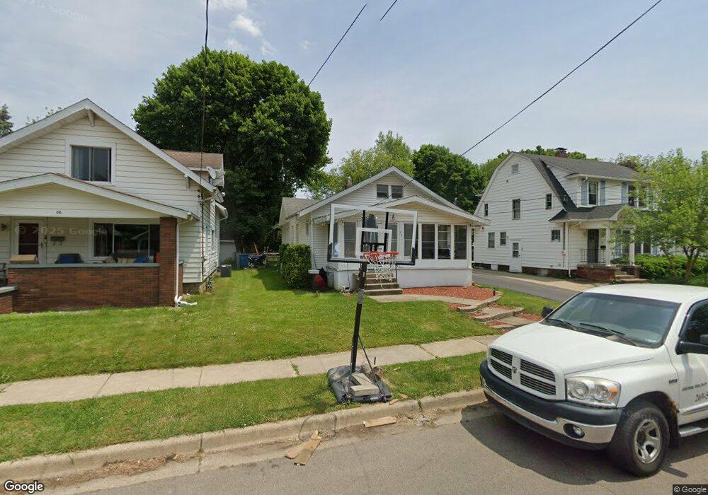
82 Woodward Ave Battle Creek, MI 49017
Northeast Battle Creek NeighborhoodEstimated Value: $90,000 - $159,000
2
Beds
2
Baths
1,200
Sq Ft
$94/Sq Ft
Est. Value
About This Home
This home is located at 82 Woodward Ave, Battle Creek, MI 49017 and is currently estimated at $112,862, approximately $94 per square foot. 82 Woodward Ave is a home located in Calhoun County with nearby schools including Verona Elementary School, Northwestern Middle School, and Battle Creek Central High School.
Ownership History
Date
Name
Owned For
Owner Type
Purchase Details
Closed on
Jul 25, 2023
Sold by
Jaycor Holdings Llc
Bought by
Jones Philip and Deforest Ashley
Current Estimated Value
Home Financials for this Owner
Home Financials are based on the most recent Mortgage that was taken out on this home.
Original Mortgage
$67,896
Outstanding Balance
$66,240
Interest Rate
6.67%
Mortgage Type
FHA
Estimated Equity
$46,622
Purchase Details
Closed on
Jul 30, 2009
Sold by
Lagro Corey and Lagro Sarah
Bought by
Jaycor Holdings Llc
Purchase Details
Closed on
Dec 13, 2007
Sold by
Lagro Corey T and Lagro Sarah A
Bought by
Lagro Corey and Lagro Sarah
Purchase Details
Closed on
Jul 28, 2000
Sold by
Nevins Roy and Nevins Frances L
Bought by
Lagro Corey T and Lagro Sarah A
Purchase Details
Closed on
May 11, 1998
Bought by
Nevins
Create a Home Valuation Report for This Property
The Home Valuation Report is an in-depth analysis detailing your home's value as well as a comparison with similar homes in the area
Home Values in the Area
Average Home Value in this Area
Purchase History
| Date | Buyer | Sale Price | Title Company |
|---|---|---|---|
| Jones Philip | $69,150 | Chicago Title | |
| Jaycor Holdings Llc | -- | None Available | |
| Lagro Corey | -- | None Available | |
| Lagro Corey T | $66,000 | -- | |
| Nevins | $24,500 | -- |
Source: Public Records
Mortgage History
| Date | Status | Borrower | Loan Amount |
|---|---|---|---|
| Open | Jones Philip | $67,896 |
Source: Public Records
Tax History Compared to Growth
Tax History
| Year | Tax Paid | Tax Assessment Tax Assessment Total Assessment is a certain percentage of the fair market value that is determined by local assessors to be the total taxable value of land and additions on the property. | Land | Improvement |
|---|---|---|---|---|
| 2025 | -- | $46,600 | $0 | $0 |
| 2024 | $1,610 | $42,319 | $0 | $0 |
| 2023 | $1,539 | $36,324 | $0 | $0 |
| 2022 | $1,093 | $31,360 | $0 | $0 |
| 2021 | $1,462 | $25,970 | $0 | $0 |
| 2020 | $1,378 | $25,570 | $0 | $0 |
| 2019 | $1,370 | $25,890 | $0 | $0 |
| 2018 | $1,370 | $24,516 | $1,190 | $23,326 |
| 2017 | $1,334 | $24,960 | $0 | $0 |
| 2016 | $1,330 | $24,716 | $0 | $0 |
| 2015 | $1,758 | $20,615 | $2,129 | $18,486 |
| 2014 | $1,758 | $27,352 | $2,129 | $25,223 |
Source: Public Records
Map
Nearby Homes
- 86 Woodward Ave
- 78 Woodward Ave
- 90 Woodward Ave
- 74 Woodward Ave
- 53 Sanderson St
- 57 Sanderson St
- 49 Sanderson St
- 63 Sanderson St
- 70 Woodward Ave
- 43 Sanderson St
- 81 Woodward Ave
- 66 Woodward Ave
- 91 Woodward Ave
- 73 Woodward Ave
- 69 Woodward Ave
- 62 Woodward Ave
- 67 Sanderson St
- 139 Bryant St
- 149 Bryant St
- 143 Bryant St