B
Seller's Agent in 2013
Barbara Lawson
Century 21 Kima Properties
Estimated Value: $95,000 - $132,000
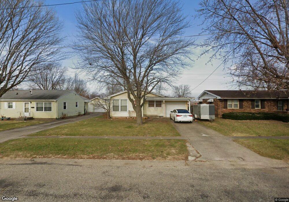
Immaculate home with three bedrooms, hardwood floors and bonus room (no heat). Updates include kitchen in 2007, bath 2012, roof 2006, dishwasher & water heater new and sewer line 2008. Patio access to basement. Sump pump in basement. Also, fenced yard and large patio!
Last Agent to Sell the Property
Barbara Lawson
Century 21 Kima Properties License #475126660 Listed on: 01/16/2013
| Date | Buyer | Sale Price | Title Company |
|---|---|---|---|
| True Amy J | $1,250 | None Available |
| Date | Status | Borrower | Loan Amount |
|---|---|---|---|
| Open | True Amy J | $78,570 |
| Date | Event | Price | List to Sale | Price per Sq Ft |
|---|---|---|---|---|
| 03/01/2013 03/01/13 | Sold | $75,500 | 0.0% | $61 / Sq Ft |
| 01/19/2013 01/19/13 | Pending | -- | -- | -- |
| 01/16/2013 01/16/13 | For Sale | $75,500 | -- | $61 / Sq Ft |
| Year | Tax Paid | Tax Assessment Tax Assessment Total Assessment is a certain percentage of the fair market value that is determined by local assessors to be the total taxable value of land and additions on the property. | Land | Improvement |
|---|---|---|---|---|
| 2024 | $2,104 | $30,758 | $1,667 | $29,091 |
| 2023 | $1,837 | $27,462 | $1,488 | $25,974 |
| 2022 | $1,837 | $27,008 | $1,463 | $25,545 |
| 2021 | $1,821 | $24,808 | $1,344 | $23,464 |
| 2020 | $1,796 | $25,704 | $1,393 | $24,311 |
| 2019 | $1,749 | $24,808 | $3,020 | $21,788 |
| 2018 | $1,717 | $24,808 | $3,020 | $21,788 |
| 2017 | $1,696 | $18,634 | $3,020 | $15,614 |
| 2016 | $1,660 | $18,634 | $3,020 | $15,614 |
| 2015 | $1,640 | $18,634 | $3,020 | $15,614 |
| 2014 | $1,640 | $18,634 | $3,020 | $15,614 |
| 2013 | $1,640 | $18,634 | $3,020 | $15,614 |
B
Seller's Agent in 2013
Barbara Lawson
Century 21 Kima Properties

Buyer's Agent in 2013
Julie Willingham
Premier Realtors
(217) 273-9039
133 in this area
230 Total Sales
Source: Central Illinois Board of REALTORS®
MLS Number: 4217487
APN: 07-2-15137-000
Ask me questions while you tour the home.