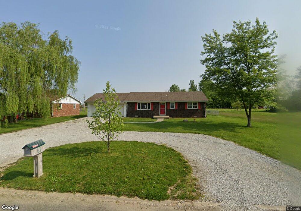
820 W 1085 N Fountaintown, IN 46130
Estimated Value: $179,000 - $195,708
3
Beds
1
Bath
1,200
Sq Ft
$155/Sq Ft
Est. Value
About This Home
This home is located at 820 W 1085 N, Fountaintown, IN 46130 and is currently estimated at $185,927, approximately $154 per square foot. 820 W 1085 N is a home located in Shelby County with nearby schools including Morristown Elementary School and Morristown Junior/Senior High School.
Ownership History
Date
Name
Owned For
Owner Type
Purchase Details
Closed on
Mar 21, 2025
Sold by
Viking Property & Land
Bought by
Viking Property And Land Llc
Current Estimated Value
Home Financials for this Owner
Home Financials are based on the most recent Mortgage that was taken out on this home.
Original Mortgage
$165,200
Outstanding Balance
$164,358
Interest Rate
6.89%
Mortgage Type
New Conventional
Estimated Equity
$21,569
Purchase Details
Closed on
Aug 3, 2023
Sold by
Sheriff Of Shelby County
Bought by
Viking Property & Land
Create a Home Valuation Report for This Property
The Home Valuation Report is an in-depth analysis detailing your home's value as well as a comparison with similar homes in the area
Home Values in the Area
Average Home Value in this Area
Purchase History
| Date | Buyer | Sale Price | Title Company |
|---|---|---|---|
| Viking Property And Land Llc | -- | None Listed On Document | |
| Viking Property & Land | $108,141 | None Listed On Document |
Source: Public Records
Mortgage History
| Date | Status | Borrower | Loan Amount |
|---|---|---|---|
| Open | Viking Property And Land Llc | $165,200 |
Source: Public Records
Tax History Compared to Growth
Tax History
| Year | Tax Paid | Tax Assessment Tax Assessment Total Assessment is a certain percentage of the fair market value that is determined by local assessors to be the total taxable value of land and additions on the property. | Land | Improvement |
|---|---|---|---|---|
| 2024 | $2,150 | $139,400 | $20,600 | $118,800 |
| 2023 | $2,171 | $137,500 | $20,600 | $116,900 |
| 2022 | $545 | $121,400 | $15,400 | $106,000 |
| 2021 | $460 | $112,800 | $15,400 | $97,400 |
| 2020 | $603 | $109,000 | $15,400 | $93,600 |
| 2019 | $549 | $104,400 | $14,700 | $89,700 |
| 2018 | $474 | $96,900 | $13,600 | $83,300 |
| 2017 | $412 | $92,700 | $13,600 | $79,100 |
| 2016 | $383 | $92,700 | $13,600 | $79,100 |
| 2014 | $359 | $91,100 | $13,600 | $77,500 |
| 2013 | $359 | $93,100 | $13,600 | $79,500 |
Source: Public Records
Map
Nearby Homes
- 10686 N Division Rd
- 5 U S 52
- 6 U S 52
- 11497 N State Road 9
- 11131 N State Road 9
- 256 E 1000 N
- 83 E Walnut St
- 11600 N 100 E
- 1069 W Railroad St
- 5477 S Main St
- 5465 S Greenfield St
- 11546 N Shelby 300 W
- 661 W 500 S
- 5555 S 200 E
- 1898 E 1000 N
- 4500 S 50 W
- 1546 E Osprey Dr
- 0 S 300 East- 2
- 1556 E 400 S
- 1744 E 850 N