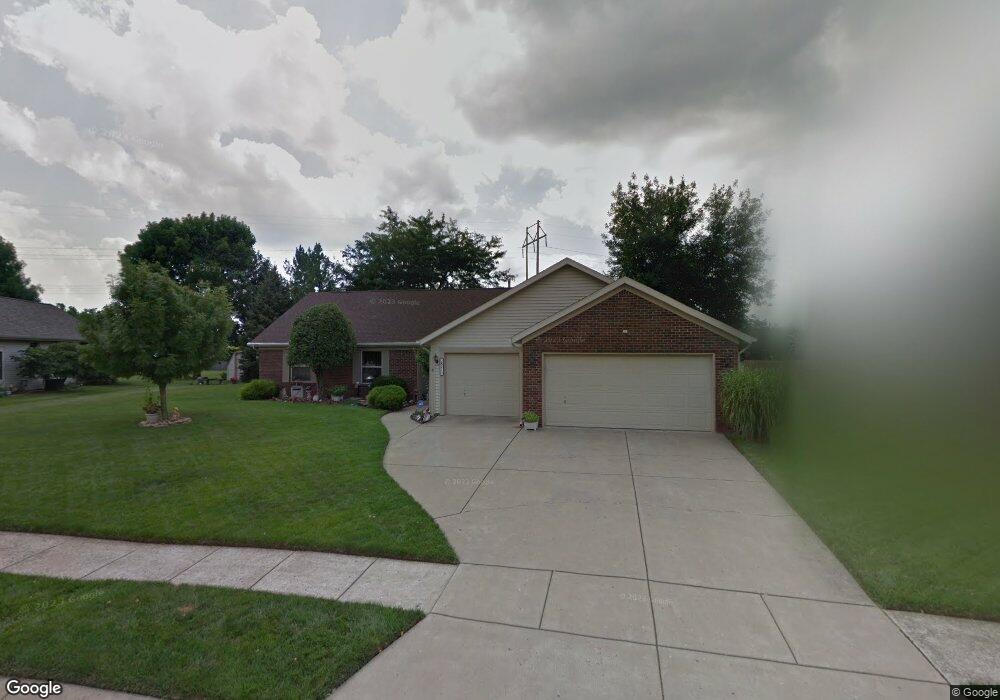
821 Brookside Dr Lafayette, IN 47909
Estimated Value: $319,692 - $348,000
Studio
--
Bath
2,096
Sq Ft
$159/Sq Ft
Est. Value
About This Home
This home is located at 821 Brookside Dr, Lafayette, IN 47909 and is currently estimated at $333,173, approximately $158 per square foot. 821 Brookside Dr is a home located in Tippecanoe County with nearby schools including Amelia Earhart Elementary School, Lafayette Tecumseh Junior High School, and Sunnyside Intermediate School.
Ownership History
Date
Name
Owned For
Owner Type
Purchase Details
Closed on
Jul 15, 2016
Sold by
Barrick William W and Barrick Myrna L
Bought by
Stevenson Gary and Stevenson Evelyn
Current Estimated Value
Home Financials for this Owner
Home Financials are based on the most recent Mortgage that was taken out on this home.
Original Mortgage
$166,250
Outstanding Balance
$132,546
Interest Rate
3.54%
Mortgage Type
New Conventional
Estimated Equity
$200,627
Purchase Details
Closed on
Feb 22, 2002
Sold by
Klaiber Mae L
Bought by
Barrick William W and Barrick Myrna L
Create a Home Valuation Report for This Property
The Home Valuation Report is an in-depth analysis detailing your home's value as well as a comparison with similar homes in the area
Purchase History
| Date | Buyer | Sale Price | Title Company |
|---|---|---|---|
| Stevenson Gary | -- | -- | |
| Barrick William W | -- | -- |
Source: Public Records
Mortgage History
| Date | Status | Borrower | Loan Amount |
|---|---|---|---|
| Open | Stevenson Gary | $166,250 |
Source: Public Records
Tax History
| Year | Tax Paid | Tax Assessment Tax Assessment Total Assessment is a certain percentage of the fair market value that is determined by local assessors to be the total taxable value of land and additions on the property. | Land | Improvement |
|---|---|---|---|---|
| 2024 | $2,708 | $270,800 | $53,000 | $217,800 |
| 2023 | $2,585 | $257,000 | $53,000 | $204,000 |
| 2022 | $1,935 | $192,400 | $30,000 | $162,400 |
| 2021 | $1,820 | $180,800 | $30,000 | $150,800 |
| 2020 | $1,686 | $169,300 | $30,000 | $139,300 |
| 2019 | $1,616 | $162,300 | $30,000 | $132,300 |
| 2018 | $1,634 | $162,200 | $30,000 | $132,200 |
| 2017 | $1,528 | $151,700 | $30,000 | $121,700 |
| 2016 | $1,506 | $149,500 | $30,000 | $119,500 |
| 2014 | $1,358 | $139,600 | $30,000 | $109,600 |
| 2013 | $1,313 | $137,800 | $30,000 | $107,800 |
Source: Public Records
Map
Nearby Homes
- 12 Brookhill Ct
- 839 Liverpool Ct
- 3435 Coventry Ln
- 3303 Crosspoint Ct S
- 3416 Coventry Ln
- 3920 George Washington Rd
- 1301 Norma Jean Dr
- 1709 Stonegate Cir
- 1401 Normandy Dr
- 8151 John Adams Rd
- 8165 John Adams Rd
- 8171 John Adams Rd
- 8157 John Adams Rd
- TBD John Adams Rd
- 1821 Starks Cir
- 904 N Southland Dr
- 1903 Starks Cir
- 1920 Honeybrook Way
- 604 Stockdale Dr
- 1712 Wolfson Way
- 817 Brookside Dr
- 825 Brookside Dr
- 61 Brookberry Dr
- 829 Brookside Dr
- 813 Brookside Dr
- 41 Brookberry Dr
- 32 Brookhill Ct
- 824 Brookside Dr
- 820 Brookside Dr
- 71 Brookberry Dr
- 816 Brookside Dr
- 828 Brookside Dr
- 833 Brookside Dr
- 932 Brookridge Ct
- 31 Brookberry Dr
- 21 Brookberry Dr
- 22 Brookhill Ct
- 81 Brookberry Dr
- 43 Brookdale Ct
- 812 Brookside Dr