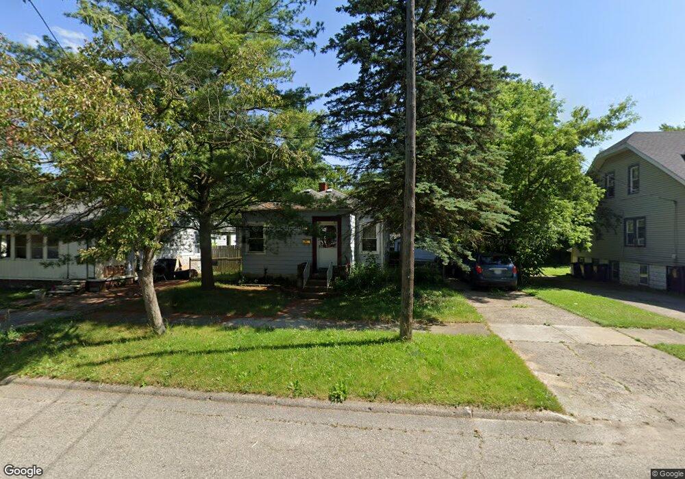
821 Clinton St Flint, MI 48507
South Side NeighborhoodEstimated Value: $44,000 - $59,000
2
Beds
2
Baths
642
Sq Ft
$75/Sq Ft
Est. Value
About This Home
This home is located at 821 Clinton St, Flint, MI 48507 and is currently estimated at $48,121, approximately $74 per square foot. 821 Clinton St is a home located in Genesee County with nearby schools including Neithercut Elementary School, Flint Southwestern Classical Academy, and International Academy of Flint (K-12).
Ownership History
Date
Name
Owned For
Owner Type
Purchase Details
Closed on
Aug 31, 2000
Sold by
Mason E J
Bought by
Wissinger Andrea N
Current Estimated Value
Home Financials for this Owner
Home Financials are based on the most recent Mortgage that was taken out on this home.
Original Mortgage
$42,439
Outstanding Balance
$15,312
Interest Rate
8.15%
Mortgage Type
Purchase Money Mortgage
Estimated Equity
$32,809
Create a Home Valuation Report for This Property
The Home Valuation Report is an in-depth analysis detailing your home's value as well as a comparison with similar homes in the area
Home Values in the Area
Average Home Value in this Area
Purchase History
We collect this data history from publicly available records. To have your information removed, we recommend requesting removal directly through your county’s website.
| Date | Buyer | Sale Price | Title Company |
|---|---|---|---|
| Wissinger Andrea N | $43,000 | First American Title Ins Co |
Source: Public Records
Mortgage History
We collect this data history from publicly available records. To have your information removed, we recommend requesting removal directly through your county’s website.
| Date | Status | Borrower | Loan Amount |
|---|---|---|---|
| Open | Wissinger Andrea N | $42,439 |
Source: Public Records
Tax History
| Year | Tax Paid | Tax Assessment Tax Assessment Total Assessment is a certain percentage of the fair market value that is determined by local assessors to be the total taxable value of land and additions on the property. | Land | Improvement |
|---|---|---|---|---|
| 2025 | $1,119 | $16,800 | $0 | $0 |
| 2024 | $819 | $17,400 | $0 | $0 |
| 2023 | $807 | $14,100 | $0 | $0 |
| 2022 | $0 | $12,600 | $0 | $0 |
| 2021 | $836 | $11,400 | $0 | $0 |
| 2020 | $758 | $11,400 | $0 | $0 |
| 2019 | $740 | $11,600 | $0 | $0 |
| 2018 | $733 | $10,500 | $0 | $0 |
| 2017 | $714 | $0 | $0 | $0 |
| 2016 | $709 | $0 | $0 | $0 |
| 2015 | -- | $0 | $0 | $0 |
| 2014 | -- | $0 | $0 | $0 |
| 2012 | -- | $12,800 | $0 | $0 |
Source: Public Records
Map
Nearby Homes
- 838 Clinton St
- 845 Alvord Ave
- 805 Alvord Ave
- 814 Alvord Ave
- 806 Alvord Ave
- 4117 Brunswick Ave
- 912 Huron St
- 920 Huron St
- 749 Crawford St
- 730 Alvord Ave
- 721 Huron St
- 935 Ingleside Ave
- 701 Alvord Ave
- 842 Leland St
- 925 Leland St
- 713 Leland St
- 652 Crawford St
- 846 W Hemphill Rd
- 822 Campbell St
- 644 Crawford St
- 829 Clinton St Unit 829 Clinton St 3
- 837 Clinton St
- 817 Clinton St
- 830 Huron St
- 822 Huron St
- 834 Huron St
- 813 Clinton St
- 845 Clinton St
- 832 Clinton St
- 830 Clinton St
- 842 Huron St
- 822 Clinton St
- 818 Clinton St
- 842 Clinton St
- 842 Clinton St Unit b
- 805 Clinton St
- 849 Clinton St
- 814 Clinton St
- 850 Huron St
- 4301 Brunswick Ave
Your Personal Tour Guide
Ask me questions while you tour the home.