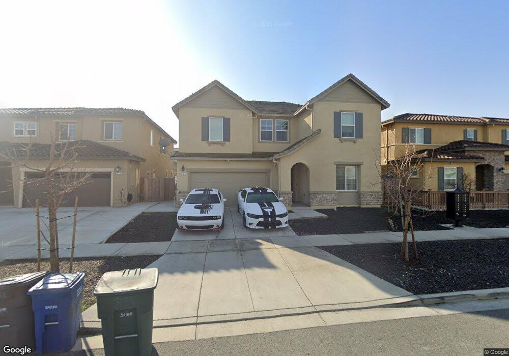
821 Riverrock Dr Oakley, CA 94561
Estimated Value: $761,166 - $848,000
5
Beds
4
Baths
3,093
Sq Ft
$260/Sq Ft
Est. Value
About This Home
This home is located at 821 Riverrock Dr, Oakley, CA 94561 and is currently estimated at $805,292, approximately $260 per square foot. 821 Riverrock Dr is a home located in Contra Costa County with nearby schools including Iron House Elementary School, Delta Vista Middle School, and Freedom High School.
Ownership History
Date
Name
Owned For
Owner Type
Purchase Details
Closed on
May 18, 2020
Sold by
Brookfield Bay Area Holdings Llc
Bought by
Dunlap Karima D and Lowe Julius
Current Estimated Value
Home Financials for this Owner
Home Financials are based on the most recent Mortgage that was taken out on this home.
Original Mortgage
$618,578
Outstanding Balance
$548,146
Interest Rate
3.3%
Mortgage Type
FHA
Estimated Equity
$257,146
Purchase Details
Closed on
Aug 23, 2017
Sold by
Brookfield Emerson Land Llc
Bought by
Brookfield Bay Area Holdings Llc
Create a Home Valuation Report for This Property
The Home Valuation Report is an in-depth analysis detailing your home's value as well as a comparison with similar homes in the area
Home Values in the Area
Average Home Value in this Area
Purchase History
| Date | Buyer | Sale Price | Title Company |
|---|---|---|---|
| Dunlap Karima D | $630,000 | First American Title Company | |
| Brookfield Bay Area Holdings Llc | -- | Accommodation |
Source: Public Records
Mortgage History
| Date | Status | Borrower | Loan Amount |
|---|---|---|---|
| Open | Dunlap Karima D | $618,578 |
Source: Public Records
Tax History
| Year | Tax Paid | Tax Assessment Tax Assessment Total Assessment is a certain percentage of the fair market value that is determined by local assessors to be the total taxable value of land and additions on the property. | Land | Improvement |
|---|---|---|---|---|
| 2025 | $13,604 | $688,883 | $164,045 | $524,838 |
| 2024 | $13,176 | $675,377 | $160,829 | $514,548 |
| 2023 | $13,176 | $662,135 | $157,676 | $504,459 |
| 2022 | $12,933 | $649,153 | $154,585 | $494,568 |
| 2021 | $12,714 | $636,425 | $151,554 | $484,871 |
| 2019 | $5,417 | $70,887 | $70,887 | $0 |
| 2018 | $5,308 | $69,498 | $69,498 | $0 |
| 2017 | $3,462 | $68,136 | $68,136 | $0 |
Source: Public Records
Map
Nearby Homes
- 268 Coolcrest Dr
- 279 Coolcrest Dr
- 732 Westmoor Cir
- 208 Littleton St
- 624 Brinwood Way
- 649 Channel Cir
- 645 Channel Cir
- 641 Channel Cir
- 500 Brinwood Way
- 656 Channel Cir
- 660 Channel Cir
- 626 Channel Cir
- 633 Channel Cir
- 659 Channel Cir
- 629 Channel Cir
- 618 Channel Cir
- 6381 Sellers Ave
- 663 Channel Cir
- 672 Channel Cir
- Residence 2 Plan at Riverine
- 825 Riverrock Dr
- 817 Riverrock Dr
- 924 Windrift Way
- 916 Windrift Way
- 813 Riverrock Dr
- 829 Riverrock Dr
- 912 Windrift Way
- 833 Riverrock Dr
- 928 Winddrift Way
- 809 Riverrock Dr
- 932 Windrift Way
- 820 Riverrock Dr
- 816 Riverrock Dr
- 908 Windrift Way
- 920 Winddrift Way
- 933 Winddrift Way
- 0 Winddrift Way
- 812 Riverrock Dr
- 837 Riverrock Dr
- 205 Willowrun Way