Estimated Value: $352,940 - $455,000
2
Beds
1
Bath
976
Sq Ft
$401/Sq Ft
Est. Value
About This Home
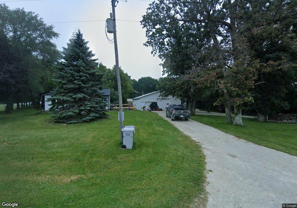
This home is located at 8213 19th St NW, Byron, MN 55920 and is currently estimated at $391,235, approximately $400 per square foot. 8213 19th St NW is a home located in Olmsted County with nearby schools including Byron Intermediate School, Byron Middle School, and Byron Senior High School.
Ownership History
Date
Name
Owned For
Owner Type
Purchase Details
Closed on
Jan 24, 2025
Sold by
Bond Michael C and Depoppe Heather L
Bought by
Bond Michael C
Current Estimated Value
Home Financials for this Owner
Home Financials are based on the most recent Mortgage that was taken out on this home.
Original Mortgage
$260,000
Outstanding Balance
$258,397
Interest Rate
6.72%
Mortgage Type
Credit Line Revolving
Estimated Equity
$132,838
Purchase Details
Closed on
Sep 1, 2017
Sold by
Bond Michael C and Bond Russell A
Bought by
Bond Michael C and Depoppe Heather L
Home Financials for this Owner
Home Financials are based on the most recent Mortgage that was taken out on this home.
Original Mortgage
$93,177
Interest Rate
3.75%
Mortgage Type
FHA
Purchase Details
Closed on
May 4, 2016
Sold by
Bond Russell A
Bought by
Bond Russell A and Bond Michael C
Purchase Details
Closed on
Sep 25, 2012
Sold by
Bond Henrietta A and Gerold C Bond Revocable Living
Bought by
Bond Russell A
Home Financials for this Owner
Home Financials are based on the most recent Mortgage that was taken out on this home.
Original Mortgage
$50,000
Interest Rate
5%
Mortgage Type
Purchase Money Mortgage
Purchase Details
Closed on
Nov 19, 2007
Sold by
Bond Garold C and Bond Henrietta A
Bought by
Bond Russell A
Home Financials for this Owner
Home Financials are based on the most recent Mortgage that was taken out on this home.
Original Mortgage
$80,000
Interest Rate
6.1%
Mortgage Type
Seller Take Back
Purchase Details
Closed on
Oct 12, 2004
Sold by
Bond Garold C and Bond Henrietta A
Bought by
Bond Garold C and Bond Henrietta A
Create a Home Valuation Report for This Property
The Home Valuation Report is an in-depth analysis detailing your home's value as well as a comparison with similar homes in the area
Home Values in the Area
Average Home Value in this Area
Purchase History
| Date | Buyer | Sale Price | Title Company |
|---|---|---|---|
| Bond Michael C | $500 | Results Title | |
| Bond Michael C | -- | None Available | |
| Bond Russell A | -- | Attorney | |
| Bond Russell A | $220,000 | None Available | |
| Bond Russell A | $220,000 | None Available | |
| Bond Garold C | -- | None Available |
Source: Public Records
Mortgage History
| Date | Status | Borrower | Loan Amount |
|---|---|---|---|
| Open | Bond Michael C | $260,000 | |
| Previous Owner | Bond Michael C | $93,177 | |
| Previous Owner | Bond Russell A | $50,000 | |
| Previous Owner | Bond Russell A | $80,000 |
Source: Public Records
Tax History Compared to Growth
Tax History
| Year | Tax Paid | Tax Assessment Tax Assessment Total Assessment is a certain percentage of the fair market value that is determined by local assessors to be the total taxable value of land and additions on the property. | Land | Improvement |
|---|---|---|---|---|
| 2024 | $3,042 | $294,500 | $95,000 | $199,500 |
| 2023 | $2,998 | $293,000 | $95,000 | $198,000 |
| 2022 | $1,926 | $36,100 | $0 | $36,100 |
| 2021 | $1,976 | $33,000 | $0 | $33,000 |
| 2020 | $2,192 | $33,400 | $0 | $33,400 |
| 2019 | $2,800 | $24,900 | $0 | $24,900 |
| 2018 | $2,166 | $11,100 | $11,100 | $0 |
| 2017 | $2,120 | $36,000 | $11,100 | $24,900 |
| 2016 | $1,906 | $36,600 | $11,700 | $24,900 |
| 2015 | $1,868 | $36,600 | $11,700 | $24,900 |
| 2014 | $1,054 | $175,300 | $150,400 | $24,900 |
| 2012 | -- | $206,200 | $181,800 | $24,400 |
Source: Public Records
Map
Nearby Homes
- 1705 Brandt Dr NE
- 1676 Brandt Dr NE
- 1792 (L3,B1) Brandt Dr NE
- 1644 Brandt Dr NE
- 1582 Brandt Dr NE
- 1764 Brandt Dr NE
- 1886 (L11,B2) Robinson Ln NE
- 1872 (L10,B2) Robinson Ln NE
- 1860 (L9,B2) Robinson Ln NE
- 1844 (L8,B2) Robinson Ln NE
- 1863 (L13,B2) Robinson Ln NE
- 1830 (L7,B2) Robinson Ln NE
- 1807 (L14,B2) Robinson Ln NE
- 1884 Ashley Dr NE
- 1806 Brandt Dr NE
- 1812 Brandt Dr NE
- 1805 Brandt Dr NE
- 1421 Tunbridge Place NE
- 1824 Brandt Dr NE
- 1830 Brandt Dr NE
- 8315 19th St NW
- 8125 19th St NW
- 2001 County Road 3 NW
- 1905 County Road 3 NW
- 2918 County Road 3 NW
- 2903 County Road 3 NW
- 1710 20th St NE
- 1610 County Road 3 NW
- 1527 20th St NE
- 1550 20th St NE
- 8145 14th St NW
- 8411 14th St NW
- 8431 14th St NW
- 1518 20th St NE
- 7851 34th St NW
- 7849 34th St NW
- 1505 20th St NE
- 699 Steenhoek Ln NE
- 7906 14th St NW
- 689 Steenhoek Ln NE