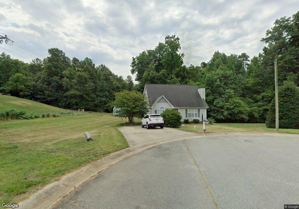
822 Anniston's Ct Graham, NC 27253
Estimated Value: $286,000 - $314,000
3
Beds
3
Baths
1,450
Sq Ft
$207/Sq Ft
Est. Value
About This Home
This home is located at 822 Anniston's Ct, Graham, NC 27253 and is currently estimated at $300,069, approximately $206 per square foot. 822 Anniston's Ct is a home located in Alamance County with nearby schools including South Graham Elementary School, Southern Alamance Middle School, and Southern Alamance High School.
Ownership History
Date
Name
Owned For
Owner Type
Purchase Details
Closed on
Nov 21, 2016
Sold by
Jones Bertina F
Bought by
Laney Preston Reeves and Laney Jessica
Current Estimated Value
Home Financials for this Owner
Home Financials are based on the most recent Mortgage that was taken out on this home.
Original Mortgage
$124,208
Outstanding Balance
$99,179
Interest Rate
3.25%
Mortgage Type
FHA
Estimated Equity
$200,890
Create a Home Valuation Report for This Property
The Home Valuation Report is an in-depth analysis detailing your home's value as well as a comparison with similar homes in the area
Home Values in the Area
Average Home Value in this Area
Purchase History
| Date | Buyer | Sale Price | Title Company |
|---|---|---|---|
| Laney Preston Reeves | $127,000 | Attorney |
Source: Public Records
Mortgage History
| Date | Status | Borrower | Loan Amount |
|---|---|---|---|
| Open | Laney Preston Reeves | $124,208 |
Source: Public Records
Tax History Compared to Growth
Tax History
| Year | Tax Paid | Tax Assessment Tax Assessment Total Assessment is a certain percentage of the fair market value that is determined by local assessors to be the total taxable value of land and additions on the property. | Land | Improvement |
|---|---|---|---|---|
| 2025 | $1,246 | $252,189 | $36,000 | $216,189 |
| 2024 | $1,183 | $252,189 | $36,000 | $216,189 |
| 2023 | $1,084 | $252,189 | $36,000 | $216,189 |
| 2022 | $1,404 | $127,443 | $25,000 | $102,443 |
| 2021 | $1,417 | $127,443 | $25,000 | $102,443 |
| 2020 | $1,429 | $127,443 | $25,000 | $102,443 |
| 2019 | $1,434 | $127,443 | $25,000 | $102,443 |
| 2018 | $0 | $127,443 | $25,000 | $102,443 |
| 2017 | $1,094 | $189,549 | $25,000 | $164,549 |
| 2016 | $1,340 | $129,424 | $25,000 | $104,424 |
| 2015 | $747 | $129,424 | $25,000 | $104,424 |
| 2014 | $683 | $129,424 | $25,000 | $104,424 |
Source: Public Records
Map
Nearby Homes
- 00 Thompson Rd
- 544 Woodland Dr
- 552 Woodland Dr
- 627 Carraway Dr
- 0 Rogers Rd Unit 10122339
- 312 Loon Ct
- 540 Alamanni Ct
- 514 Alamanni Ct
- 605 Sania Ct
- 1619 Broadway Dr
- 1911 Darrell Dr Unit 4
- 1911 Darrell Dr
- 1926 Darrell Dr Unit Lot 13
- 1926 Darrell Dr
- 1923 Darrell Dr Unit 6
- 1923 Darrell Dr
- 1932 Darrell Dr Unit Lot12
- 1932 Darrell Dr
- 1917 Darrell Dr Unit 5
- 1917 Darrell Dr
- 822 Annistons Ct
- 825 Anniston's Ct
- 825 Annistons Ct
- 600 Thompson Rd
- 600 Thompson Rd Lot87
- 604 Thompson Rd
- 604 Thompson Rd
- 821 Annistons Ct
- 817 Anniston's Ct
- 817 Annistons Ct
- 608 Thompson Rd
- 0 Anniston's Ct
- 612 Thompson Rd
- 737 Williamsdale Rd
- 756 Trails End Dr
- 733 Williamsdale Rd
- 807 Trails End Dr
- 700 Thompson Rd
- 813 Annistons Ct
- 752 Trail's End Dr