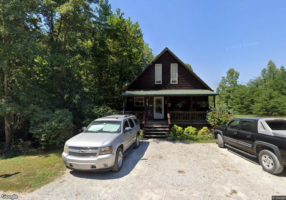
822 Northstar Rd Jamestown, TN 38556
Estimated Value: $169,295 - $214,000
--
Bed
2
Baths
662
Sq Ft
$302/Sq Ft
Est. Value
About This Home
This home is located at 822 Northstar Rd, Jamestown, TN 38556 and is currently estimated at $200,074, approximately $302 per square foot. 822 Northstar Rd is a home located in Pickett County with nearby schools including Pickett County Elementary School and Pickett County High School.
Ownership History
Date
Name
Owned For
Owner Type
Purchase Details
Closed on
Sep 15, 2016
Sold by
Anderson Donna
Bought by
Benefield Tim and Benefield Theresa
Current Estimated Value
Purchase Details
Closed on
Jun 27, 2014
Sold by
Davis Joe
Bought by
Fitzgerald Tommy C and Anderson Donna A
Purchase Details
Closed on
Dec 9, 2005
Sold by
Not Provided
Bought by
Chiles Terry
Home Financials for this Owner
Home Financials are based on the most recent Mortgage that was taken out on this home.
Original Mortgage
$42,450
Interest Rate
6.29%
Mortgage Type
Cash
Purchase Details
Closed on
Jun 12, 2003
Bought by
Jones William E and Jones Cynthia
Create a Home Valuation Report for This Property
The Home Valuation Report is an in-depth analysis detailing your home's value as well as a comparison with similar homes in the area
Home Values in the Area
Average Home Value in this Area
Purchase History
| Date | Buyer | Sale Price | Title Company |
|---|---|---|---|
| Benefield Tim | $82,500 | -- | |
| Fitzgerald Tommy C | $98,200 | -- | |
| Chiles Terry | $84,900 | -- | |
| Jones William E | $70,000 | -- |
Source: Public Records
Mortgage History
| Date | Status | Borrower | Loan Amount |
|---|---|---|---|
| Previous Owner | Chiles Terry | $42,450 |
Source: Public Records
Tax History Compared to Growth
Tax History
| Year | Tax Paid | Tax Assessment Tax Assessment Total Assessment is a certain percentage of the fair market value that is determined by local assessors to be the total taxable value of land and additions on the property. | Land | Improvement |
|---|---|---|---|---|
| 2024 | $479 | $28,025 | $2,750 | $25,275 |
| 2023 | $478 | $28,025 | $2,750 | $25,275 |
| 2022 | $474 | $19,675 | $2,125 | $17,550 |
| 2021 | $474 | $19,675 | $2,125 | $17,550 |
| 2020 | $474 | $19,675 | $2,125 | $17,550 |
| 2019 | $484 | $19,675 | $2,125 | $17,550 |
| 2018 | $338 | $19,675 | $2,125 | $17,550 |
| 2017 | $356 | $19,050 | $2,125 | $16,925 |
| 2016 | $356 | $19,050 | $2,125 | $16,925 |
| 2015 | $356 | $19,058 | $0 | $0 |
| 2014 | $356 | $19,058 | $0 | $0 |
Source: Public Records
Map
Nearby Homes
- 2021 Milky Way
- 0 Lot 55 Milky Way
- 0 Milky Way Rd Unit RTC2996177
- 5735 E East Port Rd
- 400 Sabre Park Rd
- 0 Bolestown Loop
- 0 Bolestown Loop
- 00 Bolestown Loop
- 4986 Robbinstown Rd
- 0 Cliff Edge Rd
- Lot Cliff Edge Rd
- 1100 Eastport Dock Rd
- 1255 Winningham Rd
- 43.36 ac Winningham Rd
- 221 Cedar Grove Ln
- 0 Crab Mountain Rd Unit 1305293
- 12.55ac Winningham Rd
- Lot 66 Big Hollow Rd
- Lot 11 Big Hollow Rd
- 00 N Star Rd
- 822 N Star Rd
- 969 Big Sky Rd
- 999 Milky Way
- 969 Big Sky Rd
- 581 Big Sky Rd
- 571 Big Sky Rd
- Lot 56 Milky Way Rd
- 1049 Orion's Beltway
- 2021 Milky Way Rd
- 2031 Milky Way Rd
- 980 Big Sky Rd
- 1000 Orien Beltway
- 1000 Orien Beltway
- 0 the Milk Way
- 00 Milky Way Rd
- .91 acre Milky Way Rd
- 1200 Orions Belt Way
- 531 Big Sky Rd
- 0 Milky Way Ed