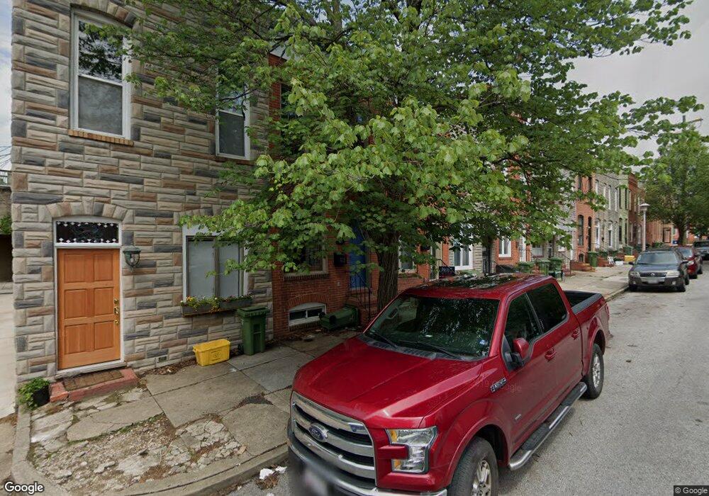
822 S Port St Baltimore, MD 21224
Canton NeighborhoodEstimated Value: $329,965 - $379,000
--
Bed
2
Baths
1,146
Sq Ft
$309/Sq Ft
Est. Value
About This Home
This home is located at 822 S Port St, Baltimore, MD 21224 and is currently estimated at $354,483, approximately $309 per square foot. 822 S Port St is a home located in Baltimore City with nearby schools including Booker T. Washington Middle School, Paul Laurence Dunbar High School, and Digital Harbor High School.
Ownership History
Date
Name
Owned For
Owner Type
Purchase Details
Closed on
Sep 16, 2021
Sold by
Shank Christopher T
Bought by
Martin Brianne Thompson
Current Estimated Value
Home Financials for this Owner
Home Financials are based on the most recent Mortgage that was taken out on this home.
Original Mortgage
$295,850
Interest Rate
2.8%
Mortgage Type
New Conventional
Purchase Details
Closed on
May 25, 2005
Sold by
Yori Gabriel
Bought by
Shank Christopher T
Purchase Details
Closed on
Feb 19, 2002
Sold by
Sherry Francis R
Bought by
Yori Gabriel and Yori Heather
Purchase Details
Closed on
Oct 10, 2001
Sold by
Jones Clark D
Bought by
Sherry Francis R
Purchase Details
Closed on
Apr 24, 2001
Sold by
Reed John H
Bought by
Jones Clark D and Jones David C
Create a Home Valuation Report for This Property
The Home Valuation Report is an in-depth analysis detailing your home's value as well as a comparison with similar homes in the area
Home Values in the Area
Average Home Value in this Area
Purchase History
| Date | Buyer | Sale Price | Title Company |
|---|---|---|---|
| Martin Brianne Thompson | $305,000 | Terrain Title | |
| Shank Christopher T | $339,900 | -- | |
| Yori Gabriel | $89,950 | -- | |
| Sherry Francis R | $71,000 | -- | |
| Jones Clark D | $50,000 | -- |
Source: Public Records
Mortgage History
| Date | Status | Borrower | Loan Amount |
|---|---|---|---|
| Previous Owner | Martin Brianne Thompson | $295,850 |
Source: Public Records
Tax History Compared to Growth
Tax History
| Year | Tax Paid | Tax Assessment Tax Assessment Total Assessment is a certain percentage of the fair market value that is determined by local assessors to be the total taxable value of land and additions on the property. | Land | Improvement |
|---|---|---|---|---|
| 2025 | $6,577 | $288,367 | -- | -- |
| 2024 | $6,577 | $280,033 | $0 | $0 |
| 2023 | $6,382 | $271,700 | $100,000 | $171,700 |
| 2022 | $6,392 | $270,833 | $0 | $0 |
| 2021 | $6,371 | $269,967 | $0 | $0 |
| 2020 | $6,351 | $269,100 | $100,000 | $169,100 |
| 2019 | $6,168 | $262,600 | $0 | $0 |
| 2018 | $6,044 | $256,100 | $0 | $0 |
| 2017 | $5,891 | $249,600 | $0 | $0 |
| 2016 | $6,663 | $243,867 | $0 | $0 |
| 2015 | $6,663 | $238,133 | $0 | $0 |
| 2014 | $6,663 | $232,400 | $0 | $0 |
Source: Public Records
Map
Nearby Homes
- 832 S Milton Ave
- 2411 Fait Ave
- 2415 Boston St
- 801 S Rose St
- 2339 Cambridge Walk
- 2527 Foster Ave
- 2515 Boston St Unit 201
- 2515 Boston St Unit 1206
- 2515 Boston St Unit 706
- 2335 Boston St Unit 4
- 2305 Essex St
- 624 S Milton Ave
- 2303 Essex St
- 638 S Montford Ave
- 2642 Hudson St
- 612 S Rose St
- 616 S Luzerne Ave
- 612 S Luzerne Ave
- 827 S Lakewood Ave
- 2433 Fleet St
- 822 S Port St
- 820 S Port St
- 824 S Port St
- 818 S Port St
- 826 S Port St
- 816 S Port St
- 814 S Port St
- 812 S Port St
- 810 S Port St
- 2404 Hudson St
- 831 S Montford Ave
- 2406 Hudson St
- 2402 Hudson St
- 829 S Montford Ave
- 833 S Montford Ave
- 2400 Hudson St
- 827 S Montford Ave
- 2408 Hudson St
- 835 S Montford Ave
- 808 S Port St