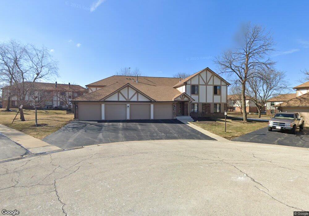
822 Thornton Ct Schaumburg, IL 60193
Elk Grove Village West NeighborhoodEstimated Value: $259,000 - $273,000
2
Beds
--
Bath
1,300
Sq Ft
$205/Sq Ft
Est. Value
About This Home
This home is located at 822 Thornton Ct, Schaumburg, IL 60193 and is currently estimated at $265,942, approximately $204 per square foot. 822 Thornton Ct is a home located in Cook County with nearby schools including Frederick Nerge Elementary School, Margaret Mead Junior High School, and J B Conant High School.
Ownership History
Date
Name
Owned For
Owner Type
Purchase Details
Closed on
Mar 6, 1995
Sold by
Wagner Paul E and Kohout Holly L
Bought by
Itskovich Bronislav and Tabakova Elena
Current Estimated Value
Home Financials for this Owner
Home Financials are based on the most recent Mortgage that was taken out on this home.
Original Mortgage
$73,900
Interest Rate
9.13%
Create a Home Valuation Report for This Property
The Home Valuation Report is an in-depth analysis detailing your home's value as well as a comparison with similar homes in the area
Home Values in the Area
Average Home Value in this Area
Purchase History
| Date | Buyer | Sale Price | Title Company |
|---|---|---|---|
| Itskovich Bronislav | $99,000 | -- |
Source: Public Records
Mortgage History
| Date | Status | Borrower | Loan Amount |
|---|---|---|---|
| Closed | Itskovich Bronislav | $73,900 |
Source: Public Records
Tax History Compared to Growth
Tax History
| Year | Tax Paid | Tax Assessment Tax Assessment Total Assessment is a certain percentage of the fair market value that is determined by local assessors to be the total taxable value of land and additions on the property. | Land | Improvement |
|---|---|---|---|---|
| 2024 | $3,972 | $17,498 | $4,494 | $13,004 |
| 2023 | $3,824 | $17,498 | $4,494 | $13,004 |
| 2022 | $3,824 | $17,498 | $4,494 | $13,004 |
| 2021 | $3,211 | $13,925 | $2,961 | $10,964 |
| 2020 | $3,224 | $13,925 | $2,961 | $10,964 |
| 2019 | $3,251 | $15,557 | $2,961 | $12,596 |
| 2018 | $2,341 | $11,235 | $2,553 | $8,682 |
| 2017 | $2,322 | $11,235 | $2,553 | $8,682 |
| 2016 | $2,414 | $11,235 | $2,553 | $8,682 |
| 2015 | $2,107 | $9,667 | $2,246 | $7,421 |
| 2014 | $2,100 | $9,667 | $2,246 | $7,421 |
| 2013 | $2,029 | $9,667 | $2,246 | $7,421 |
Source: Public Records
Map
Nearby Homes
- 800 Cardinal Ln
- 1114 Hampton Harbor Unit 8501
- 1045 Hampton Harbor Unit 9602
- 426 E Niagara Ave
- 421 E Wise Rd
- 813 Shawnee Trail
- 907 Cross Creek Dr N Unit BB2
- 677 Cross Creek Dr W Unit AA
- 755 N Woodfield Trail
- 630 Cumberland Trail Unit AA1
- 1642 Iowa Dr
- 542 Bryce Trail
- 1603 Dakota Dr
- 1027 Newport Harbor Unit 6504
- 1803 Vermont Dr Unit 293
- 780 Chisholm Trail
- 278 Nantucket Harbor Unit 703
- 770 Yosemite Trail
- 276 Greensboro Ct Unit 184
- 226 Nantucket Harbor Unit 226
- 822 Thornton Ct
- 822 Thornton Ct
- 822 Thornton Ct
- 822 Thornton Ct Unit 1A
- 822 Thornton Ct Unit 2B
- 826 Thornton Ct
- 826 Thornton Ct
- 826 Thornton Ct
- 826 Thornton Ct
- 826 Thornton Ct Unit 1B
- 826 Thornton Ct Unit 1A
- 826 Thornton Ct
- 826 Thornton Ct Unit 2A
- 826 Thornton Ct Unit 2AL
- 1219 Knottingham Ct Unit 1B
- 1219 Knottingham Ct
- 1219 Knottingham Ct
- 1219 Knottingham Ct
- 1219 Knottingham Ct
- 1223 Knottingham Ct