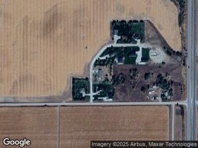
8220 W Fork Ave Hastings, NE 68901
Estimated Value: $386,789 - $539,000
3
Beds
3
Baths
2,010
Sq Ft
$228/Sq Ft
Est. Value
About This Home
This home is located at 8220 W Fork Ave, Hastings, NE 68901 and is currently estimated at $458,197, approximately $227 per square foot. 8220 W Fork Ave is a home located in Adams County with nearby schools including Adams County 15, Wallace School, and Adams Central Elementary School.
Ownership History
Date
Name
Owned For
Owner Type
Purchase Details
Closed on
Feb 7, 2012
Sold by
Hollman Kent L and Hollman Janet R
Bought by
Nelson Andrew D and Gartner Nelson Kelly R
Current Estimated Value
Home Financials for this Owner
Home Financials are based on the most recent Mortgage that was taken out on this home.
Original Mortgage
$138,400
Interest Rate
4%
Mortgage Type
New Conventional
Purchase Details
Closed on
Aug 31, 2005
Sold by
Norris Larry L and Norris Belinda M
Bought by
Hollman Kent L and Hollman Janet R
Home Financials for this Owner
Home Financials are based on the most recent Mortgage that was taken out on this home.
Original Mortgage
$95,000
Interest Rate
5.81%
Mortgage Type
New Conventional
Create a Home Valuation Report for This Property
The Home Valuation Report is an in-depth analysis detailing your home's value as well as a comparison with similar homes in the area
Home Values in the Area
Average Home Value in this Area
Purchase History
| Date | Buyer | Sale Price | Title Company |
|---|---|---|---|
| Nelson Andrew D | $173,000 | Praire Title | |
| Hollman Kent L | $162,000 | None Available |
Source: Public Records
Mortgage History
| Date | Status | Borrower | Loan Amount |
|---|---|---|---|
| Open | Nelson Andrew D | $160,900 | |
| Closed | Nelson Andrew D | $138,400 | |
| Previous Owner | Hollman Kent L | $95,000 |
Source: Public Records
Tax History Compared to Growth
Tax History
| Year | Tax Paid | Tax Assessment Tax Assessment Total Assessment is a certain percentage of the fair market value that is determined by local assessors to be the total taxable value of land and additions on the property. | Land | Improvement |
|---|---|---|---|---|
| 2024 | $2,674 | $294,356 | $47,500 | $246,856 |
| 2023 | $3,942 | $294,356 | $47,500 | $246,856 |
| 2022 | $3,267 | $222,956 | $47,500 | $175,456 |
| 2021 | $2,556 | $185,355 | $13,900 | $171,455 |
| 2020 | $2,486 | $185,355 | $13,900 | $171,455 |
| 2019 | $2,341 | $185,355 | $13,900 | $171,455 |
| 2018 | $2,323 | $185,355 | $13,900 | $171,455 |
| 2017 | $2,234 | $185,355 | $0 | $0 |
| 2016 | $2,218 | $185,355 | $13,900 | $171,455 |
| 2010 | $2,719 | $175,650 | $13,900 | $161,750 |
Source: Public Records
Map
Nearby Homes
- 406 Fox Run St
- 790 E Clark St
- 314 Pintail Cir
- 5804 Pheasant Run Ave
- 1036 Country Club Dr
- 1731 Highland Dr
- 1543 Highland Dr
- 15 Village Dr
- 5413 Randolph Cir
- 4904 Loch Loyal Ct
- 0 Jordan Way
- TBD Osborne Dr W
- 3704 Fisherman Ln
- 3505 Wendell Dr
- 3813 Lake Park Ln
- 3247 Wendell Dr
- 3109 W Laux Dr
- 3107 W Laux Dr
- 3117 Frahm Ln
- 3217 Frahm Ln
- 8220 W Fork Ave
- 8210 W Fork Ave
- 8230 W Fork Ave
- 8205 W Fork Ave
- 201 E Buffalo Cir
- 195 E Buffalo Cir
- 205 E Buffalo Cir
- 200 E Buffalo Cir
- 150 W 82nd St
- 8005 Osborne Dr W
- 8595 Osborne Dr W
- 8000 Osborne Dr E
- 8609 Osborne Dr W
- 8635 Flatcreek Dr
- 7920 Osborne Dr E
- 8613 Osborne Dr W
- 8719 Osborne Dr W
- 8755 Osborne Dr W
- 340 E 82nd St
- 7810 Osborne Dr E