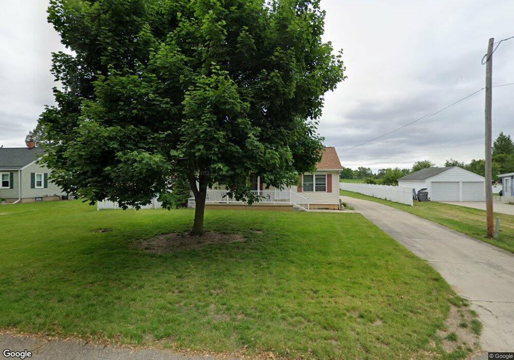
8223 Calvin Rd Battle Creek, MI 49017
Estimated Value: $252,000 - $324,000
--
Bed
2
Baths
1,344
Sq Ft
$223/Sq Ft
Est. Value
About This Home
This home is located at 8223 Calvin Rd, Battle Creek, MI 49017 and is currently estimated at $300,000, approximately $223 per square foot. 8223 Calvin Rd is a home located in Calhoun County with nearby schools including Pennfield Dunlap Elementary School, North Pennfield Elementary School, and Pennfield Middle School.
Ownership History
Date
Name
Owned For
Owner Type
Purchase Details
Closed on
Aug 25, 2015
Sold by
Cochran Roger Louis and Cochran Lynda K
Bought by
Roger L Cochran & Lynda K Cochran Living
Current Estimated Value
Purchase Details
Closed on
May 27, 2004
Sold by
Cochran Lynda K and Revocable Living Trust Agreeme
Bought by
Cochran Roger Louis and Cochran Lynda K
Purchase Details
Closed on
Feb 25, 1999
Sold by
Pluff Robert and Pluff Joan
Bought by
Cochran Roger and Cochran Lynda
Purchase Details
Closed on
Jun 7, 1996
Sold by
Vandlen David and Vandlen Janice
Bought by
Pluff Robert and Pluff Joan
Create a Home Valuation Report for This Property
The Home Valuation Report is an in-depth analysis detailing your home's value as well as a comparison with similar homes in the area
Home Values in the Area
Average Home Value in this Area
Purchase History
| Date | Buyer | Sale Price | Title Company |
|---|---|---|---|
| Roger L Cochran & Lynda K Cochran Living | -- | Attorney | |
| Cochran Roger Louis | -- | -- | |
| Cochran Roger Louis | -- | -- | |
| Cochran Roger | $31,800 | -- | |
| Pluff Robert | $10,000 | -- |
Source: Public Records
Tax History Compared to Growth
Tax History
| Year | Tax Paid | Tax Assessment Tax Assessment Total Assessment is a certain percentage of the fair market value that is determined by local assessors to be the total taxable value of land and additions on the property. | Land | Improvement |
|---|---|---|---|---|
| 2025 | $3,444 | $150,700 | $0 | $0 |
| 2024 | $1,536 | $141,100 | $0 | $0 |
| 2023 | $2,976 | $109,810 | $0 | $0 |
| 2022 | $1,393 | $99,130 | $0 | $0 |
| 2021 | $2,987 | $94,500 | $0 | $0 |
| 2020 | $2,933 | $85,960 | $0 | $0 |
| 2019 | $2,837 | $82,420 | $0 | $0 |
| 2018 | $2,557 | $81,320 | $7,220 | $74,100 |
| 2017 | $0 | $70,210 | $0 | $0 |
| 2016 | $0 | $62,870 | $0 | $0 |
| 2015 | -- | $61,520 | $8,188 | $53,332 |
| 2014 | -- | $61,640 | $8,188 | $53,452 |
Source: Public Records
Map
Nearby Homes
- 114 Wanondoger Cir
- 220 Pennbrook Trail
- 150 Pennbrook Trail
- 21520 Swafford Rd
- V/L East Ave N
- 215 Pony Ave
- 22511 Capital Ave NE
- 6381 Saint Marys Lake Rd
- 22150 East Ave N
- 106 Buckingham
- 19687 East Ave N
- 146 Maplehurst Blvd
- 117 Old Lantern Trail
- 20259 Pine Lake Rd
- 9559 Brian Dr
- 1731 Capital Ave NE
- 8671 Gorsline Rd
- 228 Indian Rd
- 146 Indian Rd
- 20291 Chippewa Trail