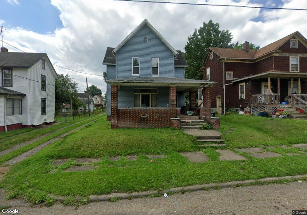
823 E Grant St Alliance, OH 44601
Estimated Value: $83,000 - $133,000
4
Beds
1
Bath
1,760
Sq Ft
$55/Sq Ft
Est. Value
About This Home
This home is located at 823 E Grant St, Alliance, OH 44601 and is currently estimated at $97,376, approximately $55 per square foot. 823 E Grant St is a home located in Stark County with nearby schools including Alliance Elementary School at Rockhill, Alliance Intermediate School at Northside, and Alliance Middle School.
Ownership History
Date
Name
Owned For
Owner Type
Purchase Details
Closed on
Jul 1, 2022
Sold by
Kathy Graham
Bought by
Winters Jamesina
Current Estimated Value
Purchase Details
Closed on
Feb 9, 2017
Sold by
Ramsey Robert P and Ramsey Sandra A
Bought by
Graham Kathy
Purchase Details
Closed on
May 20, 2013
Sold by
Guesman James
Bought by
Ramsey Robert P and Ramsey Sandra A
Purchase Details
Closed on
Jul 2, 2012
Sold by
Ramsey Robert P and Ramsey Sandra A
Bought by
Guesman James
Purchase Details
Closed on
Apr 12, 2012
Sold by
Davis Amber
Bought by
Ramsey Robert P
Purchase Details
Closed on
Dec 2, 2008
Sold by
Wells Fargo Bank Na
Bought by
Davis Jeremy M
Purchase Details
Closed on
Sep 24, 2007
Sold by
Campbell Jimmie L
Bought by
Wells Fargo Bank Na
Purchase Details
Closed on
Jul 26, 1999
Sold by
Ford Allen and Ford Clarie
Bought by
Campbell Jimmie L
Purchase Details
Closed on
Feb 5, 1999
Sold by
Campbell Elizabeth
Bought by
Campbell Jimmie L
Purchase Details
Closed on
Dec 15, 1998
Sold by
Peterson Joyce A
Bought by
Ford Allen and Ford Clarie
Create a Home Valuation Report for This Property
The Home Valuation Report is an in-depth analysis detailing your home's value as well as a comparison with similar homes in the area
Home Values in the Area
Average Home Value in this Area
Purchase History
| Date | Buyer | Sale Price | Title Company |
|---|---|---|---|
| Winters Jamesina | -- | None Listed On Document | |
| Graham Kathy | $6,500 | None Available | |
| Ramsey Robert P | -- | None Available | |
| Guesman James | -- | None Available | |
| Ramsey Robert P | $4,000 | Attorney | |
| Davis Jeremy M | $2,800 | None Available | |
| Wells Fargo Bank Na | $20,000 | None Available | |
| Campbell Jimmie L | $4,500 | -- | |
| Campbell Jimmie L | -- | -- | |
| Ford Allen | -- | -- |
Source: Public Records
Tax History
| Year | Tax Paid | Tax Assessment Tax Assessment Total Assessment is a certain percentage of the fair market value that is determined by local assessors to be the total taxable value of land and additions on the property. | Land | Improvement |
|---|---|---|---|---|
| 2025 | $719 | $8,440 | $3,360 | $5,080 |
| 2024 | $2,599 | $8,440 | $3,360 | $5,080 |
| 2023 | $3,567 | $12,080 | $3,430 | $8,650 |
| 2022 | $712 | $11,340 | $3,430 | $7,910 |
| 2021 | $459 | $11,340 | $3,430 | $7,910 |
| 2020 | $436 | $10,050 | $2,980 | $7,070 |
| 2019 | $430 | $10,050 | $2,980 | $7,070 |
Source: Public Records
Map
Nearby Homes
- 935 S Morgan Ave
- 955 E Summit St
- 452 E Summit St
- 442 S Liberty Ave
- 726 S Arch Ave
- V/L S Freedom Ave
- 1350 S Freedom Ave
- 234 Rosenberry St
- 231 Rosenberry St
- 22862 Norman Ave
- 226 Milner St
- 1522 Wade Ave
- 167 11th St
- 834 Devine St
- 134 11th St
- 46 Rosenberry St
- 233 Shadyside Ct
- 361 E Main St
- 807 S Union Ave
- 62 E High St
- 813 E Grant St
- 835 E Grant St
- 803 E Grant St
- 804 S Webb Ave
- 815 S Morgan Ave
- 805 S Morgan Ave
- 840 S Webb Ave
- 812 E Grant St
- 827 S Morgan Ave
- 818 Garwood St
- 831 S Morgan Ave
- 836 Garwood St
- 757 E Grant St
- 825 S Webb Ave
- 754 S Webb Ave
- 846 Garwood St
- 757 S Morgan Ave
- 806 S Morgan Ave
- 747 E Grant St
- 816 S Morgan Ave
Your Personal Tour Guide
Ask me questions while you tour the home.