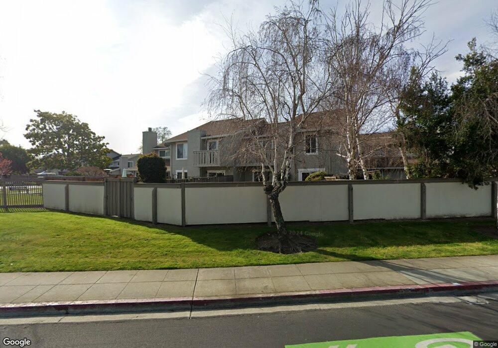
823 Spruance Ln Foster City, CA 94404
Harbor Side NeighborhoodEstimated Value: $1,515,039 - $1,899,000
3
Beds
3
Baths
1,700
Sq Ft
$1,027/Sq Ft
Est. Value
About This Home
This home is located at 823 Spruance Ln, Foster City, CA 94404 and is currently estimated at $1,746,010, approximately $1,027 per square foot. 823 Spruance Ln is a home located in San Mateo County with nearby schools including Foster City Elementary School, Bowditch Middle School, and San Mateo High School.
Ownership History
Date
Name
Owned For
Owner Type
Purchase Details
Closed on
Aug 30, 2018
Sold by
Voorhees Leslie T and Higa Debra
Bought by
Voorhees Leslie T and Higa Debra Sue M
Current Estimated Value
Purchase Details
Closed on
Jan 14, 2002
Sold by
Kempker Leonard B and Kempker Susan M
Bought by
Voorhees Leslie T and Higa Debra
Home Financials for this Owner
Home Financials are based on the most recent Mortgage that was taken out on this home.
Original Mortgage
$569,000
Outstanding Balance
$229,209
Interest Rate
6.84%
Mortgage Type
Stand Alone First
Estimated Equity
$1,516,801
Create a Home Valuation Report for This Property
The Home Valuation Report is an in-depth analysis detailing your home's value as well as a comparison with similar homes in the area
Home Values in the Area
Average Home Value in this Area
Purchase History
| Date | Buyer | Sale Price | Title Company |
|---|---|---|---|
| Voorhees Leslie T | -- | None Available | |
| Voorhees Leslie T | $569,000 | First American Title Co |
Source: Public Records
Mortgage History
| Date | Status | Borrower | Loan Amount |
|---|---|---|---|
| Open | Voorhees Leslie T | $569,000 | |
| Closed | Voorhees Leslie T | $33,800 |
Source: Public Records
Tax History Compared to Growth
Tax History
| Year | Tax Paid | Tax Assessment Tax Assessment Total Assessment is a certain percentage of the fair market value that is determined by local assessors to be the total taxable value of land and additions on the property. | Land | Improvement |
|---|---|---|---|---|
| 2025 | $9,437 | $840,560 | $420,280 | $420,280 |
| 2023 | $9,437 | $807,922 | $403,961 | $403,961 |
| 2022 | $9,130 | $792,082 | $396,041 | $396,041 |
| 2021 | $9,019 | $776,552 | $388,276 | $388,276 |
| 2020 | $8,769 | $768,590 | $384,295 | $384,295 |
| 2019 | $8,378 | $753,520 | $376,760 | $376,760 |
| 2018 | $8,154 | $738,746 | $369,373 | $369,373 |
| 2017 | $8,063 | $724,262 | $362,131 | $362,131 |
| 2016 | $7,891 | $710,062 | $355,031 | $355,031 |
| 2015 | $8,013 | $699,398 | $349,699 | $349,699 |
| 2014 | $7,809 | $685,698 | $342,849 | $342,849 |
Source: Public Records
Map
Nearby Homes
- 1041 Shell Blvd Unit 8
- 1017 Shell Blvd Unit 12
- 1102 Burke Ln
- 971 Marquette Ln
- 986 Cartier Ln
- 910 Beach Park Blvd Unit 106
- 851 Peary Ln
- 822 Magellan Ln
- 851 Cabot Ln
- 803 Peary Ln
- 825 Cortez Ln
- 707 Santa Cruz Ln
- 619 Mystic Ln
- 1024 Rudder Ln
- 879 Carina Ln
- 1018 Lido Ln
- 1171 Compass Ln Unit 211
- 1131 Compass Ln Unit 108
- 801 Ram Ln
- 803 Balboa Ln
- 825 Spruance Ln
- 821 Spruance Ln
- 827 Spruance Ln
- 829 Spruance Ln
- 1107 Forrestal Ln
- 831 Spruance Ln
- 1105 Forrestal Ln
- 1115 Forrestal Ln
- 1108 Forrestal Ln
- 833 Spruance Ln
- 1103 Forrestal Ln Unit 4
- 1110 Forrestal Ln
- 1112 Forrestal Ln
- 835 Spruance Ln
- 1114 Forrestal Ln
- 1101 Forrestal Ln
- 1119 Forrestal Ln
- 1116 Forrestal Ln
- 837 Spruance Ln