Estimated Value: $343,000 - $413,000
Studio
2
Baths
1,930
Sq Ft
$198/Sq Ft
Est. Value
About This Home
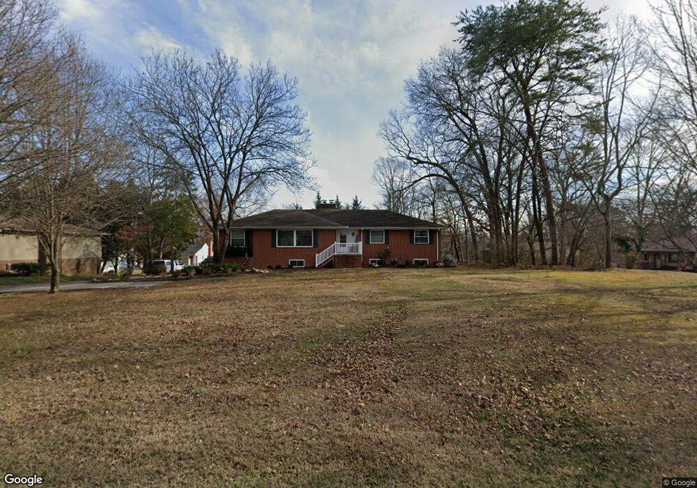
This home is located at 824 E Hunt Rd, Alcoa, TN 37701 and is currently estimated at $382,967, approximately $198 per square foot. 824 E Hunt Rd is a home located in Blount County with nearby schools including Alcoa Elementary School, Alcoa Middle School, and Alcoa High School.
Ownership History
Date
Name
Owned For
Owner Type
Purchase Details
Closed on
May 31, 2017
Sold by
Cooper Robert Mack
Bought by
Garner Cynthia R and Waller Edward L
Current Estimated Value
Purchase Details
Closed on
Aug 17, 2004
Sold by
Mills David
Bought by
Cooper Mary K
Home Financials for this Owner
Home Financials are based on the most recent Mortgage that was taken out on this home.
Original Mortgage
$92,000
Interest Rate
5.38%
Purchase Details
Closed on
Aug 13, 2004
Bought by
Cooper Robert Mack and Cooper Mary
Home Financials for this Owner
Home Financials are based on the most recent Mortgage that was taken out on this home.
Original Mortgage
$92,000
Interest Rate
5.38%
Purchase Details
Closed on
Dec 19, 1986
Bought by
Mills Edith E
Create a Home Valuation Report for This Property
The Home Valuation Report is an in-depth analysis detailing your home's value as well as a comparison with similar homes in the area
Home Values in the Area
Average Home Value in this Area
Purchase History
| Date | Buyer | Sale Price | Title Company |
|---|---|---|---|
| Garner Cynthia R | -- | -- | |
| Cooper Mary K | $115,000 | -- | |
| Cooper Robert Mack | $115,000 | -- | |
| Mills Edith E | -- | -- |
Source: Public Records
Mortgage History
| Date | Status | Borrower | Loan Amount |
|---|---|---|---|
| Previous Owner | Mills Edith E | $92,000 | |
| Previous Owner | Mills Edith E | $92,000 |
Source: Public Records
Tax History
| Year | Tax Paid | Tax Assessment Tax Assessment Total Assessment is a certain percentage of the fair market value that is determined by local assessors to be the total taxable value of land and additions on the property. | Land | Improvement |
|---|---|---|---|---|
| 2025 | -- | $93,250 | $13,500 | $79,750 |
| 2024 | -- | $90,525 | $13,500 | $77,025 |
| 2023 | $2,969 | $90,525 | $13,500 | $77,025 |
| 2022 | $2,229 | $47,025 | $8,750 | $38,275 |
| 2021 | $2,229 | $47,025 | $8,750 | $38,275 |
| 2020 | $2,229 | $47,025 | $8,750 | $38,275 |
| 2019 | $2,229 | $47,025 | $8,750 | $38,275 |
| 2018 | $1,955 | $44,125 | $7,500 | $36,625 |
| 2017 | $1,955 | $44,125 | $7,500 | $36,625 |
| 2016 | $1,955 | $44,125 | $7,500 | $36,625 |
| 2015 | $1,814 | $44,125 | $7,500 | $36,625 |
| 2014 | $1,828 | $44,125 | $7,500 | $36,625 |
| 2013 | $1,828 | $44,475 | $0 | $0 |
Source: Public Records
Map
Nearby Homes
- 1741 N Wright Rd
- 1539 Boyle St
- 1631 Springbrook Rd
- 1450 Dalton St
- 1413 Perkins St
- 1372 Remsen St
- 1362 Dalton St
- 1321 Nobel St Unit E
- 1119 Cherry St
- 1240 N Wright Rd
- 971 Maple St
- 0 N Wright Rd
- 922 Poplar St
- 966 Poplar St
- 1826 Peppertree Dr
- 1538 Tsuga Dr
- 1421 Edenbridge Dr
- 2405 Huckleberry Dr
- 2620 Marshall St
- 2638 Orton Dr
Your Personal Tour Guide
Ask me questions while you tour the home.