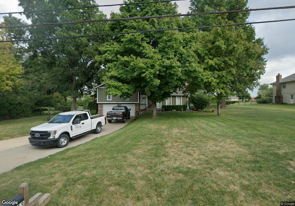
8243 Gleason Rd Lenexa, KS 66227
Estimated Value: $387,000 - $409,000
3
Beds
2
Baths
1,400
Sq Ft
$283/Sq Ft
Est. Value
About This Home
This home is located at 8243 Gleason Rd, Lenexa, KS 66227 and is currently estimated at $396,276, approximately $283 per square foot. 8243 Gleason Rd is a home located in Johnson County with nearby schools including Mize Elementary School, Mill Creek Middle School, and De Soto High School.
Ownership History
Date
Name
Owned For
Owner Type
Purchase Details
Closed on
May 21, 2003
Sold by
Parker Susan W
Bought by
Carlson Jeffrey L and Carlson Jan L
Current Estimated Value
Home Financials for this Owner
Home Financials are based on the most recent Mortgage that was taken out on this home.
Original Mortgage
$128,800
Outstanding Balance
$55,775
Interest Rate
5.74%
Mortgage Type
Purchase Money Mortgage
Estimated Equity
$340,501
Create a Home Valuation Report for This Property
The Home Valuation Report is an in-depth analysis detailing your home's value as well as a comparison with similar homes in the area
Home Values in the Area
Average Home Value in this Area
Purchase History
| Date | Buyer | Sale Price | Title Company |
|---|---|---|---|
| Carlson Jeffrey L | -- | Chicago Title Insurance Co |
Source: Public Records
Mortgage History
| Date | Status | Borrower | Loan Amount |
|---|---|---|---|
| Open | Carlson Jeffrey L | $128,800 | |
| Closed | Carlson Jeffrey L | $32,200 |
Source: Public Records
Tax History Compared to Growth
Tax History
| Year | Tax Paid | Tax Assessment Tax Assessment Total Assessment is a certain percentage of the fair market value that is determined by local assessors to be the total taxable value of land and additions on the property. | Land | Improvement |
|---|---|---|---|---|
| 2024 | $4,326 | $35,960 | $6,425 | $29,535 |
| 2023 | $4,135 | $33,649 | $5,592 | $28,057 |
| 2022 | $3,734 | $29,842 | $5,592 | $24,250 |
| 2021 | $3,350 | $25,829 | $5,327 | $20,502 |
| 2020 | $3,289 | $25,196 | $4,631 | $20,565 |
| 2019 | $3,121 | $23,552 | $3,844 | $19,708 |
| 2018 | $2,971 | $22,103 | $3,844 | $18,259 |
| 2017 | $3,070 | $21,999 | $3,844 | $18,155 |
| 2016 | $3,007 | $21,286 | $3,844 | $17,442 |
| 2015 | $3,069 | $20,895 | $3,844 | $17,051 |
| 2013 | -- | $18,906 | $3,844 | $15,062 |
Source: Public Records
Map
Nearby Homes
- 8265 Gleason Rd
- 22921 W 72nd Terrace
- 7505 Mccormick Dr
- 23718 W 88th Terrace
- 8978 Shady Bend Rd
- 8901 Shady Bend Rd
- 8973 Shady Bend Rd
- 8972 Shady Bend Rd
- 7822 Houston St
- 8843 Quill St
- 8444 Shady Bend Rd
- 8925 Inkster
- 24976 W 87th St
- 9280 Barth Rd
- 23435 W 89th Terrace
- 22698 W 87th St
- 8523 Pickering St
- 25371 W 84th St
- 3.5 acres near Gander & 91st Terrace
- 8520 Pickering St
- 8221 Gleason Rd
- 8218 Gleason Rd
- 8219 Gleason Rd
- 8206 Gleason Rd
- 8230 Gleason Rd
- 23760 W 82nd Terrace
- 8194 Gleason Rd
- 8187 Gleason Rd
- 23939 W 82nd Ct
- 23945 W 82nd Ct
- 23950 W 83rd St
- 8170 Gleason Rd
- 8165 Gleason Rd
- 24040 W 83rd St
- 23840 W 81st Terrace
- 24090 W 83rd St
- 8302 Lewis Dr
- 8308 Lewis Dr
- 8120 Gleason Rd
- 8233 Barth Rd