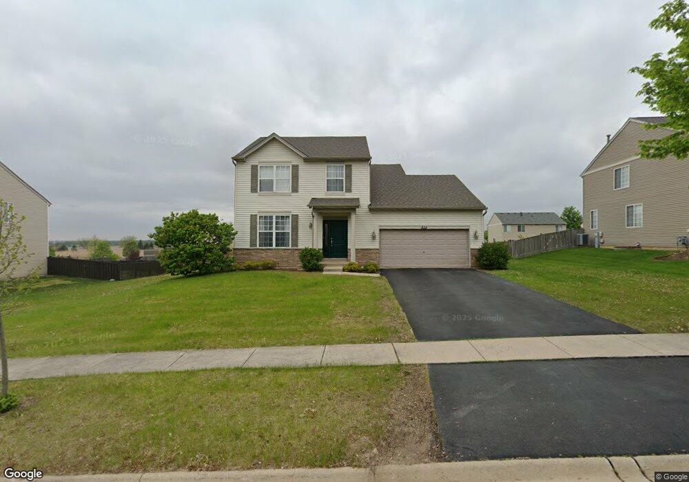
825 Briarcliff Dr Minooka, IL 60447
North Minooka NeighborhoodEstimated Value: $341,099 - $378,000
4
Beds
3
Baths
2,254
Sq Ft
$160/Sq Ft
Est. Value
About This Home
This home is located at 825 Briarcliff Dr, Minooka, IL 60447 and is currently estimated at $360,775, approximately $160 per square foot. 825 Briarcliff Dr is a home located in Kendall County with nearby schools including Jones Elementary School, Minooka Junior High School, and Minooka Intermediate School.
Ownership History
Date
Name
Owned For
Owner Type
Purchase Details
Closed on
Nov 20, 2006
Sold by
Summerfield Venture Llc
Bought by
Ott Ryan M and Ott Amy L
Current Estimated Value
Home Financials for this Owner
Home Financials are based on the most recent Mortgage that was taken out on this home.
Original Mortgage
$36,885
Interest Rate
6.15%
Mortgage Type
Stand Alone Second
Create a Home Valuation Report for This Property
The Home Valuation Report is an in-depth analysis detailing your home's value as well as a comparison with similar homes in the area
Home Values in the Area
Average Home Value in this Area
Purchase History
| Date | Buyer | Sale Price | Title Company |
|---|---|---|---|
| Ott Ryan M | $246,000 | North American Title Co |
Source: Public Records
Mortgage History
| Date | Status | Borrower | Loan Amount |
|---|---|---|---|
| Closed | Ott Ryan M | $36,885 | |
| Open | Ott Ryan M | $196,700 |
Source: Public Records
Tax History Compared to Growth
Tax History
| Year | Tax Paid | Tax Assessment Tax Assessment Total Assessment is a certain percentage of the fair market value that is determined by local assessors to be the total taxable value of land and additions on the property. | Land | Improvement |
|---|---|---|---|---|
| 2024 | $8,341 | $106,304 | $15,425 | $90,879 |
| 2023 | $6,618 | $97,216 | $14,690 | $82,526 |
| 2022 | $6,618 | $83,841 | $13,990 | $69,851 |
| 2021 | $6,485 | $80,134 | $14,203 | $65,931 |
| 2020 | $6,423 | $76,539 | $13,566 | $62,973 |
| 2019 | $6,469 | $75,141 | $13,318 | $61,823 |
| 2018 | $6,249 | $73,501 | $13,027 | $60,474 |
| 2017 | $6,129 | $69,240 | $13,027 | $56,213 |
| 2016 | $5,701 | $64,339 | $12,866 | $51,473 |
| 2015 | $5,426 | $61,060 | $12,210 | $48,850 |
| 2014 | -- | $64,619 | $12,210 | $52,409 |
| 2013 | -- | $64,619 | $12,210 | $52,409 |
Source: Public Records
Map
Nearby Homes
- 814 Daniel Dr
- 1419 Kettleson Dr
- 844 Daniel Dr
- 603 Briarcliff Dr
- 2041 Isabella Ln
- 2033 Isabella
- 194 acres W Holt Rd
- Lot 1 Minooka Ridge & Jones Rd
- LOT 1 Bob Blair Rd
- 103 E Coady Dr
- 201 W Church St
- 308 Wabasso Place
- 405 W Mondamin St
- 1133 Coneflower Ct
- 401 Feeney Dr
- 101 Fieldcrest Ct
- 504 Flanagan Dr Unit A
- 107 Sibley Dr
- LOT 28 O Toole Dr
- 817 Casey Dr
- 829 Briarcliff Dr
- 821 Briarcliff Dr
- 833 Briarcliff Dr
- 733 Avalon Way
- 824 Briarcliff Dr
- 737 Avalon Way
- 817 Briarcliff Dr
- 828 Briarcliff Dr
- 729 Avalon Way
- 820 Briarcliff Dr
- 832 Briarcliff Dr Unit 1
- 837 Briarcliff Dr
- 725 Avalon Way
- 741 Avalon Way
- 813 Briarcliff Dr
- 816 Briarcliff Dr
- 836 Briarcliff Dr
- 701 Gallant Dr
- 721 Avalon Way
- 635 Gallant Dr