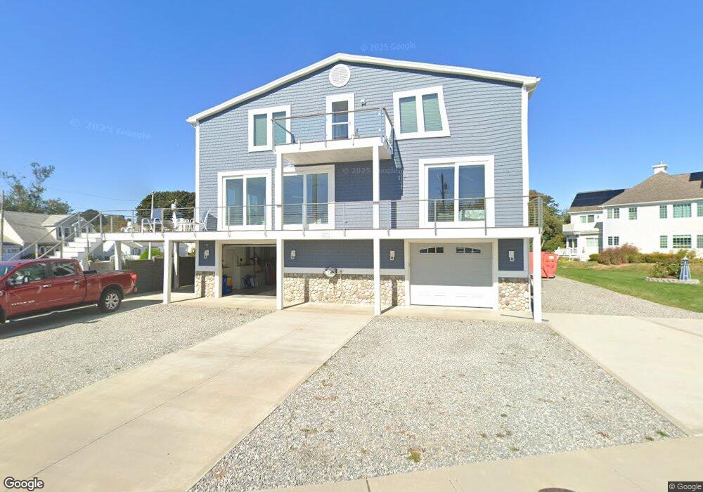
825 Pequot Ave New London, CT 06320
South New London NeighborhoodEstimated Value: $963,000 - $1,311,897
3
Beds
3
Baths
3,307
Sq Ft
$353/Sq Ft
Est. Value
About This Home
This home is located at 825 Pequot Ave, New London, CT 06320 and is currently estimated at $1,165,724, approximately $352 per square foot. 825 Pequot Ave is a home with nearby schools including Harbor Elementary School, Bennie Dover Jackson Middle School, and New London High School.
Ownership History
Date
Name
Owned For
Owner Type
Purchase Details
Closed on
Dec 24, 2020
Sold by
3 Nuts & A Squirrel Llc
Bought by
Edward F Bartelli Ret
Current Estimated Value
Purchase Details
Closed on
Dec 22, 2018
Sold by
Bartelli Edward
Bought by
3 Nnutsand A Squirrel Llc
Purchase Details
Closed on
May 18, 2015
Sold by
Roland Edwin J and Roland Mary B
Bought by
Bartelli Edward
Create a Home Valuation Report for This Property
The Home Valuation Report is an in-depth analysis detailing your home's value as well as a comparison with similar homes in the area
Home Values in the Area
Average Home Value in this Area
Purchase History
| Date | Buyer | Sale Price | Title Company |
|---|---|---|---|
| Edward F Bartelli Ret | -- | None Available | |
| Edward F Bartelli Ret | -- | None Available | |
| 3 Nnutsand A Squirrel Llc | -- | -- | |
| 3 Nnutsand A Squirrel Llc | -- | -- | |
| Bartelli Edward | $235,000 | -- | |
| Bartelli Edward | $235,000 | -- |
Source: Public Records
Tax History Compared to Growth
Tax History
| Year | Tax Paid | Tax Assessment Tax Assessment Total Assessment is a certain percentage of the fair market value that is determined by local assessors to be the total taxable value of land and additions on the property. | Land | Improvement |
|---|---|---|---|---|
| 2025 | $18,874 | $693,900 | $276,800 | $417,100 |
| 2024 | $19,082 | $693,900 | $276,800 | $417,100 |
| 2023 | $14,997 | $402,710 | $203,910 | $198,800 |
| 2022 | $15,025 | $402,710 | $203,910 | $198,800 |
| 2021 | $15,283 | $402,710 | $203,910 | $198,800 |
| 2020 | $15,379 | $402,710 | $203,910 | $198,800 |
| 2019 | $16,914 | $423,920 | $203,910 | $220,010 |
| 2018 | $2,720 | $413,070 | $189,350 | $223,720 |
| 2017 | $2,504 | $304,990 | $189,350 | $115,640 |
| 2016 | $7,944 | $196,350 | $189,350 | $7,000 |
| 2015 | $7,477 | $189,350 | $189,350 | $0 |
| 2014 | -- | $189,350 | $189,350 | $0 |
Source: Public Records
Map
Nearby Homes
- 925 Pequot Ave
- 17 Henderson Rd
- 11 Glenwood Park S
- 993 Pequot Ave
- 597 Pequot Ave
- 1092 Ocean Ave
- 899 Ocean Ave
- 845 Ocean Ave
- 1176 Ocean Ave
- 14 Park St
- 41 Stuart Ave
- 41 Niles Hill Rd
- 12 Greenfield St
- 4 Ridgewood Ave
- 107 Niles Hill Rd Unit A
- 2 Forest St
- 57 Westridge Rd Unit B2
- 142 Plant St
- 2 Maginnis Pkwy
- 19 Dart St
- 801 Pequot Ave
- 787 Pequot Ave
- 800 Pequot Ave
- 777 Pequot Ave
- 70 Admiral Dr
- 807 Pequot Ave
- 815 Pequot Ave
- 62 Admiral Dr
- 810 Pequot Ave
- 76 Admiral Dr
- 771 Pequot Ave
- 770 Pequot Ave
- 821 Pequot Ave
- 824 Pequot Ave
- 56 Admiral Dr
- 75 Admiral Dr
- 843 Pequot Ave
- 843 Pequot Ave Unit 1
- 80 Admiral Dr
- 764 Pequot Ave