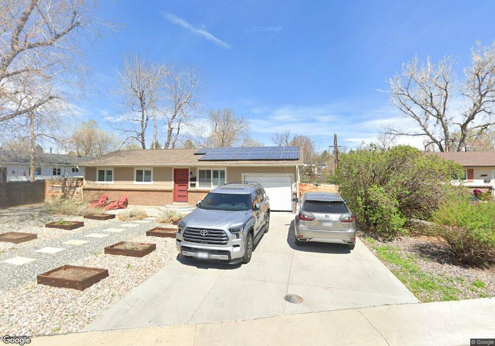
8265 Brooks Dr Arvada, CO 80004
Alta Vista NeighborhoodEstimated Value: $542,000 - $568,000
3
Beds
1
Bath
1,176
Sq Ft
$473/Sq Ft
Est. Value
About This Home
This home is located at 8265 Brooks Dr, Arvada, CO 80004 and is currently estimated at $556,598, approximately $473 per square foot. 8265 Brooks Dr is a home located in Jefferson County with nearby schools including Lawrence Elementary School, North Arvada Middle School, and Arvada High School.
Ownership History
Date
Name
Owned For
Owner Type
Purchase Details
Closed on
Aug 9, 2019
Sold by
Perry Mae Marie and Blevins Lisa
Bought by
Schaller Tyler J
Current Estimated Value
Home Financials for this Owner
Home Financials are based on the most recent Mortgage that was taken out on this home.
Original Mortgage
$373,500
Outstanding Balance
$327,117
Interest Rate
3.7%
Mortgage Type
New Conventional
Estimated Equity
$229,481
Purchase Details
Closed on
Apr 24, 2001
Sold by
Marie Perry Mae
Bought by
Perry Mae Marie and Blevins Lisa
Home Financials for this Owner
Home Financials are based on the most recent Mortgage that was taken out on this home.
Original Mortgage
$140,250
Interest Rate
10.75%
Purchase Details
Closed on
Dec 22, 1995
Sold by
Perry Matthew R and Perry Hazel E
Bought by
Perry Mae Marie
Home Financials for this Owner
Home Financials are based on the most recent Mortgage that was taken out on this home.
Original Mortgage
$74,724
Interest Rate
7.33%
Mortgage Type
FHA
Create a Home Valuation Report for This Property
The Home Valuation Report is an in-depth analysis detailing your home's value as well as a comparison with similar homes in the area
Home Values in the Area
Average Home Value in this Area
Purchase History
| Date | Buyer | Sale Price | Title Company |
|---|---|---|---|
| Schaller Tyler J | $415,000 | First American Title | |
| Perry Mae Marie | -- | -- | |
| Perry Mae Marie | $75,000 | First American |
Source: Public Records
Mortgage History
| Date | Status | Borrower | Loan Amount |
|---|---|---|---|
| Open | Schaller Tyler J | $373,500 | |
| Previous Owner | Perry Mae Marie | $140,250 | |
| Previous Owner | Perry Mae Marie | $74,724 |
Source: Public Records
Tax History
| Year | Tax Paid | Tax Assessment Tax Assessment Total Assessment is a certain percentage of the fair market value that is determined by local assessors to be the total taxable value of land and additions on the property. | Land | Improvement |
|---|---|---|---|---|
| 2024 | $3,115 | $32,112 | $16,201 | $15,911 |
| 2023 | $3,115 | $32,112 | $16,201 | $15,911 |
| 2022 | $2,520 | $25,737 | $11,988 | $13,749 |
| 2021 | $2,562 | $26,477 | $12,333 | $14,144 |
| 2020 | $2,185 | $22,639 | $9,606 | $13,033 |
| 2019 | $2,155 | $22,639 | $9,606 | $13,033 |
| 2018 | $2,046 | $20,893 | $6,434 | $14,459 |
| 2017 | $1,873 | $20,893 | $6,434 | $14,459 |
| 2016 | $1,524 | $16,014 | $5,539 | $10,475 |
| 2015 | $1,265 | $16,014 | $5,539 | $10,475 |
| 2014 | $1,265 | $12,498 | $4,872 | $7,626 |
Source: Public Records
Map
Nearby Homes
- 8243 Brooks Dr
- 8202 W 59th Ave
- 6150 Carr St
- 6164 Brentwood St
- 6176 Ammons St
- 6007 Yarrow St Unit D
- 6021 Yarrow St Unit B11
- 8520 W 59th Ave
- 8410 Alta Vista Dr
- 6175 Dover St
- 7705 W 61st Ave
- 0000S Balsam St Unit 1
- 0000N Balsam St Unit 1
- 8233 W 62nd Place
- 7963 W 62nd Way
- 5600 Dover St
- 7605 W 62nd Ave
- 8370 W 64th Ave
- 7313 W 60th Ave
- 8940 Cole Dr
- 6020 Brentwood St
- 6030 Brentwood St
- 6040 Brentwood St
- 6023 Balsam St
- 6033 Balsam St
- 5921 Balsam Place
- 6050 Brentwood St
- 5931 Balsam Place
- 8305 Brooks Dr
- 6025 Brentwood St
- 6043 Balsam St
- 6035 Brentwood St
- 5911 Balsam Place
- 6062 Brentwood St
- 8305 W 59th Ave
- 6045 Brentwood St
- 6053 Balsam St
- 6038 Balsam St
- 8315 W 59th Ave
- 8201 W 59th Ave
Your Personal Tour Guide
Ask me questions while you tour the home.