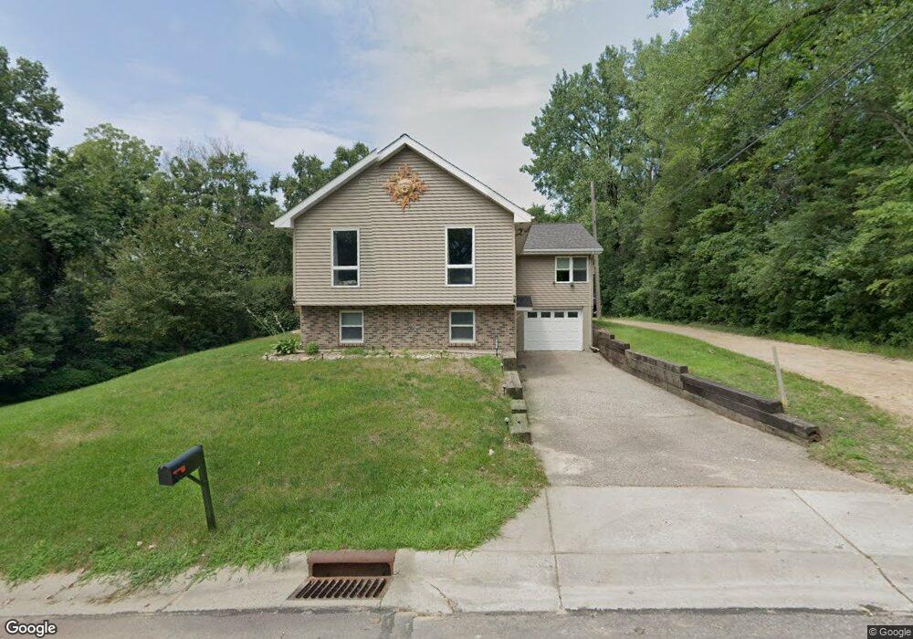
827 Clinton St Waterville, MN 56096
Estimated Value: $235,000 - $299,000
4
Beds
1
Bath
2,160
Sq Ft
$125/Sq Ft
Est. Value
About This Home
This home is located at 827 Clinton St, Waterville, MN 56096 and is currently estimated at $270,168, approximately $125 per square foot. 827 Clinton St is a home located in Le Sueur County with nearby schools including Waterville Elementary School, Morristown Elementary School, and Waterville-Elysian-Morristown Junior High School.
Ownership History
Date
Name
Owned For
Owner Type
Purchase Details
Closed on
Aug 23, 2019
Sold by
Delaske Tamara A
Bought by
Lemcke Daniel
Current Estimated Value
Home Financials for this Owner
Home Financials are based on the most recent Mortgage that was taken out on this home.
Original Mortgage
$220,924
Outstanding Balance
$196,984
Interest Rate
4.62%
Mortgage Type
FHA
Estimated Equity
$73,184
Create a Home Valuation Report for This Property
The Home Valuation Report is an in-depth analysis detailing your home's value as well as a comparison with similar homes in the area
Home Values in the Area
Average Home Value in this Area
Purchase History
| Date | Buyer | Sale Price | Title Company |
|---|---|---|---|
| Lemcke Daniel | $225,000 | Titlesmart Inc |
Source: Public Records
Mortgage History
| Date | Status | Borrower | Loan Amount |
|---|---|---|---|
| Open | Lemcke Daniel | $220,924 |
Source: Public Records
Tax History Compared to Growth
Tax History
| Year | Tax Paid | Tax Assessment Tax Assessment Total Assessment is a certain percentage of the fair market value that is determined by local assessors to be the total taxable value of land and additions on the property. | Land | Improvement |
|---|---|---|---|---|
| 2025 | $3,084 | $246,100 | $48,000 | $198,100 |
| 2024 | $2,840 | $243,000 | $48,000 | $195,000 |
| 2023 | $2,736 | $230,400 | $40,000 | $190,400 |
| 2022 | $2,560 | $219,600 | $40,000 | $179,600 |
| 2021 | $2,306 | $173,200 | $40,000 | $133,200 |
| 2020 | $2,188 | $152,200 | $37,000 | $115,200 |
| 2019 | $1,716 | $131,700 | $33,887 | $97,813 |
| 2018 | $1,701 | $98,000 | $27,639 | $70,361 |
| 2017 | $1,517 | $94,300 | $27,345 | $66,955 |
| 2016 | $3,176 | $85,700 | $26,591 | $59,109 |
| 2015 | $1,382 | $81,700 | $26,210 | $55,490 |
| 2014 | $1,246 | $81,700 | $26,210 | $55,490 |
| 2013 | $1,316 | $86,400 | $26,667 | $59,733 |
Source: Public Records
Map
Nearby Homes
- 124 4th St S
- 124 124 S 4th St
- 212 212 S 2nd St
- 212 2nd St S
- 130 1st St N
- 314 314 S Buchannon St
- 314 Buchannon St S
- 617 1st St N
- 705 1st St N
- 709 1st St N
- 730 1st St N
- XXXX Southridge Ln
- 902 Marion St
- 921 Lillian St
- 921 921 Lillian
- 624 Tetonka View Dr
- 114 114 S Reed
- 13262 Sakatah Lake Rd
- 11698 Morristown Blvd
- 48004 State Highway 13
- 815 Clinton St
- 805 805 Clinton St
- 805 Clinton St
- 828 Clinton St
- 904 Fremont St E
- 526 Silver St
- 807 807 N Fremont St
- 807 807 Fremont St E
- 804 Fremont St E
- 809 Freemont St E
- 529 Silver St
- 801 Fremont St E
- 807 Freemont St E
- 801 Freemont St E
- 526 Hamilton St S
- 530 530 Silver St
- 725 Clinton St
- 427 Division St
- 427 427 S Division St
- 530 Silver St