Estimated Value: $410,990 - $439,000
3
Beds
3
Baths
1,313
Sq Ft
$326/Sq Ft
Est. Value
About This Home
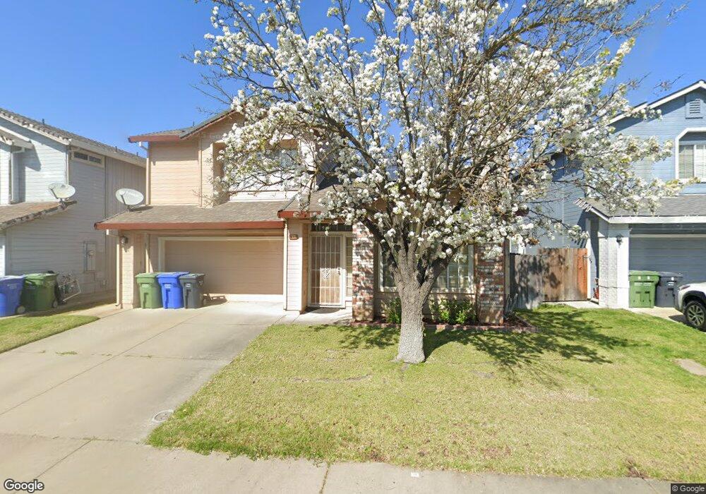
This home is located at 827 Lyonia Dr, Galt, CA 95632 and is currently estimated at $427,998, approximately $325 per square foot. 827 Lyonia Dr is a home located in Sacramento County with nearby schools including River Oaks Elementary School, Robert L. McCaffrey Middle School, and Galt High School.
Ownership History
Date
Name
Owned For
Owner Type
Purchase Details
Closed on
Dec 29, 1998
Sold by
Hatfield Thomas E and Hatfield Cherie E
Bought by
Line Larry T
Current Estimated Value
Home Financials for this Owner
Home Financials are based on the most recent Mortgage that was taken out on this home.
Original Mortgage
$102,212
Outstanding Balance
$23,830
Interest Rate
6.82%
Mortgage Type
FHA
Estimated Equity
$404,168
Create a Home Valuation Report for This Property
The Home Valuation Report is an in-depth analysis detailing your home's value as well as a comparison with similar homes in the area
Home Values in the Area
Average Home Value in this Area
Purchase History
| Date | Buyer | Sale Price | Title Company |
|---|---|---|---|
| Line Larry T | $103,500 | First American Title Ins Co |
Source: Public Records
Mortgage History
| Date | Status | Borrower | Loan Amount |
|---|---|---|---|
| Open | Line Larry T | $102,212 | |
| Closed | Line Larry T | $5,110 |
Source: Public Records
Tax History
| Year | Tax Paid | Tax Assessment Tax Assessment Total Assessment is a certain percentage of the fair market value that is determined by local assessors to be the total taxable value of land and additions on the property. | Land | Improvement |
|---|---|---|---|---|
| 2025 | $1,940 | $167,102 | $39,180 | $127,922 |
| 2024 | $1,940 | $163,826 | $38,412 | $125,414 |
| 2023 | $1,909 | $160,614 | $37,659 | $122,955 |
| 2022 | $2,137 | $157,466 | $36,921 | $120,545 |
| 2021 | $2,139 | $154,380 | $36,198 | $118,182 |
| 2020 | $2,097 | $150,323 | $35,827 | $114,496 |
| 2019 | $2,055 | $147,376 | $35,125 | $112,251 |
| 2018 | $2,052 | $144,487 | $34,437 | $110,050 |
| 2017 | $1,987 | $141,655 | $33,762 | $107,893 |
| 2016 | $1,925 | $138,878 | $33,100 | $105,778 |
| 2015 | $1,873 | $136,793 | $32,603 | $104,190 |
| 2014 | $1,869 | $134,115 | $31,965 | $102,150 |
Source: Public Records
Map
Nearby Homes
- 974 Lyonia Dr
- 712 Parkridge Dr
- 820 N Lincoln Way Unit 42
- 820 N Lincoln Way Unit 104
- 820 N Lincoln Way Unit 7
- 605 Pringle Ave Unit 22
- 604 Pringle Ave Unit 94
- 604 Pringle Ave Unit 1
- 854 Pecan Tree Ln
- 856 Pecan Tree Ln
- 851 Pecan Tree Ln
- 855 Pecan Tree Ln
- 859 Pecan Tree Ln
- 863 Pecan Tree Ln
- 981 Vintage Oak Ave
- 552 Denier Ct
- 973 Stenton Way
- 829 Grizzly Mesa Ct
- 709 Prairie Ct
- 981 Lanigan Ct
Your Personal Tour Guide
Ask me questions while you tour the home.