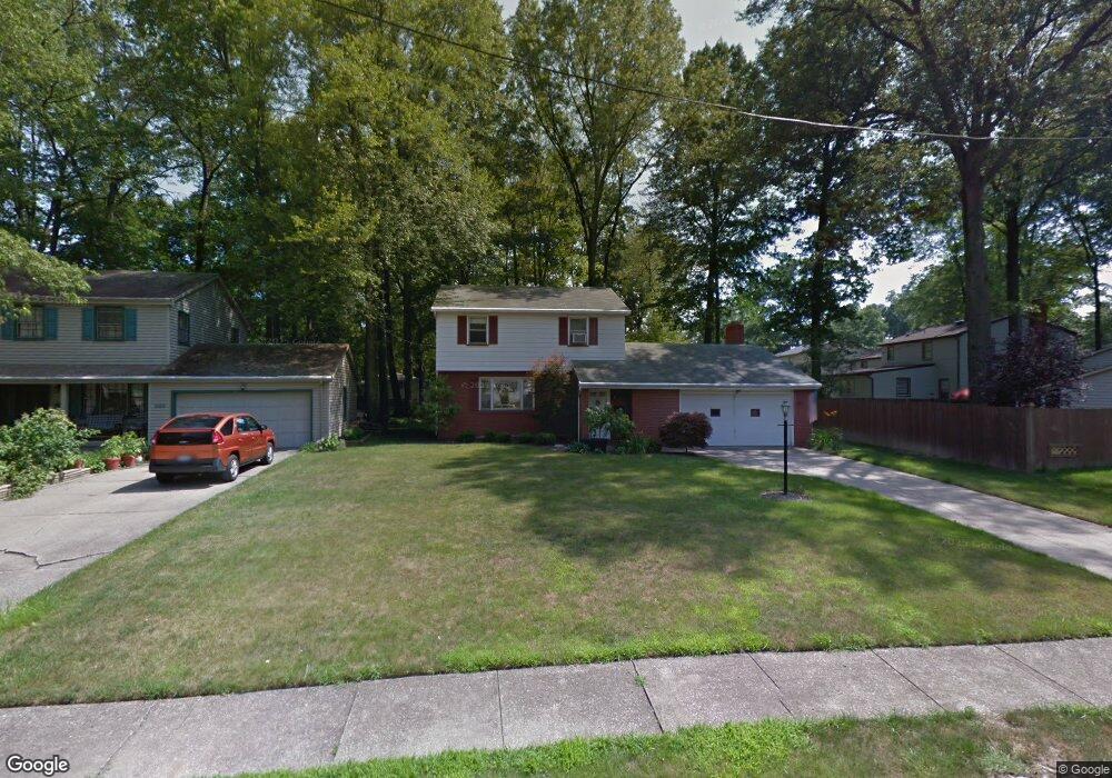
827 Maple Ridge Dr Youngstown, OH 44512
Estimated Value: $189,000 - $233,000
3
Beds
2
Baths
1,680
Sq Ft
$128/Sq Ft
Est. Value
About This Home
This home is located at 827 Maple Ridge Dr, Youngstown, OH 44512 and is currently estimated at $214,789, approximately $127 per square foot. 827 Maple Ridge Dr is a home located in Mahoning County with nearby schools including Robinwood Lane Elementary School, Boardman Glenwood Junior High School, and Boardman High School.
Ownership History
Date
Name
Owned For
Owner Type
Purchase Details
Closed on
Jul 2, 2007
Sold by
Little Linda Sue Sterling and Sterling June L
Bought by
Austin Jeffrey P and Austin Carmela M
Current Estimated Value
Home Financials for this Owner
Home Financials are based on the most recent Mortgage that was taken out on this home.
Original Mortgage
$94,500
Outstanding Balance
$58,663
Interest Rate
6.37%
Mortgage Type
Purchase Money Mortgage
Estimated Equity
$156,126
Purchase Details
Closed on
Mar 2, 1962
Bought by
Sterling John R and J L
Create a Home Valuation Report for This Property
The Home Valuation Report is an in-depth analysis detailing your home's value as well as a comparison with similar homes in the area
Home Values in the Area
Average Home Value in this Area
Purchase History
| Date | Buyer | Sale Price | Title Company |
|---|---|---|---|
| Austin Jeffrey P | $105,000 | Attorney | |
| Sterling John R | -- | -- |
Source: Public Records
Mortgage History
| Date | Status | Borrower | Loan Amount |
|---|---|---|---|
| Open | Austin Jeffrey P | $94,500 |
Source: Public Records
Tax History Compared to Growth
Tax History
| Year | Tax Paid | Tax Assessment Tax Assessment Total Assessment is a certain percentage of the fair market value that is determined by local assessors to be the total taxable value of land and additions on the property. | Land | Improvement |
|---|---|---|---|---|
| 2024 | $2,838 | $55,540 | $7,640 | $47,900 |
| 2023 | $2,800 | $55,540 | $7,640 | $47,900 |
| 2022 | $2,273 | $34,330 | $6,210 | $28,120 |
| 2021 | $2,275 | $34,330 | $6,210 | $28,120 |
| 2020 | $2,286 | $34,330 | $6,210 | $28,120 |
| 2019 | $2,238 | $29,590 | $5,350 | $24,240 |
| 2018 | $1,921 | $29,590 | $5,350 | $24,240 |
| 2017 | $1,896 | $29,590 | $5,350 | $24,240 |
| 2016 | $2,060 | $31,880 | $5,350 | $26,530 |
| 2015 | $2,020 | $31,880 | $5,350 | $26,530 |
| 2014 | $2,025 | $31,880 | $5,350 | $26,530 |
| 2013 | $2,000 | $31,880 | $5,350 | $26,530 |
Source: Public Records
Map
Nearby Homes
- 6229 Appleridge Dr
- 857 Maple Ridge Dr
- 6278 Appleridge Dr
- 792 Forest Ridge Dr
- 772 Teakwood Dr
- 796 Edenridge Dr
- 707 Oakridge Dr
- 928 Edenridge Dr
- 424 Mathews Rd
- 6785 Tanglewood Dr
- 642 Oakridge Dr
- 785 Terraview Dr
- 0 Moyer Ave
- 6001 Applecrest Dr
- 0 Mathews Rd Unit 5038026
- 197 Mathews Rd Unit B
- 1738 Island Dr
- 0 Mulberry Ln Unit 5119623
- 0 Mathews Rd Unit 5149232
- 0 Mathews Rd Unit 5143059
- 833 Maple Ridge Dr
- 6247 Appleridge Dr
- 6253 Appleridge Dr
- 839 Maple Ridge Dr
- 6259 Appleridge Dr
- 826 Oakridge Dr
- 834 Oakridge Dr
- 6241 Appleridge Dr
- 826 Maple Ridge Dr
- 848 Oakridge Dr
- 6265 Appleridge Dr
- 845 Maple Ridge Dr
- 834 Maple Ridge Dr
- 854 Oakridge Dr
- 6235 Appleridge Dr
- 6248 Appleridge Dr
- 6254 Appleridge Dr
- 848 Maple Ridge Dr
- 851 Maple Ridge Dr
- 6260 Appleridge Dr