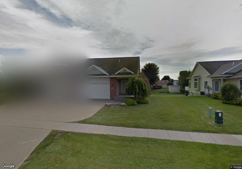
827 W Cherry St North Liberty, IA 52317
Estimated Value: $280,000 - $320,000
2
Beds
2
Baths
1,014
Sq Ft
$294/Sq Ft
Est. Value
About This Home
This home is located at 827 W Cherry St, North Liberty, IA 52317 and is currently estimated at $298,552, approximately $294 per square foot. 827 W Cherry St is a home located in Johnson County with nearby schools including Buford Garner Elementary School, North Central Junior High School, and Liberty High School.
Ownership History
Date
Name
Owned For
Owner Type
Purchase Details
Closed on
Aug 1, 2007
Sold by
Prime Ventures Construction Inc
Bought by
The Watts Group Lc
Current Estimated Value
Home Financials for this Owner
Home Financials are based on the most recent Mortgage that was taken out on this home.
Original Mortgage
$144,415
Outstanding Balance
$91,156
Interest Rate
6.69%
Mortgage Type
Purchase Money Mortgage
Estimated Equity
$207,396
Create a Home Valuation Report for This Property
The Home Valuation Report is an in-depth analysis detailing your home's value as well as a comparison with similar homes in the area
Home Values in the Area
Average Home Value in this Area
Purchase History
| Date | Buyer | Sale Price | Title Company |
|---|---|---|---|
| The Watts Group Lc | $170,000 | None Available |
Source: Public Records
Mortgage History
| Date | Status | Borrower | Loan Amount |
|---|---|---|---|
| Open | The Watts Group Lc | $144,415 |
Source: Public Records
Tax History Compared to Growth
Tax History
| Year | Tax Paid | Tax Assessment Tax Assessment Total Assessment is a certain percentage of the fair market value that is determined by local assessors to be the total taxable value of land and additions on the property. | Land | Improvement |
|---|---|---|---|---|
| 2025 | $4,604 | $289,300 | $57,200 | $232,100 |
| 2024 | $4,504 | $267,700 | $57,200 | $210,500 |
| 2023 | $4,310 | $267,700 | $57,200 | $210,500 |
| 2022 | $4,086 | $222,100 | $23,400 | $198,700 |
| 2021 | $3,920 | $222,100 | $23,400 | $198,700 |
| 2020 | $3,920 | $203,200 | $23,400 | $179,800 |
| 2019 | $3,918 | $203,200 | $23,400 | $179,800 |
| 2018 | $3,844 | $203,200 | $23,400 | $179,800 |
| 2017 | $3,426 | $203,200 | $23,400 | $179,800 |
| 2016 | $3,334 | $180,300 | $23,400 | $156,900 |
| 2015 | $3,334 | $180,300 | $23,400 | $156,900 |
| 2014 | $3,252 | $179,400 | $23,400 | $156,000 |
Source: Public Records
Map
Nearby Homes
- 144 Elm Ridge Dr
- 142 Elm Ridge Dr
- 1190 Berkshire Ln
- 1035 Liberty Way
- 470 N Colton Dr
- 100 Cherry Ct Unit 2
- 115 N Colton Dr
- 455 Heritage Place
- 445 Heritage Place
- 425 Heritage Place
- 415 Heritage Place Unit 417
- 464 N Dubuque St Unit A
- 400 W Penn St
- 1105 Millie Ln
- 1101 Millie Ln
- 1103 Millie Ln
- 555 Country Ln
- 513 Sugar Creek Ln
- 1165 Edward Dr
- 540 Augusta Cir Unit 5
- 845 W Cherry St
- 825 W Cherry St
- 847 W Cherry St
- 820 Maple St
- 295 Elm Ridge Dr
- 855 W Cherry St
- 830 Maple St
- 797 W Cherry St
- 857 W Cherry St
- 840 Maple St
- 795 W Cherry St
- 865 W Cherry St Unit A
- 290 Elm Ridge Dr
- 850 Maple St
- Lot 18 Rice Ridge NE
- 275 Elm Ridge Dr
- 867 W Cherry St
- 270 Elm Ridge Dr
- 825 Maple St
- 835 Maple St