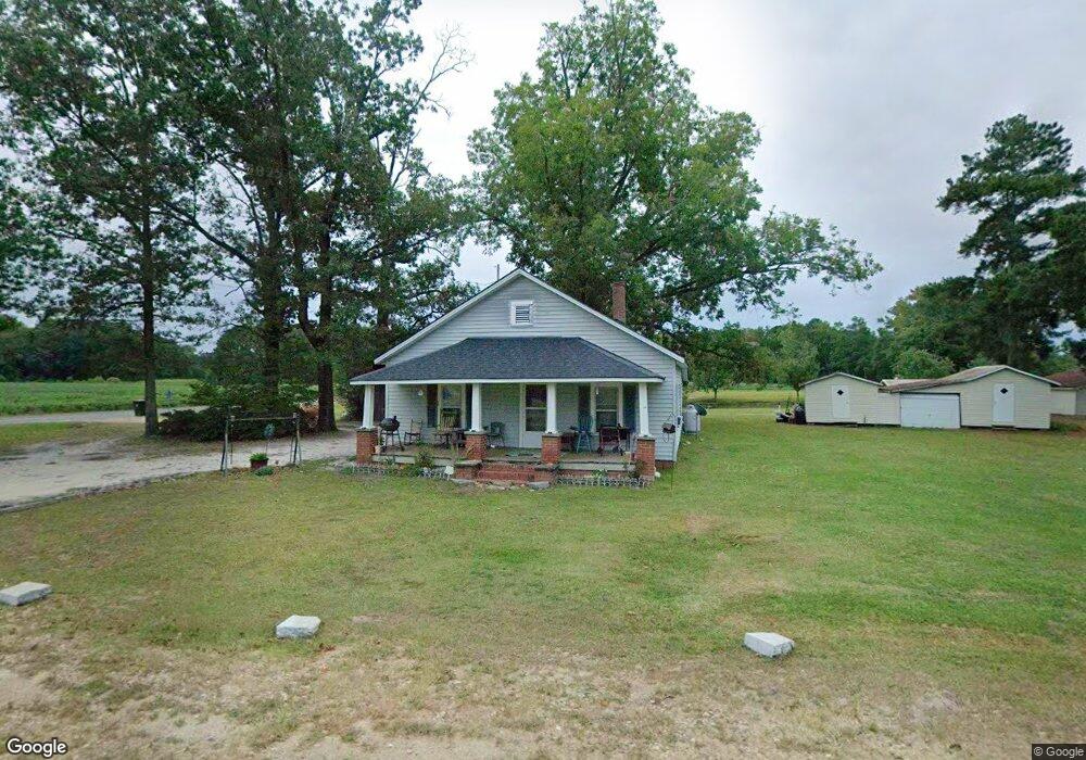
8275 Nc 27 W Lillington, NC 27546
Estimated Value: $156,590 - $349,000
3
Beds
1
Bath
1,020
Sq Ft
$223/Sq Ft
Est. Value
About This Home
This home is located at 8275 Nc 27 W, Lillington, NC 27546 and is currently estimated at $227,898, approximately $223 per square foot. 8275 Nc 27 W is a home located in Harnett County with nearby schools including Boone Trail Elementary School, Western Harnett Middle School, and Western Harnett High School.
Ownership History
Date
Name
Owned For
Owner Type
Purchase Details
Closed on
Feb 11, 2025
Sold by
Cummings Edd Lewis and Cummings Sue Pate
Bought by
Cummings Sue Pate
Current Estimated Value
Purchase Details
Closed on
Nov 16, 2022
Sold by
Cummings Sue Pate
Bought by
Cummings David Lewis and Cummings Allison Lynn
Purchase Details
Closed on
May 17, 2006
Sold by
Smith Janice S and Smith Lowell G
Bought by
Cummings Edd Lewis
Purchase Details
Closed on
May 2, 2005
Sold by
Smith Edgar T and Smith Debbie T
Bought by
Cummings Edd Lewis
Create a Home Valuation Report for This Property
The Home Valuation Report is an in-depth analysis detailing your home's value as well as a comparison with similar homes in the area
Home Values in the Area
Average Home Value in this Area
Purchase History
| Date | Buyer | Sale Price | Title Company |
|---|---|---|---|
| Cummings Sue Pate | -- | None Listed On Document | |
| Cummings Sue Pate | -- | None Listed On Document | |
| Cummings David Lewis | -- | -- | |
| Cummings Edd Lewis | -- | None Available | |
| Cummings Edd Lewis | -- | None Available |
Source: Public Records
Tax History Compared to Growth
Tax History
| Year | Tax Paid | Tax Assessment Tax Assessment Total Assessment is a certain percentage of the fair market value that is determined by local assessors to be the total taxable value of land and additions on the property. | Land | Improvement |
|---|---|---|---|---|
| 2025 | $666 | $80,592 | $0 | $0 |
| 2024 | $666 | $80,592 | $0 | $0 |
| 2023 | $614 | $80,592 | $0 | $0 |
| 2022 | $614 | $80,592 | $0 | $0 |
| 2021 | $614 | $60,120 | $0 | $0 |
| 2020 | $614 | $60,120 | $0 | $0 |
| 2019 | $599 | $60,120 | $0 | $0 |
| 2018 | $593 | $60,120 | $0 | $0 |
| 2017 | $593 | $60,120 | $0 | $0 |
| 2016 | $522 | $51,950 | $0 | $0 |
| 2015 | $522 | $51,950 | $0 | $0 |
| 2014 | $522 | $51,950 | $0 | $0 |
Source: Public Records
Map
Nearby Homes
- 136 Spring Hill Church Rd
- 92 Rad St
- 121 Smith Farms Dr
- 104 Smith Farms Dr
- 84 Smith Farms Dr
- The Bradley Plan at Reedy Branch
- The Avery Plan at Reedy Branch
- The Benson II Plan at Reedy Branch
- The Landen Plan at Reedy Branch
- The McGinnis Plan at Reedy Branch
- The Coleman Plan at Reedy Branch
- 4166 Darroch Rd
- 4182 Darroch Rd
- 9301 Nc 27 W
- 4198 Darroch Rd
- 4238 Darroch Rd
- 4214 Darroch Rd
- 8319 Nc 27 W
- 4 Spring Hill Church Rd
- 8358 Nc 27 W
- 8406 Nc 27 W
- 100 Spring Hill Church Rd
- 128 Spring Hill Church Rd
- 145 Spring Hill Church Rd
- 171 Spring Hill Church Rd
- 8482 Nc 27 W
- 8044 Nc 27 W
- 275 Clark Rd
- 226 Spring Hill Church Rd
- 8543 Nc 27 W
- 8543 Nc 27 W
- 258 Spring Hill Church Rd
- 8556 Nc 27 W
- 324 Clark Rd
- 181 Rad St
- 8600 Nc 27 W
- 355 Clark Rd